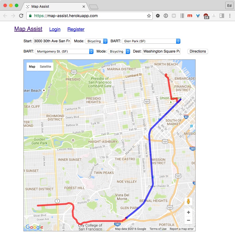
Google Maps is great - you can get directions for Driving or Bicycling or Walking or Transit.
But.... you can't mix & match! (well, except for walking + transit). If you want to map a trip via Bicycle + BART + Bicycle - sorry, you'll need to call up directions on three separate Google Maps! 🤔
This is where Map Assist comes in.
Map Assist lets you enter a starting & ending destination, two BART stations, and the mode of travel between them (i.e. walking, bicycling or driving), and will display all 3 legs of your journey on one map, simultaneously. Version 1 is hosted on Heroku, and has this basic functionality:
The in-progress version on the development branch will have the following additional features:
- Location input via a Google Places field, with autocomplete drop-down.
- Favorites: Saved locations, legs & trips
- Aggregate time calculation for entire trip
- Nicer style & more responsive mobile-friendly design
