The curated dataset of Zoraptera occurrences described in the paper "". The dataset is stored in zoraptera.csv file, its based on Darwin Core standard, and is updated manually or by semi-automated workflow described below.
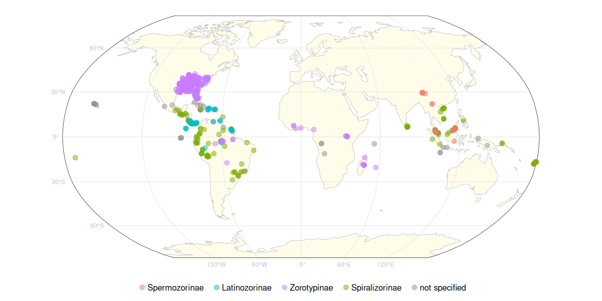
 Geographical distribution of Zoraptera records in the dataset by subfamily
 Count of Zoraptera records in the dataset across years by family
All updates can be tracked in history of the file, or in commits history in general. Semi-automated updates are tracked in update.log file including date, source, and doi if aplicable.
Simply manual manipulation of zoraptera.csv
- designated person revise identification directly on iNaturalist
- run script
scripts/inat.rwhich lookup actual iNaturalist data and check if any new identification were done by designated person (now only Petr Kočárek), and if there any, its automatically written tozoraptera_occs.csv, and information about update (date, source) will be written in to logfileupdate.log
- run script
scripts/gbif.rwhich downloads latest used GBIF dataset with doi red from logfileupdate.log - any new data found will be written to csv file, and information about update (date, source, dataset doi) will be written in to logfile
update.log - csv file with the new data have to be manually checked and implemented in
zoraptera_occs.csvacording to methods published in paper.
If any new record without coordinates is added to the dataset, the coordinates and positional uncertainty will be obtained following this workflow:
- use OSM place search plugin to find the locality by name, and copy appropriate features to the layer
geom/geom.gpkg - edit the geometry to represent the locality as close as possible, if the desired place is not the feature but it is related to it, add a new polygon while keeping the original feature attributes. Remove sea or ocean areas with OSM features taged
natural=coastlines - if the locality is not present in OSM, draw polygon manually
- simplify the polygon with QGIS
Simplifyalgorithm from geoprocessing toolbox (Visvalingam algorithm, tolerance 100) - fill the
feature_originattribute with categories:manual- not related to any OSM feature, manually digitized from the descriptionosm_related- features related to OSM features, not intersecting them but manually digitized based on themosm_derived- features derived from OSM features, features intersecting each otherosm_exact- features that are exact copies of OSM features
- polygon geometry can be edited in
geom/geom.gpkg(e.g. polygon site improvement or adding new polygons)
- after any
geom/geom.gpkgedit, the coordinates and positional uncertainty should be recalculated withscripts/geom_calc.rto write changes tozoraptera_occs.csv