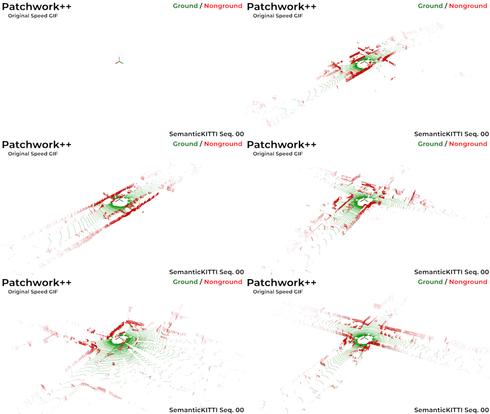
Patchwork++
📑 About Patchwork++ (IROS'22)
- A fast and robust ground segmentation algorithm on 3D point cloud.
-
An extension of Patchwork (RA-L'21 with IROS'21).
-
Please refer our paper for detailed explanantions and experimental results!
- Validated on SemanticKITTI dataset. The benchmark code is available on here.
📂 What's in this repo
- C++ source code of Patchwork++ (patchworkpp)
- Python binding of Patchwork++ using pybind11 (python_wrapper)
- Examples codes, which visualizes a ground segmentation result by Patchwork++ (examples)
👍
If you are familiar with ROS, you can also visit here and try executing ROS-based Patchwork++!
📦 Prerequisite packages
You may need to install Eigen, numpy, and Open3D. Open3D is used for point cloud visualization.
# To install Eigen and numpy
$ sudo apt-get install libeigen3-dev
$ pip install numpy

# To install Open3D Python packages
$ pip install open3d

# To install Open3D C++ packages
$ git clone https://github.com/isl-org/Open3D
$ cd Open3D
$ util/install_deps_ubuntu.sh # Only needed for Ubuntu
$ mkdir build && cd build
$ cmake ..
$ make
$ sudo make install
⚙️ How to build
Please follow below codes to build Patchwork++.
$ git clone https://github.com/url-kaist/patchwork-plusplus
$ cd patchwork-plusplus
$ mkdir build && cd build
$ cmake ..
$ make
🏃 To run the demo codes
There are some example codes for your convenience! Please try using Patchwork++ to segment ground points in a 3D point cloud
😃
Python
# Run patchwork++ and visualize ground points(green) and nonground points(red)
$ python examples/python/demo_visualize.py

# Run patchwork++ with sequential point cloud inputs
$ python examples/python/demo_sequential.py
C++
# Run patchwork++ and visualize ground points(green) and nonground points(red)
$ ./examples/cpp/demo_visualize

# Run patchwork++ with sequential point cloud inputs
$ ./examples/cpp/demo_sequential
Demo Result
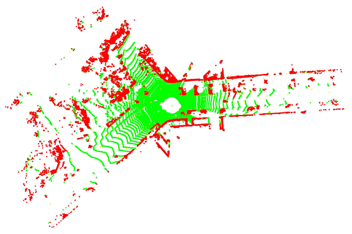
If you execute Patchwork++ with given demo codes well, you can get the following result!
It is a ground segmentation result of data/000000.bin file using Open3D visualization. (Ground : Green, Nonground : Red)
Citation
If you use our codes, please cite our paper (arXiv)
@inproceedings{lee2022patchworkpp,
    title={{Patchwork++: Fast and robust ground segmentation solving partial under-segmentation using 3D point cloud}},
    author={Lee, Seungjae and Lim, Hyungtae and Myung, Hyun},
    booktitle={Proc. IEEE/RSJ Int. Conf. Intell. Robots Syst.},
    year={2022},
    note={{Submitted}}
}
In addition, you can also check the paper of our baseline(Patchwork) here.
@article{lim2021patchwork,
    title={Patchwork: Concentric Zone-based Region-wise Ground Segmentation with Ground Likelihood Estimation Using a 3D LiDAR Sensor},
    author={Lim, Hyungtae and Minho, Oh and Myung, Hyun},
    journal={IEEE Robotics and Automation Letters},
    year={2021}
}
📫 Contact Information
If you have any questions, please do not hesitate to contact us
- Seungjae Lee
✉️ sj98lee at kaist.ac.kr - Hyungtae Lim
✉️ shapelim at kaist.ac.kr

