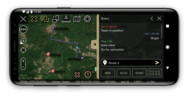
you have to get the atak software from the tak.gov page ( you can only access the download page with an account ) these are only satellite images for TAK software ( Wintak and ATAK )
DTED0 World folder has to be zipped and later imported use z-zip or any other software to do it
Then you can import each folder from the repository do not import the full zip since it contains the GitHub properties files
!!!! REMEMBER TO NOT UPLOAD THE FULL ZIP FILE BUT EACH FOLDER THAT CONTAINS MAPS SEPARATELY !!!
These is an example of a functional tack server deployment, were the nodes will autamticaly get the information needed from the closet/or factest relay point (users may also be used as a relay)
graph TD;
    Server-->Relay-1;
    Server-->Relay-2;
    Relay-2-->Relay-3;
    Relay-2-->Relay-4;
    Server-->User-1;
    User-1-->User-2;
    User-1-->User-3;
    Relay-3-->user-4;
    Relay-3-->user-5;
    Relay-4-->user-5;
    User-2-->Relay-4;
Android Team Awareness Kit, designed to be used in mobile devices with the android system from android 4
Available on most android devices ( do not download it from the Google app store go to the tak.gov page )
some devices may need external GPS I recommend the GotennaMESH and meshtastic antennas for communications
The native version of tak for windows
Track each member from your team, these only work if you have a takserver and each member is connected to it
Have live reports on weather and satellite images( only available from access to private servers )
Elevation data with maps
test


