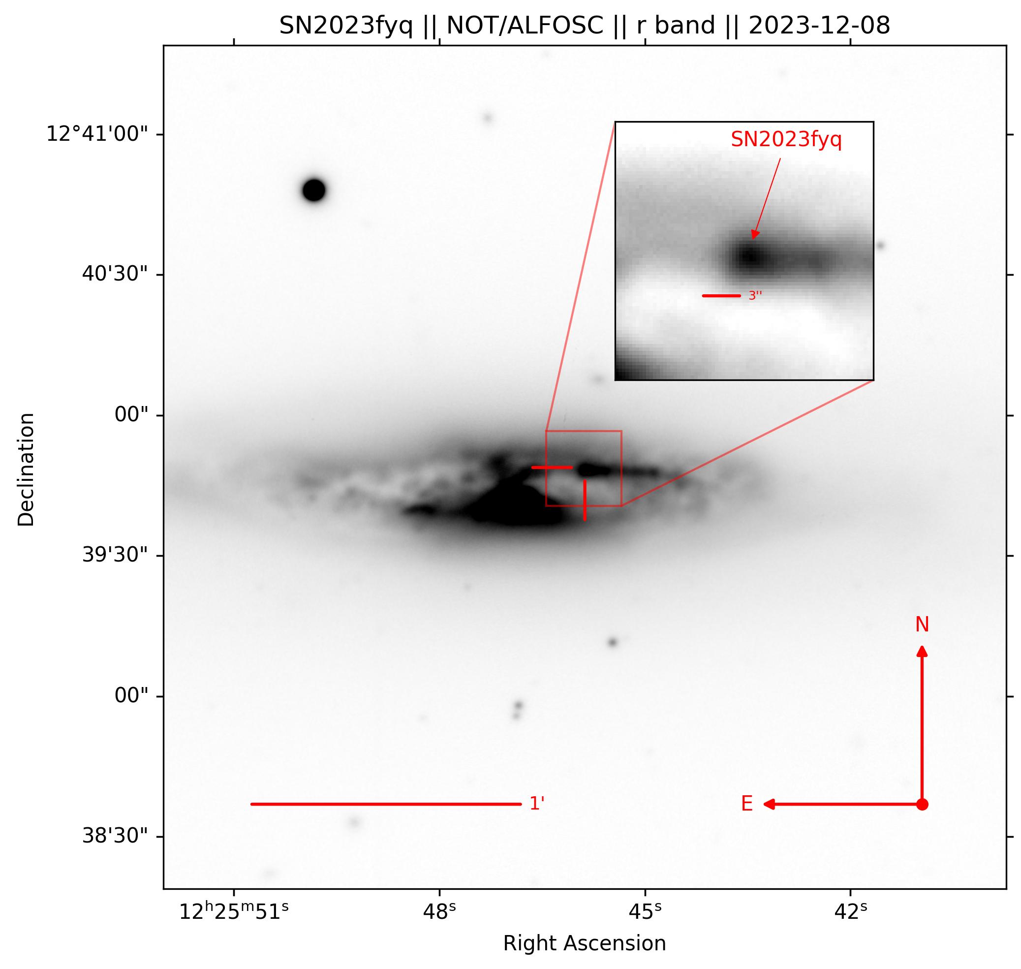
This is a relatively simple code using Astropy to produce a science-ready finder chart to be used for transient identification. The code will take a standard FITS image, align the image to celestial North, and annotate and highlight a given source.
This script is meant to replace the lack of a dedicated means to rapidly produce science-ready finder charts.
Important
This code does not solve for WCS (World Coordinate System) values and uses the transient's Right Ascension and Declination as inputs. Make sure you have accurate WCS values written to your FITS files; otherwise, your finder chart may be incorrect!"
To produce your own finder chart - edit the following block of code in create_finder_chart.py. The following code was used when producing a finder chart used in the follow-up of SN 2023fyq.
# For the filename and will be used as a label when pointing out the transient
tname = 'SN2023fyq'

# The title of the figure
title_name = 'SN2023fyq || NOT/ALFOSC || r band || 2023-12-08'

# Where your file is - WCS must be correct in the file's header
fpath = '/home/seanbrennan/Desktop/SN2023fyq/images/NOT_ALFOSC/ZTF22abzzvln_NOT_ALFOSC_20231208_r_SDSS_wcs.fits'

# The location you are saving it to
saveloc = '/home/seanbrennan/Desktop/finder_charts/github'

# Ra and Dec in degrees of the target
ra, dec = 186.441143074, +12.6635758235

# Size of image in arcminutes
cutsize = 3

# Size of scale bar in arcminutes
scalebar = 1

# Size of inset cutout in arcseconds
inset_cutsize = 8

# Size of inset scalebar in arcseconds
inset_scalebar = 3

# Lower and upper percentile values used for vmin, vmax when plotting the image
# Adjust values to improve contrast
vmin, vmax = 0.5, 99.5
Once you updated this parameters, run the code to produce your fidner chart.
> python create_finder_chart.py
An example of the output of create_finder_chart.py is given in Figure. 1
