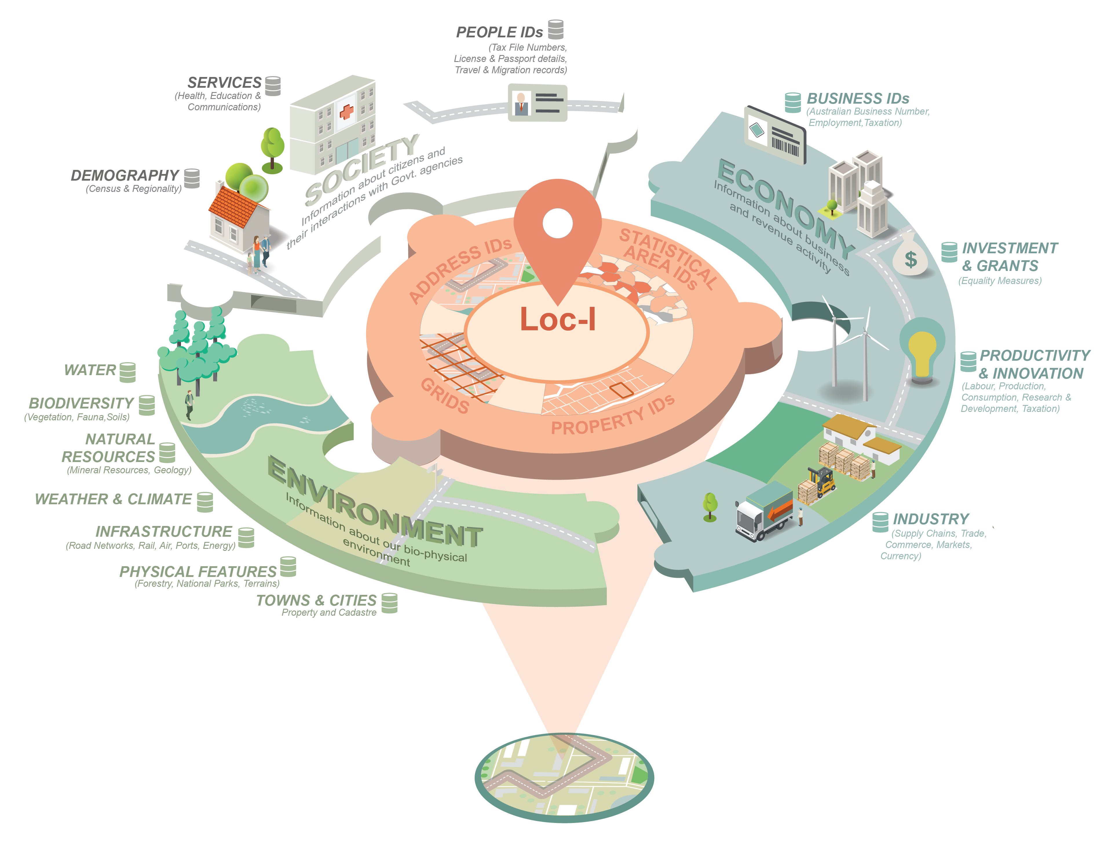
Location Index (Loc-I) is a framework that provides a consistent way to seamlessly integrate data on people, business, and the environment.
Location Index aims to extend the characteristics of the foundation spatial data of taking geospatial data (multiple geographies) which is essential to support public safety and wellbeing, or critical for a national or government decision making that contributes significantly to economic, social and environmental sustainability and linking it with observational data. Through providing the infrastructure to support cross-domain foundation data linkages and analysis will open up substantial opportunity for providing a richer set of information to develop, analyse and evaluate policy, programs and service delivery by government.
Refer to the https://www.ga.gov.au/locationindex site for more info.
- Loc-I Reference Cache
- Loc-I Datasets and Linksets
- Loc-I Geometry Data Service
- Loc-I Integration API
- Loc-I Explorer
- Loc-I Excelerator
- Loc-I IderDown
- Loc-I Test Cases
- IderDown - find identifiers from a different geography
- Excelerator - re-assign data to a different geography
- GDS - Geometry Data Service
- Integration API
Location Index is part of the Data Integration Partnership for Australia (DIPA) program and utilises the collective resources of Geoscience Australia, the Commonwealth Scientific and Industrial Research Organisation (CSIRO), the Australian Bureau of Statistics (ABS), and the Department of Agriculture, Water and the Environment .
A memorandum of understanding (MOU) was signed by all partners to define specific contributions to the Location Index for both resource and intellectual property contributions. It also defines partnersʼ roles such as business ownership, project management, technical development and advisors.
