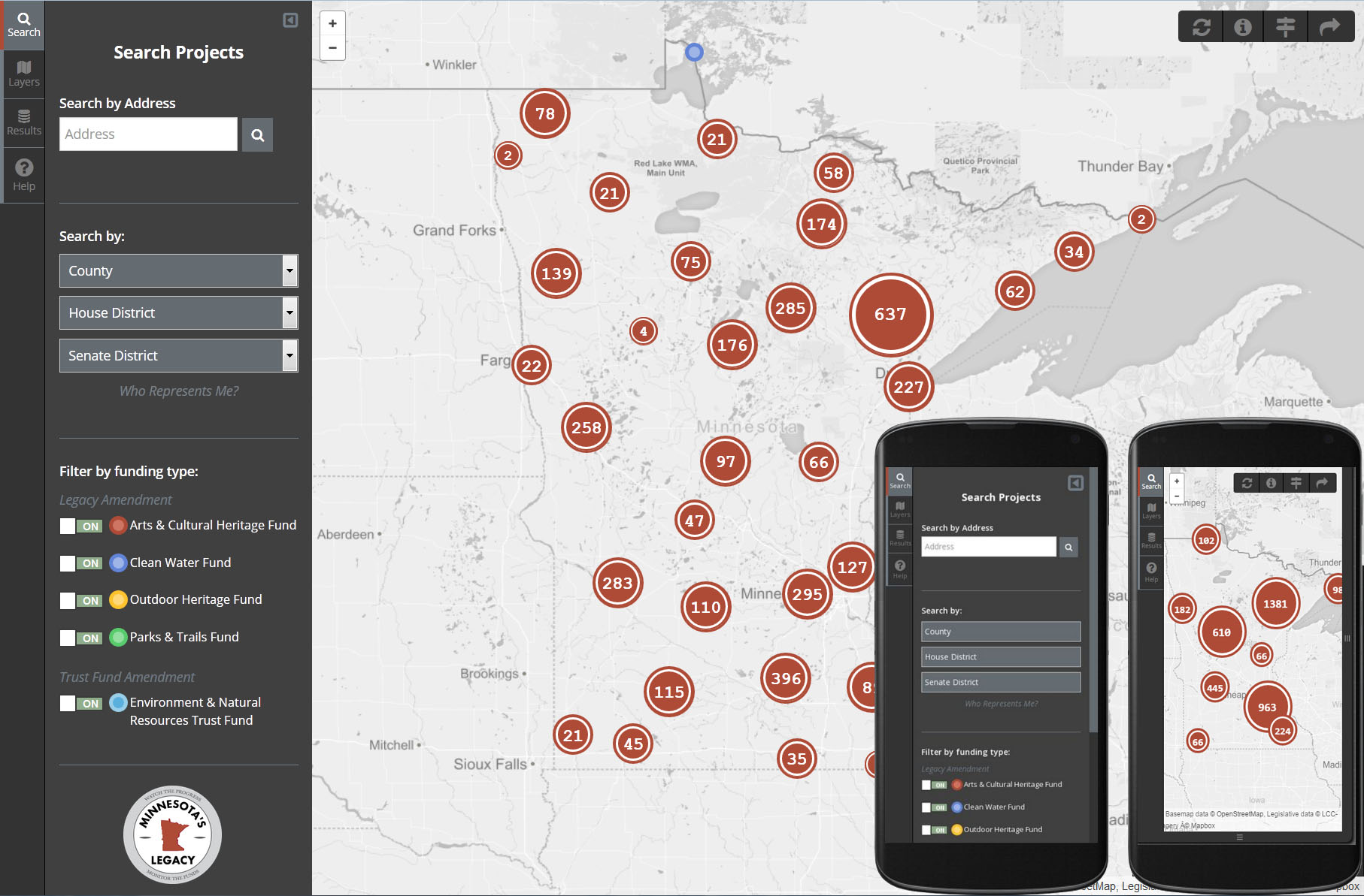
The Legacy Ammendment Map application is a completely open-source full-stack, responsive (RWD) application, built with PostGIS, Leaflet, and a little TLC.
See it in the wild at http://www.legacy.leg.mn/
- Code
- Data (GeoJSON)
- Various MN overlay layers
- mapserver.map WMS configuration file
- Fun geodev tools
- Leaflet marker-cluster graduated symbols that are out of this world
- Geocodes addresses (Google JavaScript API authentication token required)
- Zoom to location on cellphones (application optimized using RWD)
- Consumes MapServer WMS
- Free and open source map service publishing
- Much faster rendering than vectors
- Basic UI/UX
- Point and click on the map, or use the search bar to retrieve land acquisition data
- Graduated symbology
- Add overlay layers to geo-exploring
The code relies on a connection to an instance of PostGreSQL/PostGIS, a free and open-source spatial database. But for testing, connections can be made to the GeoJSON included in the data folder (see Who Represents Me? for all data).
