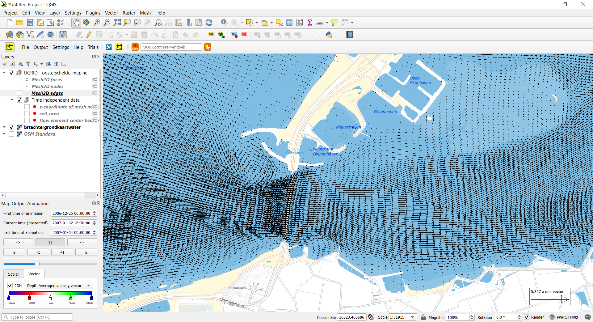
QGIS plugin to plot 1D, 1D2D and 2D time series map results as animation. The map results should be stored on a netCDF file according the UGRID standard for 1D meshes, 1D2D contact meshes and/or 2D meshes. All types could be in one netCDF file.
To build the plugin qgis_umesh you have to install QGIS (OSGeo4W network installer (64 bit), https://qgis.org/en/site/forusers/download.html ), QT 5.12 LTS, BOOST 1.72.0 and netCDF4. The windows solution will place the qgis_umesh.dll on the qgis plugin directory (ex. c:\OSGeo4W64\apps\qgis\plugins\qgis_umesh.dll)
At this moment the development environment is based on Visual Studio 2017.
Environment variables (example)
QT5DIR64=c:\Qt\Qt5.12.6\5.12.6\msvc2017_64
QT5DIR64OSGEO=c:\OSGeo4W64\apps\Qt5
netCDF library: debug and release folder contain the same libraries ./lib/x64/release/netcdf.lib ./lib/x64/debug/netcdf.lib
qgis library: debug and release folder contain the same libraries ./lib/x64/release/qgis_analysis.lib /qgis_core.lib /qgis_gui.lib /qgis_networkanalysis.lib ./lib/x64/debug/qgis_analysis.lib /qgis_core.lib /qgis_gui.lib /qgis_networkanalysis.lib
Installing QGIS from OSGeo4W network installer (64 bit) After a few screens. Selectpackages to install. Desktop: qgis: QGIS Desktop qgis-full: QGIS Full Desktop (meta package for express install) Libs: QGIS-devel: QGIS development files QT5-libs: Qt5 runtime libraries qt5-libs-debug qt5-libs-debug-pdb qt5-libs-pdb qt5-devel; qt5 headers and libraries (Development) Probably not needed qt5-qml: Qt5 QML qt5-tools: Qt5Designe & linguist (Development)
##Note (QGIS 3.18.01 and higher) When compiling the source code I had to adjusted the file qgsdistancearea.h. An extra define of M_PI_2 is added at line 215
#ifndef M_PI_2 #define M_PI_2 1.57079632679489661923 #endif
and file qgsabstractgeometry.h Line 574 #ifndef M_PI #define M_PI 3.14159265358979323846264338327950288 #endif
and also file qgsvector.h: Line 172 #ifndef M_PI #define M_PI 3.14159265358979323846264338327950288 #endif
When compiling the source code I had to adjusted the file c:\OSGeo4W64\apps\qgis\include\qgsabstractgeometry.h An extra define of M_PI is added.
Line 543 #ifndef M_PI #define M_PI 3.14159265358979323846264338327950288 #endif
and also file qgsvector.h: Line 172 #ifndef M_PI #define M_PI 3.14159265358979323846264338327950288 #endif
When QGIS 3.16.00 does close/crash without any message if reading a netCDF file, please use QGIS 3.16.01.
end document
