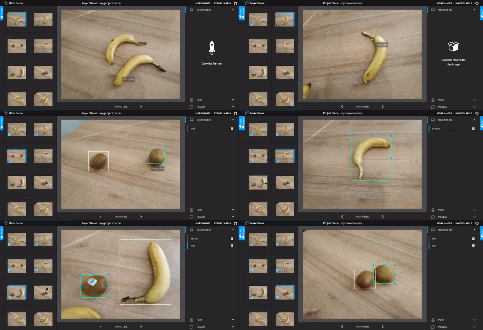
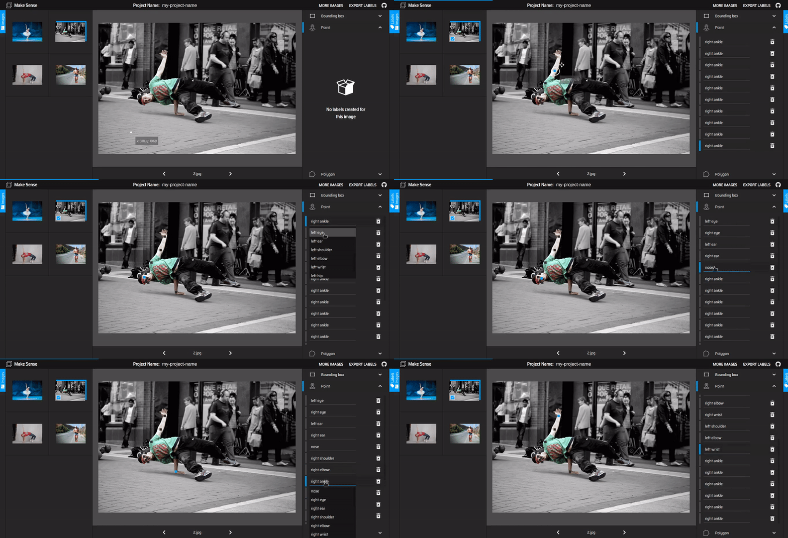
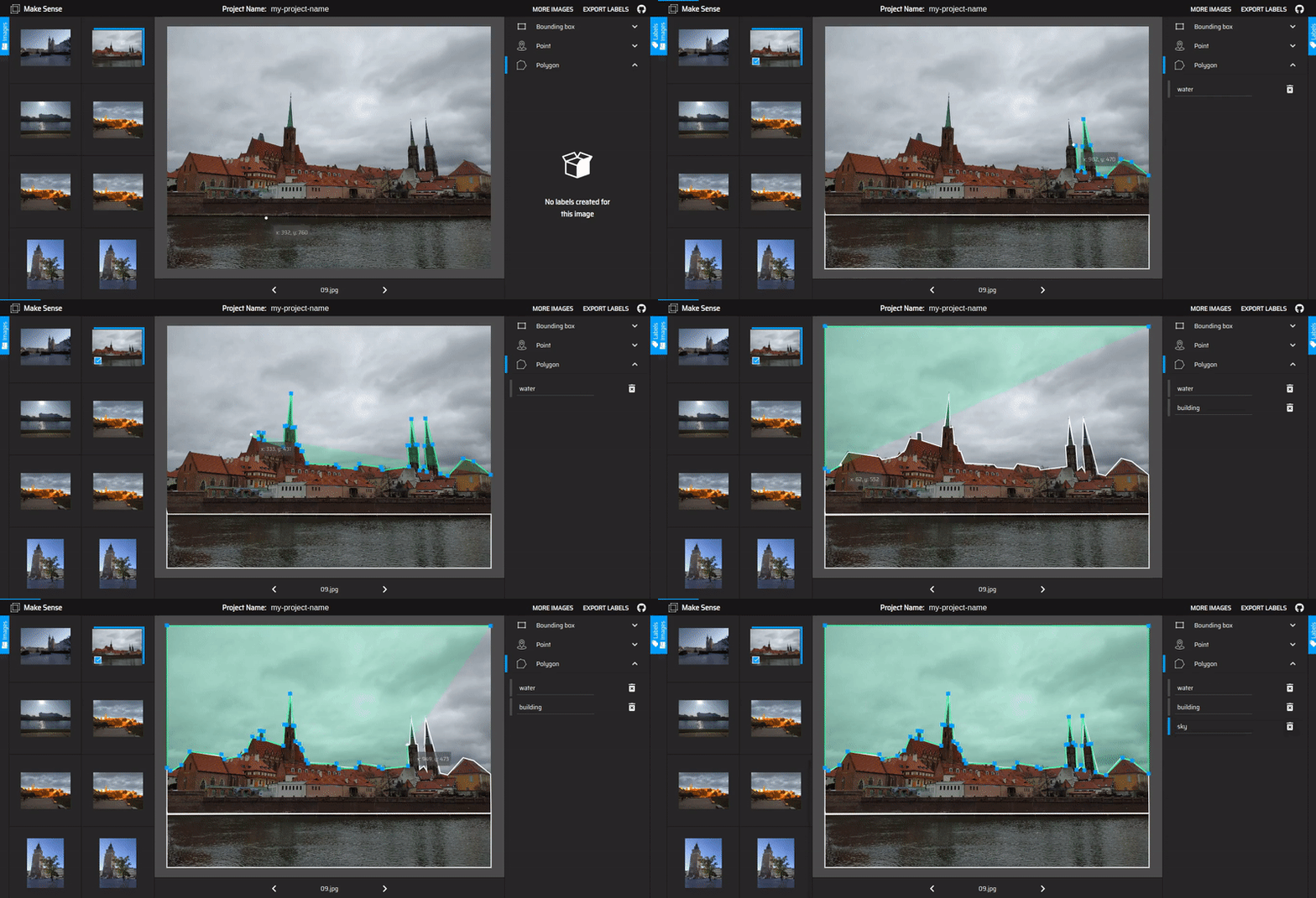
makesense.ai is a free to use online tool for labelling photos. Thanks to the use of a browser it does not require any complicated installation - just visit the website and you are ready to go. It also doesn't matter which operating system you're running on - we do our best to be truly cross-platform. It is perfect for small computer vision deeplearning projects, making the process of preparing a dataset much easier and faster. Prepared labels can be downloaded in one of multiple supported formats. The application was written in TypeScript and is based on React/Redux duo.
For AI to be free we need not just Open Source, but also a strong Open Data movement.
Andrew Ng
# clone repository
git clone https://github.com/SkalskiP/make-sense.git

# navigate to main dir
cd make-sense

# install dependencies
npm install

# serve with hot reload at localhost:3000
npm start
Some Windows 10 users may also have problems with running applications locally. The problems can be solved by adding additional dependencies to the project, through a command: npm install normalize.css --save. More information about this problem is available in the #16.
| CSV | YOLO | VOC XML | VGG JSON | COCO | PIXEL MASK | |
|---|---|---|---|---|---|---|
| Point | ☑ | ☒ | ☐ | ☐ | ☐ | ☒ |
| Rect | ☑ | ☑ | ☑ | ☐ | ☐ | ☒ |
| Polygon | ☐ | ☒ | ☐ | ☑ | ☐ | ☐ |
Table 1. The matrix of supported labels export format, where:
- ☑ - supported format
- ☐ - not yet supported format
- ☒ - format does not make sense for a given label type
A .zip package containing files in YOLO format
example of file in YOLO format
Schema:
label_index rel_rect_center_x rel_rect_center_y rel_rect_width rel_rect_height
Where:
label_index - index of the selected label
rel_rect_center_x - horizontal position of the centre of the rect in relation to overall image width, value between [0, 1]
rel_rect_center_y - vertical position of the centre of the rect in relation to overall image height, value between [0, 1]
rel_rect_width - rect width in relation to overall image width, value between [0, 1]
rel_rect_height - rect height in relation to overall image height, value between [0, 1]
Example:
1 0.404528 0.543963 0.244094 0.727034
2 0.610236 0.494751 0.188976 0.437008
1 0.754921 0.791339 0.354331 0.413386
A .zip package containing files in Pascal VOC XML format
example of file in Pascal VOC XML format
Schema:
<annotation>
    <folder>{ project_name }</folder>
    <filename>{ image_name }</filename>
    <path>{ /project_name/file_name }</path>
    <source>
        <database>Unspecified</database>
    </source>
    <size>
        <width>{ image_width }</width>
        <height>{ image_height }</height>
        <depth>3</depth>
    </size>
    <object>
        <name>{ label_name }</name>
        <pose>Unspecified</pose>
        <truncated>Unspecified</truncated>
        <difficult>Unspecified</difficult>
        <bndbox>
            <xmin>{ rect_left }</xmin>
            <ymin>{ rect_top }</ymin>
            <xmax>{ rect_right }</xmax>
            <ymax>{ rect_bottom }</ymax>
        </bndbox>
    </object>
</annotation>
Where:
project_name - user-defined project name
image_name - name of the photo file
label_name - selected label name
rect_left - absolute horizontal distance between the left edge of the image and the left edge of the rect in pixels
rect_top - absolute vertical distance between the top edge of the image and the top edge of the rect in pixels
rect_right - absolute horizontal distance between the left edge of the image and the right edge of the rect in pixels
rect_bottom - absolute vertical distance between the top edge of the image and the bottom edge of the rect in pixels
image_width - absolute image width in pixels
image_height - absolute image height in pixels
Example:
<annotation>
	<folder>my-project-name</folder>
	<filename>000007.jpg</filename>
	<path>/my-project-name/000007.jpg</path>
	<source>
		<database>Unspecified</database>
	</source>
	<size>
		<width>1280</width>
		<height>960</height>
		<depth>3</depth>
	</size>
	<object>
		<name>kiwi</name>
		<pose>Unspecified</pose>
		<truncated>Unspecified</truncated>
		<difficult>Unspecified</difficult>
		<bndbox>
			<xmin>208</xmin>
			<ymin>486</ymin>
			<xmax>497</xmax>
			<ymax>718</ymax>
		</bndbox>
	</object>
	<object>
		<name>banaba</name>
		<pose>Unspecified</pose>
		<truncated>Unspecified</truncated>
		<difficult>Unspecified</difficult>
		<bndbox>
			<xmin>643</xmin>
			<ymin>118</ymin>
			<xmax>1178</xmax>
			<ymax>799</ymax>
		</bndbox>
	</object>
</annotation>
Single CSV file
example of CSV file
Schema:
label_name,rect_left,rect_top,rect_width,rect_height,image_name,image_width,image_height
Where:
label_name - selected label name
rect_left - absolute horizontal distance between the left edge of the image and the left edge of the rect in pixels
rect_top - absolute vertical distance between the top edge of the image and the top edge of the rect in pixels
rect_width - absolute rect width in pixels
rect_height - absolute rect height in pixels
image_width - absolute image width in pixels
image_height - absolute image height in pixels
Example:
banana,491,164,530,614,000000.jpg,1280,960
banana,462,245,466,353,000001.jpg,1280,960
banana,542,477,587,375,000001.jpg,1280,960
banana,636,109,561,695,000007.jpg,1280,960
kiwi,198,477,317,251,000007.jpg,1280,960
kiwi,558,423,219,222,000008.jpg,1280,960
kiwi,758,360,252,236,000008.jpg,1280,960
We don't store your images, because we don't send them anywhere in the first place.
Our application is being actively developed. If you have an idea for a new functionality, please hit us on Twitter and Gitter or create an issue where you can describe your concept. In the meantime, see what improvements we are planning for you in the future.
- Export rect labels in Pascal VOC XML format
- Labelling objects using polygons
- Export polygon labels in VGG JSON format
- Optimization of the process of loading photos from disk - queuing
- Labelling objects using lines
- Autofill in label selection dropdown
- Export labels in COCO JSON format
- Export segmentation labels as image mask
- Separate tab with settings
- Support basic image operations like crop and resize
- Converting video to image frames
- Keyboard shortcuts to improve productivity
- Automatic detection of objects in a photo - all you have to do is to label them
- OCR labelling
- Integration with external storage - Amazon S3, Google Drive, Dropbox
- Copy annotations from previous image into the next one
@MISC{make-sense,
   author = {Piotr Skalski},
   title = {{Make Sense}},
   howpublished = "\url{https://github.com/SkalskiP/make-sense/}",
   year = {2019},
}
This project is licensed under the GPL-3.0 License - see the LICENSE file for details
Copyright (c) 2019-present, Piotr Skalski


