Department of Mathematics, Department of Geography, Department of Life Sciences Communication, and School of Medicine and Public Health, University of Wisconsin-Madison
If you use this dataset and code in your research or applications, please refer to this source:
Hou, X., Gao, S., Li, Q., Kang, Y., Chen, N., Chen, K., Rao, J., Ellenberg, J.S. and Patz, J.A. (2021). Intracounty modeling of COVID-19 infection with human mobility: assessing spatial heterogeneity with business traffic, age and race. Proceedings of the National Academy of Sciences, Jun 2021, 118 (24), e2020524118, DOI: 10.1073/pnas.2020524118
@article{hou2020intra,
  title={Intra-county modeling of COVID-19 infection with human mobility: assessing spatial heterogeneity with business traffic, age and race},
  author={Hou, Xiao and Gao, Song and Li, Qin and Kang, Yuhao and Chen, Nan and Chen, Kaiping and Rao, Jinmeng and Ellenberg, Jordan S and Patz, Jonathan A},
  journal={Proceedings of the National Academy of Sciences},
  year={2021},
  volume={118},
  number={24},
  pages={e2020524118},
  publisher={National Academy of Sciences}
}
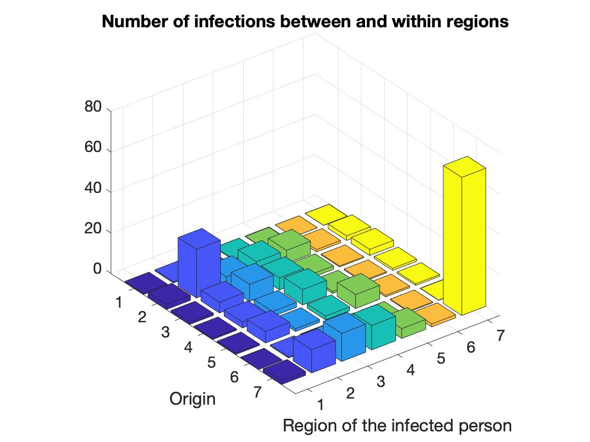
The COVID-19 pandemic is a global threat presenting health, economic and social challenges that continue to escalate. Meta-population epidemic modeling studies in the susceptible-exposed-infectious-removed (SEIR) style have played important roles in informing public health policy making to mitigate the spread of COVID-19. These models typically rely on a key assumption on the homogeneity of the population. This assumption certainly cannot be expected to hold true in real situations; various geographic, socioeconomic and cultural environments affect the behaviors that drive the spread of COVID-19 in different communities. What's more, variation of intra-county environments creates spatial heterogeneity of transmission in different regions. To address this issue, we develop a new human mobility flow-augmented stochastic SEIR-style epidemic modeling framework with the ability to distinguish different regions and their corresponding behavior. This new modeling framework is then combined with data assimilation and machine learning techniques to reconstruct the historical growth trajectories of COVID-19 confirmed cases in two counties in Wisconsin. The associations between the spread of COVID-19 and business foot-traffic, race and ethnicity, and age are then investigated. The results reveal that in a college town (Dane County) the most important heterogeneity is age structure, while in a large city area (Milwaukee County) racial and ethnic heterogeneity becomes more apparent. Scenario studies further indicate a strong response of the spread rate on various reopening policies, which suggests that policymakers may need to take these heterogeneities into account very carefully when designing policies for mitigating the ongoing spread of COVID-19 and reopening.
A description of all files in the repository is shown below:
data_0411_0814.mat: The daily COVID-19 confirmed cases data needed to run the model for Dane County, WI, provided by the Wisconsin Department of Health Services. (The codes of cleaning the data are provided in the folder ‘data_preparation’)
data_0311_0812.mat: The daily COVID-19 confirmed cases data needed to run the model for Milwaukee County, WI, provided by the Wisconsin Department of Health Services. (The codes of cleaning the data are provided in the folder ‘data_preparation’)
para_stochastic.m: A fixed-point iteration is used to determine the coefficients of the stochastic (Ornstein–Uhlenbeck) process.
fun_EKI_stochastic.m: Apply the Ensemble Kalman Filter.
SEIR_stochastic: Run the model forward
plots.m: Plot figures about the results of model.
case1.m, case2.m, case3.m: Three scenario studies of Dane County.
Distributed under the MIT License. See LICENSE for more information.
Song Gao - @gissong - song.gao at wisc.edu
Qin Li - Mathematics - qinli at math.wisc.edu
Xiao Hou - Mathematics - xhou9 at wisc.edu
Yuhao Kang - @YuhaoKang - yuhao.kang at wisc.edu
Project Link: https://github.com/GeoDS/IntraCounty-Mobility-SEIR
We thank the WDHS for providing daily census tract-level COVID-19 confirmed case data and thank SafeGraph Inc. for providing the anonymous and aggregated place visits and human mobility flow data. S.G., Q.L., K.C., and J.A.P. acknowledge funding support provided by the NSF Grant (BCS-2027375). J.S.E. acknowledges funding support provided by the NSF Grant (DMS-1700884). S.G. acknowledges support from the National Geospatial Fellowship for Advancing COVID-19 Research & Education provided by the NSF Geospatial Software Institute Conceptualization Project Grant (OAC-1743184). Q.L., N.C., and X.H. are also supported by Data Science Initiative, provided by the University of Wisconsin–Madison Office of the Chancellor and the Vice Chancellor for Research and Graduate Education with funding from the Wisconsin Alumni Research Foundation. Any opinions, findings, and conclusions or recommendations expressed in this material are those of the authors and do not necessarily reflect the views of the NSF and other funders.


