Inspired by https://gist.github.com/eteq/f879c2fe69d75d1c5a9e007b0adce30d and http://rhodesmill.org/pyephem/tutorial.html.
Note that astropy is much slower than PyEphem, but gives you more correct results. Results from this have been spot-checked against http://xjubier.free.fr/en/site_pages/solar_eclipses/TSE_2017_GoogleMapFull.html.
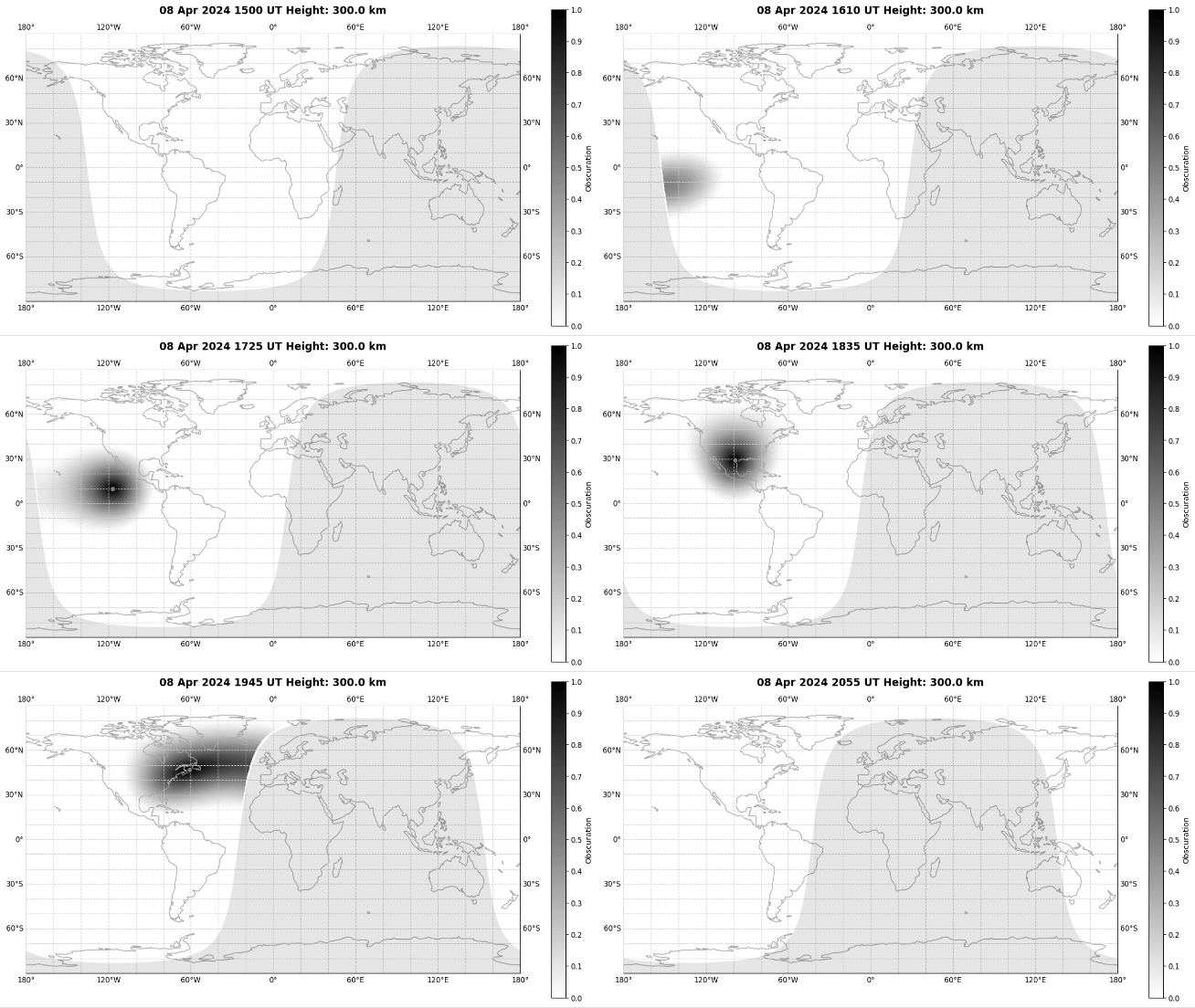
This repository includes eclipse_maps.py, which will generate world maps and CSV files of eclipse obscuration. Note that this is VERY slow. One run (along with a movie) has already been completed in the output/ directory.
- This run was completed using 4-character Maidenhead Gridsquare resolution (https://en.wikipedia.org/wiki/Maidenhead_Locator_System).
- Obscuration is set to 0 when the sun is more than 18 degrees below the horizon (astronomical night). This accounts for the sharp edges seen in the figures.
- Obscuration was calculated at 300 km altitude for purposes of studying the ionosphere and HF radio propagation effects.
