R-PCC: A Baseline for Range Image-based Point Cloud Compression
This repository contains the python implementation for our full paper submitted to ICRA 2022 "R-PCC: A Baseline for Range Image-based Point Cloud Compression". If you find our paper or code useful, please cite:
@misc{wang2021rpcc,
      title={R-PCC: A Baseline for Range Image-based Point Cloud Compression},
      author={Sukai Wang and Jianhao Jiao and Peide Cai and Ming Liu},
      year={2021},
      eprint={2109.07717},
      archivePrefix={arXiv},
      primaryClass={cs.RO}
}
The framework architecture of R-PCC:
Qualitative results:
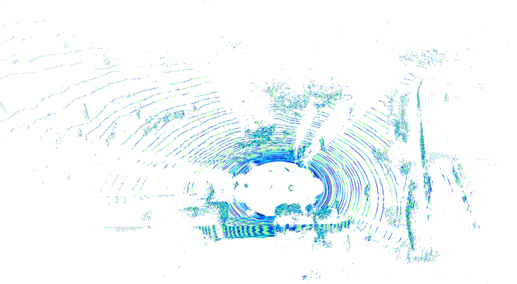
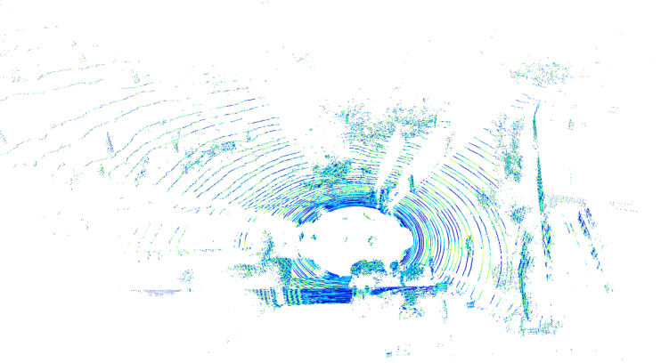
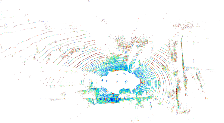
From left to right: Ours-uniform, Ours-Nonuniform, Draco, G-PCC, and JPEG-Range, respectively. The color in the point cloud and the colorbar are based on the mean symmetric chamfer distance between the reconstructed and original point cloud.
First row, from left to right: Ours-Uniform, Ours-Uniform(birds-eye-view), Ours-Nonuniform; Second row, from left to right: Draco, G-PCC, and JPEG-Range.Dataset:
We evaluated our compression framework on three datasets: KITTI (64E), Oxford (32E), and HKUSTCampus (VLP16).
You can download and test from the dataset websites or directly download the tested point clouds in the paper from here.
The detailed dataset file path can be found in data/*.txt.
1. Clone the github repository.
git clone --recursive https://github.com/StevenWang30/R-PCC.git2. Install CUDA and C++ extensions.
python setup.py developCUDA is used in FPS implementation and segmentation module, and some modules are implemented in C++ using pybind11.
3. Uninstall (if needed):
python setup.py develop --uninstall --user Set the parameters in the compression framework in cfg/compressor.yaml.
-
compress_framework: 'uniform'
Choose in ['uniform' or 'non-uniform']. Detailed explanation can be found in paper.
-
accuracy: 0.02
The maximum reconstruction error, the most important parameter affecting the compression ratio and the reconstruction quality.
For example, 0.02 means the maximum difference between the reconstructed range image and the original range image is 0.02m.
-
segment_method: 'FPS'
Choose in ['FPS' or 'DBSCAN']. Detailed explanation can be found in paper.
DBSCAN is implemented by open3d and it is really slow.
-
modeling_method: 'point'
Choose in ['point' or 'plane']. Detailed explanation can be found in paper.
The speed of plane modeling is much slower than point modeling, because of the RANSAC fitting and
np.where()in python. -
basic_compressor: 'bzip2'
The name of the basic compressor. Choose among ['lz4', 'bzip2', and 'deflate'].
- Compression rate:
bzip2 > deflate >> lz4 - Compression speed:
lz4 : deflate : bzip2 = 300 : 100 : 1
- Compression rate:
Compress single frame point cloud:
python tools/compress.py --input assets/example_data/example.bin --output example.rpcc --lidar Velodyne64E --evalCurrently supported LiDAR types: Velodyne64E / Velodyne32E / VelodyneVLP16
Currently supported data type: .bin / .pcd / .ply / .npy / .npz / .txt
The uniform and non-uniform compression framework can be switched by adding --nonuniform, and most of the parameters in the
compressor.yaml can be manually set in the command line. But it is strongly recommanded to set the parameters in the yaml file to
make sure they are matching while compression and decompression.
python tools/decompress.py --input example.rpcc --output reconstructed.pcd --lidar Velodyne64EAdd original point cloud file to evaluate the reconstruction quality.
python tools/decompress.py --input example.rpcc --output reconstructed.pcd --lidar Velodyne64E --eval --original_point_cloud assets/example_data/example.binUse datalist.txt to compress batch of point cloud.
python tools/compress_datalist.py --datalist data/test_64E_KITTI_city.txt --output_dir /output/R-PCC/test/compressed --lidar Velodyne64E The output compressed bitstream will be saved in --output_dir + original_file_path with suffix '.rpcc'.
Add --output to show the compression time and results on screen.
Add --workers 4 to set number of workers for parallel compression.
Example datalist files are in data.
python tools/decompress_datalist.py --datalist decompress_datalist.txt --output_dir /data/R-PCC/test/decompressed --lidar Velodyne64E --workers 4The file path in the datalist must have .rpcc suffix.
The output reconstructed point clouds are .bin files. The intensity information will be dropped and replaced with all-zeros.
Part of "FPS" related code is borrowed from OpenPCDet.


