Visual Localization Using AR Tags as Landmarks
Overview
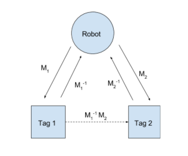
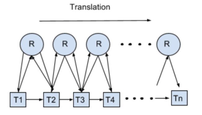
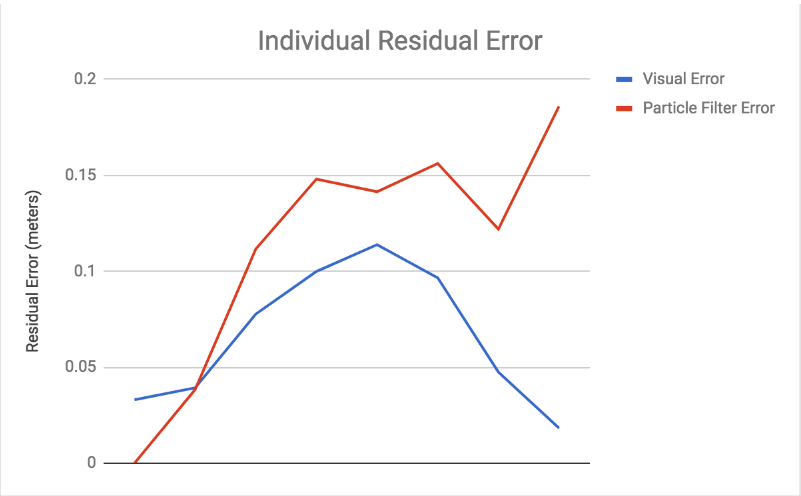
This repository contains the code that does data collection and the mapping of AR Tags location to set up the visual/landmark based locazliation. The goal was to improve the current localization system within the Segbots which currently use Monte Carlo Localization and measure the effectiveness by comparing to the ground truth.
How to run
1. Launch Segbot
roslaunch bwi_launch segbot_v2.launch
2. Launch AR_Track_Alvar to let the Segbot to track/detect AR Tags
roslaunch ar_track_alvar pr2_indiv.launch
3. Compute to create a network/mapping of tags
rosrun ar_localization data_collection
How the system works
Effectiveness of the system
Additional Information
Link to the slide


