The goal of qgisprocess is to provide an R interface to the popular
and open source desktop geographic information system (GIS) program
QGIS. The package is a re-implementation of
functionality provided by the archived
RQGIS package, which was
partially revived in the RQGIS3
package.
You can install the development version from GitHub with:
# install.packages("remotes")
remotes::install_github("r-spatial/qgisprocess")
The qgisprocess package wraps the qgis_process command-line utility,
which is available in QGIS >=
3.14.16,
released
in September 2020. MacOS users will have to install QIGS >= 3.16;
download instructions for all platforms are available at
https://download.qgis.org/. If a recent version of QGIS isn’t
available for your OS, you can use one of the Geocomputation with R
Docker images with QGIS installed.
If the automatic configuration fails (or if you have more than one
installation and would like to choose which one is used by qgisprocess),
you can set options(qgisprocess.path = "path/to/qgis_process"),
possibly in your .Rprofile to persist between sessions. You can run
qgis_configure() to print the gritty details!
library(qgisprocess)
#> Using 'qgis_process' at '/Applications/QGIS.app/Contents/MacOS/bin/qgis_process'.
#> Run `qgis_configure()` for details.
qgis_configure()
#> getOption('qgisprocess.path') was not found.
#> Sys.getenv('R_QGISPROCESS_PATH') was not found.
#> Trying 'qgis_process' on PATH
#> Error in rethrow_call(c_processx_exec, command, c(command, args), stdin, : cannot start processx process 'qgis_process' (system error 2, No such file or directory) @unix/processx.c:604 (processx_exec)
#> Found 1 QGIS installation containing 'qgis_process':
#>  /Applications/QGIS.app/Contents/MacOS/bin/qgis_process
#> Trying command '/Applications/QGIS.app/Contents/MacOS/bin/qgis_process'
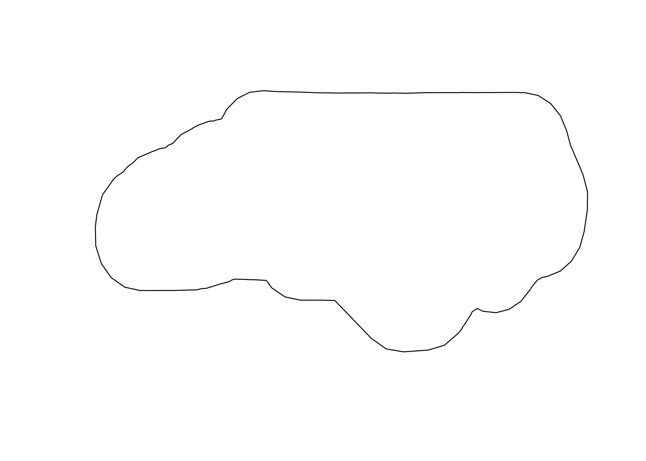
#> Success!The following example demonstrates the buffer algorithm in action. The passing of sf and raster objects is experimentally supported (and will be well-supported in the future!).
input <- sf::read_sf(system.file("shape/nc.shp", package = "sf"))

result <- qgis_run_algorithm(
  "native:buffer",
  INPUT = input,
  DISTANCE = 1,
  DISSOLVE = TRUE,
  .quiet = TRUE
)
#> Argument `SEGMENTS` is unspecified (using QGIS default value).
#> Using `END_CAP_STYLE = "Round"`
#> Using `JOIN_STYLE = "Round"`
#> Argument `MITER_LIMIT` is unspecified (using QGIS default value).
#> Using `OUTPUT = qgis_tmp_vector()`

result
#> <Result of `qgis_run_algorithm("native:buffer", ...)`>
#> List of 1
#>  $ OUTPUT: 'qgis_outputVector' chr "/var/folders/bq/2rcjstv90nx1_wrt8d3gqw6m0000gn/T//RtmptXCayy/file9b2b462efaa9/file9b2b5212f730.gpkg"

output_sf <- sf::read_sf(qgis_output(result, "OUTPUT"))
plot(sf::st_geometry(output_sf))
You can read the help associated with an algorithm using
qgis_show_help():
qgis_show_help("native:buffer")
#> Buffer (native:buffer)
#>
#> ----------------
#> Description
#> ----------------
#> This algorithm computes a buffer area for all the features in an input layer, using a fixed or dynamic distance.
#>
#> The segments parameter controls the number of line segments to use to approximate a quarter circle when creating rounded offsets.
#>
#> The end cap style parameter controls how line endings are handled in the buffer.
#>
#> The join style parameter specifies whether round, miter or beveled joins should be used when offsetting corners in a line.
#>
#> The miter limit parameter is only applicable for miter join styles, and controls the maximum distance from the offset curve to use when creating a mitered join.
#>
#> ----------------
#> Arguments
#> ----------------
#>
#> INPUT: Input layer
#>  Argument type:  source
#>  Acceptable values:
#>      - Path to a vector layer
#> DISTANCE: Distance
#>  Argument type:  distance
#>  Acceptable values:
#>      - A numeric value
#> SEGMENTS: Segments
#>  The segments parameter controls the number of line segments to use to approximate a quarter circle when creating rounded offsets.
#>  Argument type:  number
#>  Acceptable values:
#>      - A numeric value
#> END_CAP_STYLE: End cap style
#>  Argument type:  enum
#>  Available values:
#>      - 0: Round
#>      - 1: Flat
#>      - 2: Square
#>  Acceptable values:
#>      - Number of selected option, e.g. '1'
#>      - Comma separated list of options, e.g. '1,3'
#> JOIN_STYLE: Join style
#>  Argument type:  enum
#>  Available values:
#>      - 0: Round
#>      - 1: Miter
#>      - 2: Bevel
#>  Acceptable values:
#>      - Number of selected option, e.g. '1'
#>      - Comma separated list of options, e.g. '1,3'
#> MITER_LIMIT: Miter limit
#>  Argument type:  number
#>  Acceptable values:
#>      - A numeric value
#> DISSOLVE: Dissolve result
#>  Argument type:  boolean
#>  Acceptable values:
#>      - 1 for true/yes
#>      - 0 for false/no
#> OUTPUT: Buffered
#>  Argument type:  sink
#>  Acceptable values:
#>      - Path for new vector layer
#>
#> ----------------
#> Outputs
#> ----------------
#>
#> OUTPUT: <outputVector>
#>  Buffered
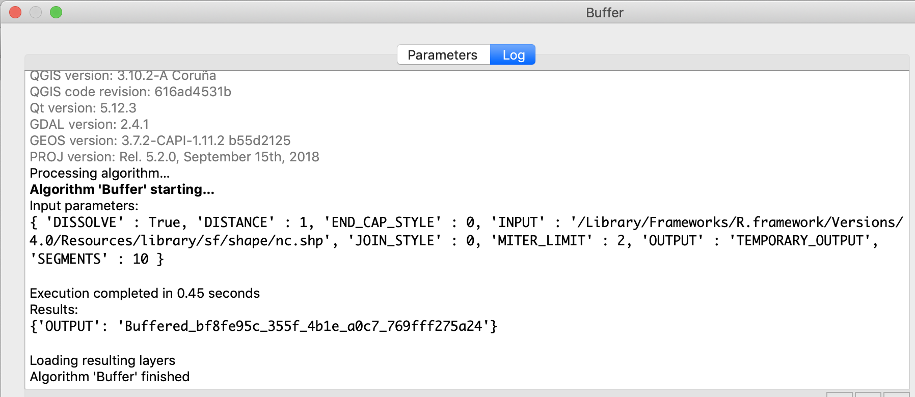
It may also be useful to run an algorithm in the QGIS GUI and examine the console ‘Input parameters’ to determine how the various input values are translated to string processing arguments:
A list of available algorithms can be found using qgis_algorithms().
When using R interactively, it may be useful to use
View(qgis_algorithms()) to search.
qgis_algorithms()
#> # A tibble: 986 x 5
#>    provider provider_title algorithm         algorithm_id    algorithm_title
#>    <chr>    <chr>          <chr>             <chr>           <chr>
#>  1 3d       QGIS (3D)      3d:tessellate     tessellate      Tessellate
#>  2 gdal     GDAL           gdal:aspect       aspect          Aspect
#>  3 gdal     GDAL           gdal:assignproje… assignprojecti… Assign projection
#>  4 gdal     GDAL           gdal:buffervecto… buffervectors   Buffer vectors
#>  5 gdal     GDAL           gdal:buildvirtua… buildvirtualra… Build virtual rast…
#>  6 gdal     GDAL           gdal:buildvirtua… buildvirtualve… Build virtual vect…
#>  7 gdal     GDAL           gdal:cliprasterb… cliprasterbyex… Clip raster by ext…
#>  8 gdal     GDAL           gdal:cliprasterb… cliprasterbyma… Clip raster by mas…
#>  9 gdal     GDAL           gdal:clipvectorb… clipvectorbyex… Clip vector by ext…
#> 10 gdal     GDAL           gdal:clipvectorb… clipvectorbypo… Clip vector by mas…
#> # … with 976 more rows- A paper on the original RQGIS package published in the R Journal
- A discussion options for running QGIS from R that led to this package
- The pull request in the
QGIS repo that led to the development of the
qgis_processcommand-line utility


