APP Demo Website: TBC
- Please download the Test_Image.zip and extract the images as input if no image is available in hand
- please make sure the dimensions of input image is less than 512*512 to maintain the perfermance and save time
- please upload the ‘PNG' image with or/and withou burnt area, based on satellite data
- please reload the website if you only see 'Analyzing' but no output. And then check you input image size and format.
Semantic Segmentation Platform on Forest Wildfire
Proposed SEmantic sEgmentation for Forest Fire(SeeFi) Platform is a cloud artificial intelligence solution for high-volume satellite data in forest wildfire detection. See4Fi shall provide easy to use high resolution burnt area calculations and visualizations to professionals within forestry and insurance. The current SeeFi functional prototype is based on optical satellite data, but a model for radar-based satellite data is being developed.
Available technologies in forest wildfire detection include aircrafts, cameras, satellites and drones. Different platforms have different image formats based on the different wavelengths, which vice versa makes the universal cloud processing difficult, not to mention the multi-source fusion.
SeeFi would provide a rapid response platform for uploading ROI image and then analyzing the input source to get final burnt area information.
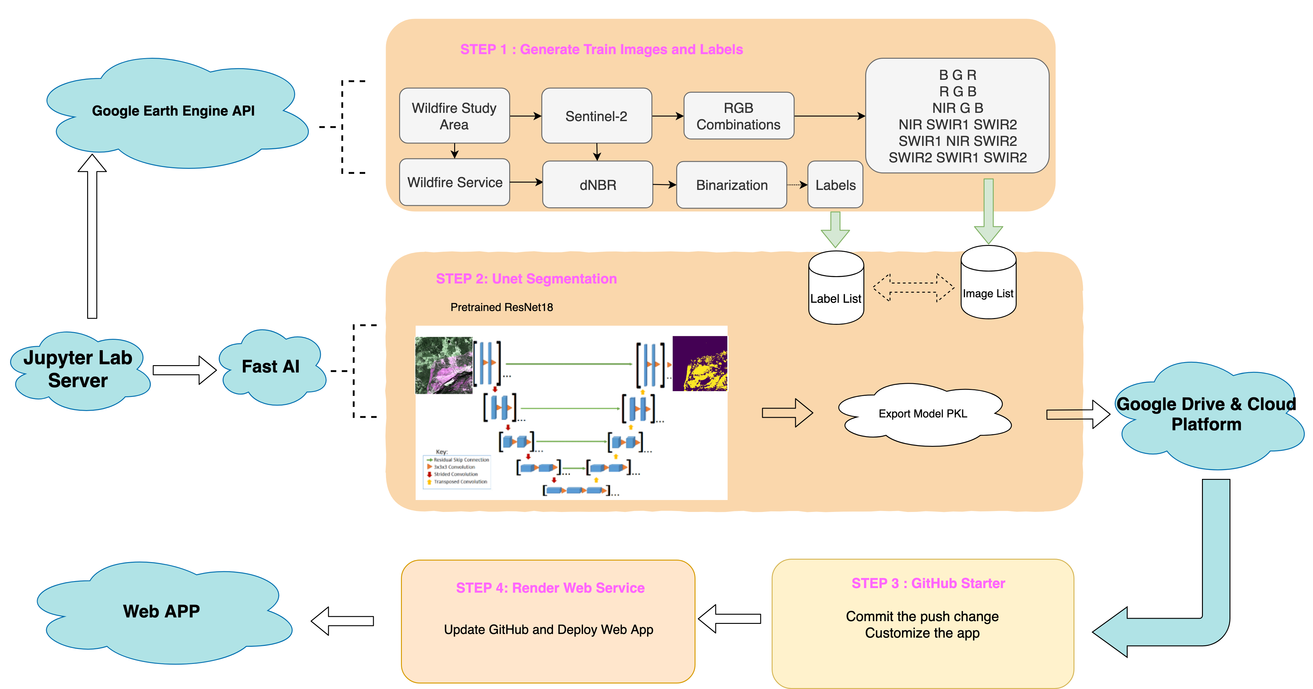
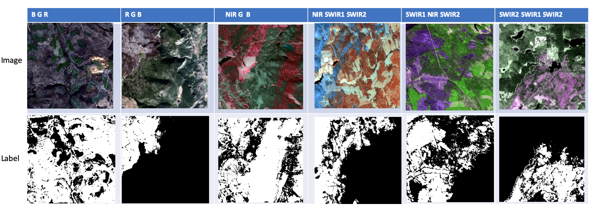
We apply Google Earth Engine Python API to generate the train images and labels. After confirming the region of interest, we could get the available Sentinel-2 images in a specific day during the fire or after the fire. Through the batch-downloading algorithm developed by us, it becomes every easy to generate the Geotiff or PNG format images including any bands we want. About the labels, we use the delta normalized burnt ratio to threshold the burnt area and then constrain it within the released official burnt region by authorities. Usually, the large wildfire would make the Sentinel-2 image huge volume. To speed the train process, we clip the ROI which contains burnt and unburnt into 300*300 pixels. The pixel resolution is 20 meters same with Sentinel-2.
The fastai library simplifies training fast and accurate neural nets using modern best practices. We download the pre-trained resnet18 model and then apply the dynamic Unet architecture to train the semantic segmentation. Finally we could export the model as pkl file and then it will be uploaded into Google Drive. Since it is bigger than 100 Megabytes. We also need the google cloud platform to help generate downloaded link.
Customize the web app based on GitHub Starter specific for fastai model. And then the app will be connected with the Deployment tool Render web service which will watch the updates in GitHub.
| Train Loss | Validation Loss | Accuracy | Dice/F1 |
|---|---|---|---|
| 0.293 | 0.283 | 0.943 | 0.743 |
- SeeFi has good performance especially in true-color image segmentation.
- SeeFi outperforms the detection results even the original labels produced by traditional dNBR with high accuracy and low noise.
- SeeFi platform learns the relationship between burnt pixels and adjacent pixels which makes its results explicable since wildfire usually has a continuous progression rather than random fire ignition pixels.
- SeeFi model could learn the representation of different combinations of optical bands which will be much more robust and general than traditional segmentation based RGB.
- SeeFi contains the advantages of all fire-sensitive bands, which could filter the unburnt pixel with abnormal reflectance in specific bands.
All the processing is finished in cloud platform. ESDL cloud server supports the computation of Step 1 and 2. Cloud Web Service and GitHub makes the web deployment successful.
- Test Image can be found in "F2S/app/Test Image" folder
- GEE download algorithm can be found in the repostory GEE_batch_download
- Unet Implementation can be found in the repostory Unet_Burnt_Area_Semantic_Seg
- The model could be downloaded in server.py


