QGIS plugin for reading STAC APIs
Site https://stac-utils.github.io/qgis-stac-plugin
The QGIS STAC API Browser currently lacks funding for maintenance, bug fixes and new features; therefore development will be slow for now. However we’re dedicated to maintaining the project. For assistance or if you have funding to contribute please reach out to Kartoza (info@kartoza.com)
Customization : Landscap Geoinfomatics Lab (University of Tartu)
- Download the release 1.1.2b from here
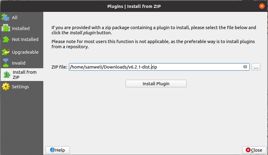
- Open the QGIS plugin manager, then select the Install from ZIP
- Click on "..." and select the zip file download in step 1
- Click install plugin
- Obtain gcp access json
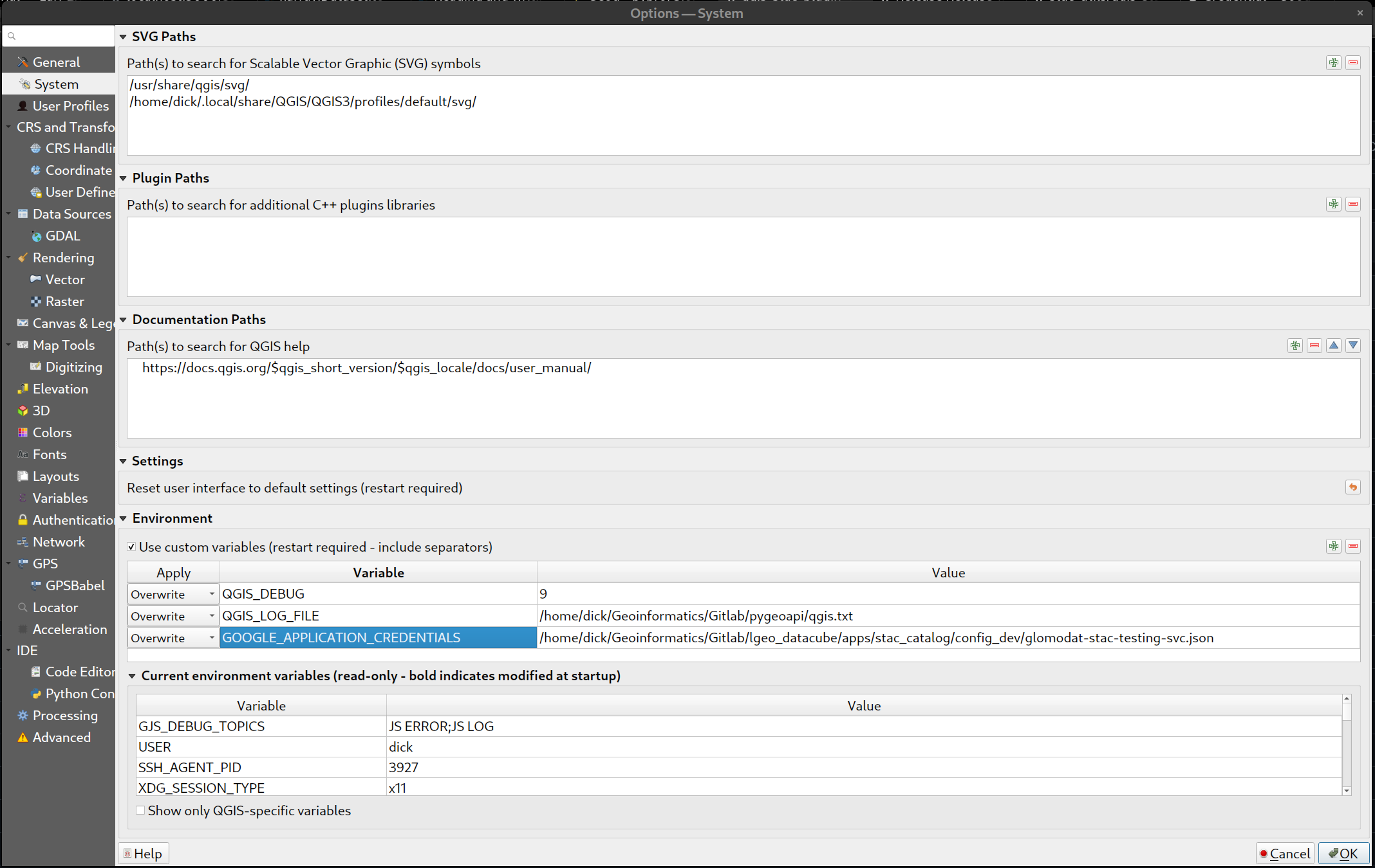
- In QGIS, Settings -> options
- Click System on the left panel
- From the right panel, look for Environment Section
- Add a new variables with :
- Apply : Overwrite
- Variable : GOOGLE_APPLICATION_CREDENTIALS
- Value : The path to the Google credential JSON file (ex. C:\Users\John\glomodat-stac-testing-svc.json)
- Click ok
- Open the STAC browser plugin from the plugin drop down
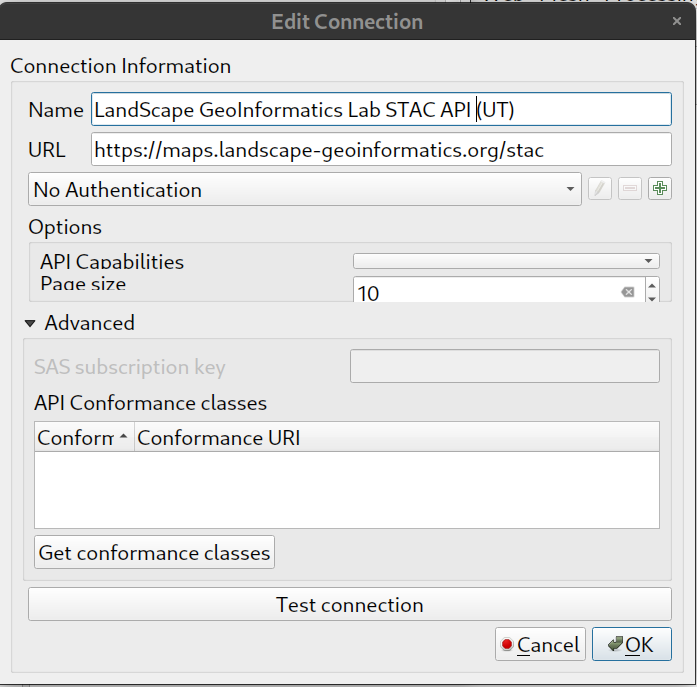
- Click New
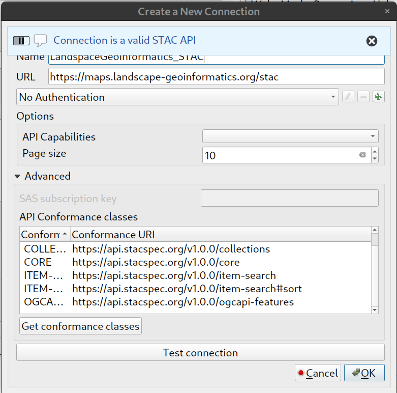
- Type in the following information:
- Name : whatever you want
- URL : https://maps.landscape-geoinformatics.org/stac
-
Click Test Connection
-
If the connection is ok , you will find a notification msg "Connection is a valid STAC API" as follow.
-
Cick OK
-
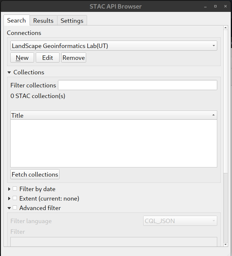
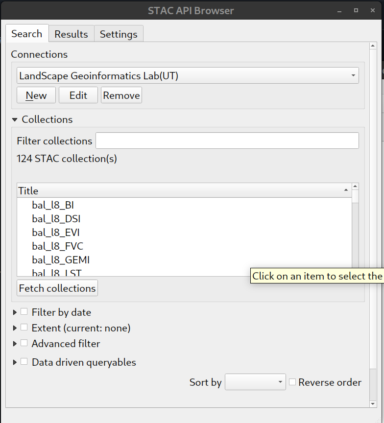
From the main browser UI, select the newly added connection from the drop down.
-
Click Fetch Collections, you will find those collections avaliable under the Collections Section
-
you can filter out collections you want by :
- typing in collection name in the Filter collections text box
- specify the Extent by clicking the Extent selction
-
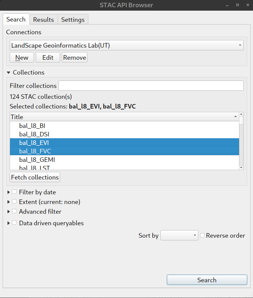
Select collections that you want to browse, then click search
-
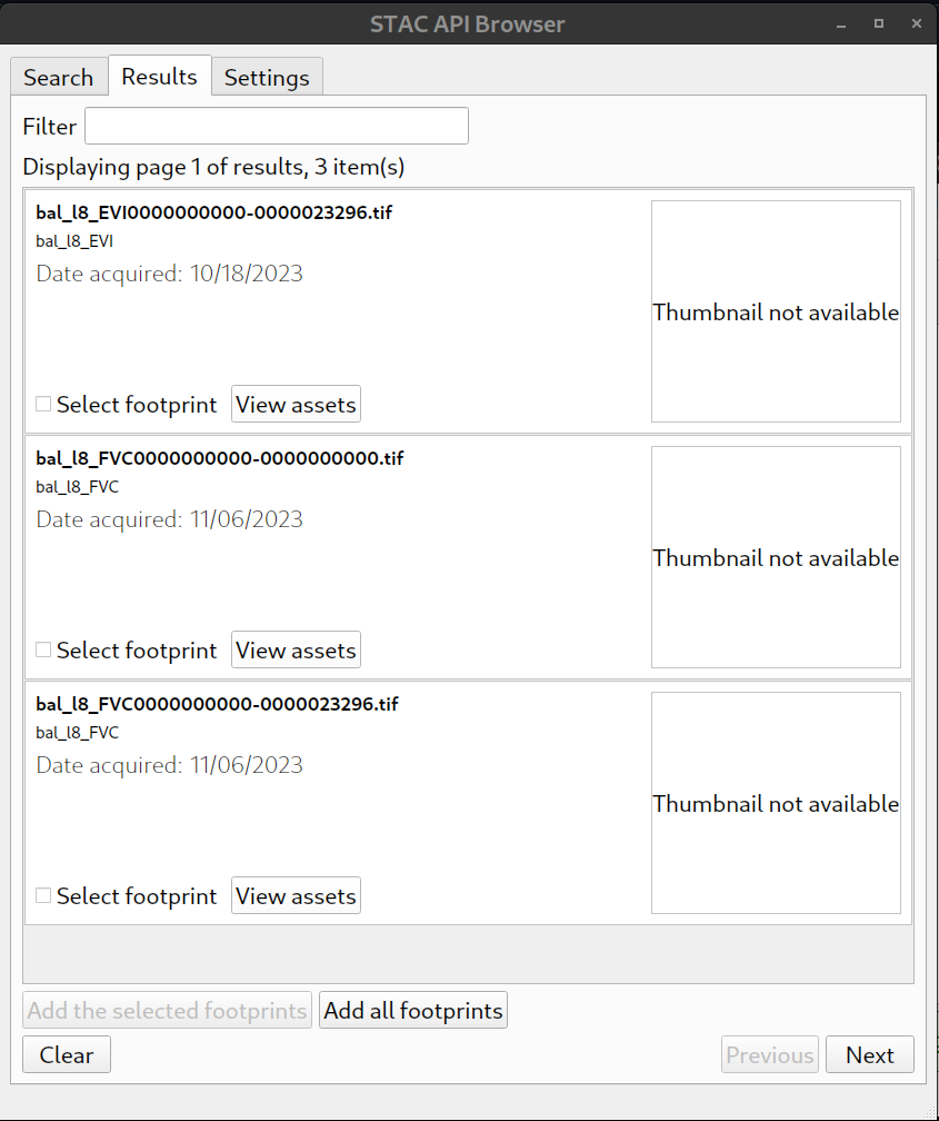
Assets under those collections that selected in the pervious step will be showns in result tab
-
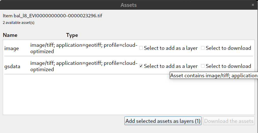
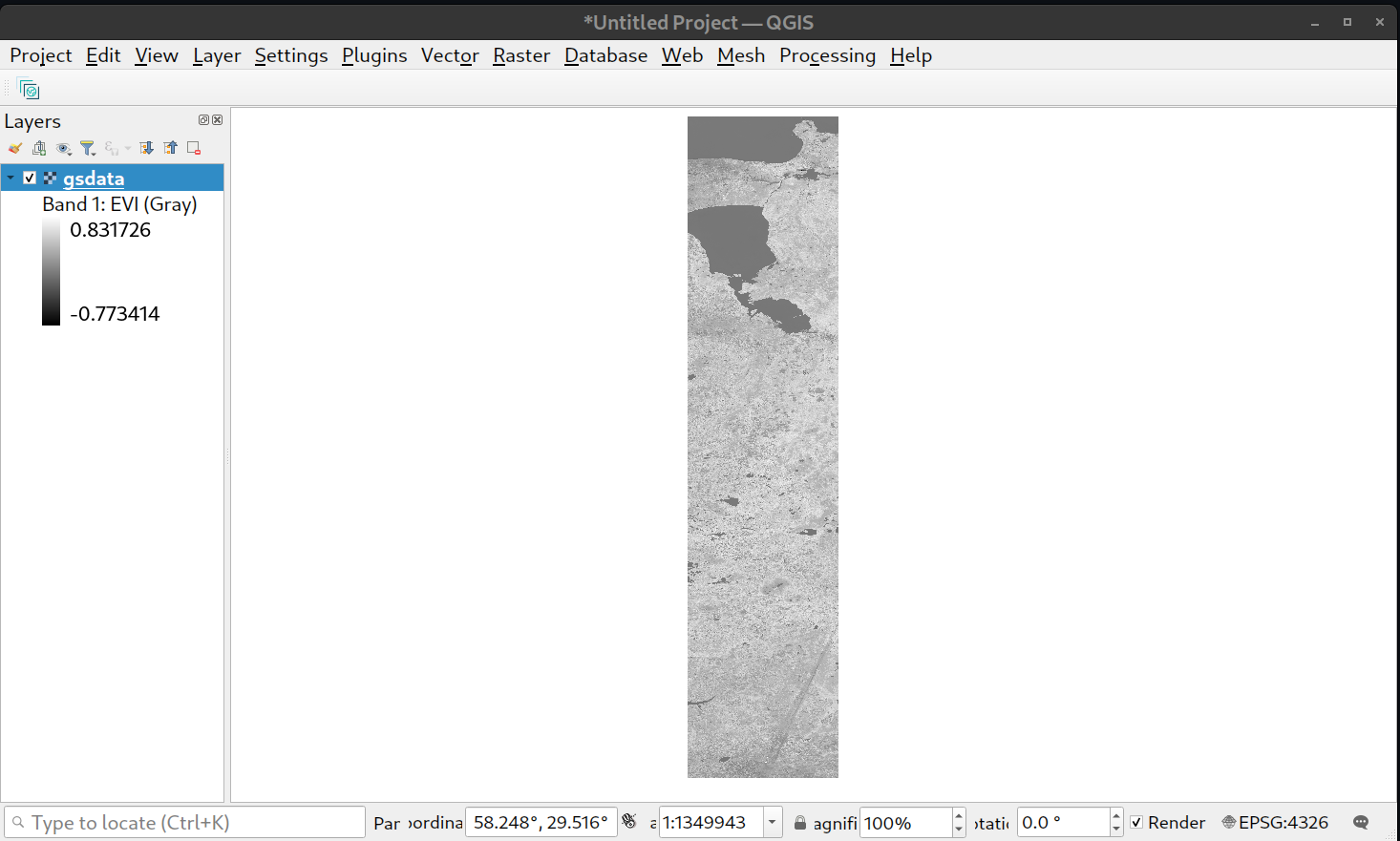
Click on view assets, from here, to load the geotiff into QGIS, click Select to add as layer under the gsdata asset
-
The selected geotiff is now loaded into QGIS


