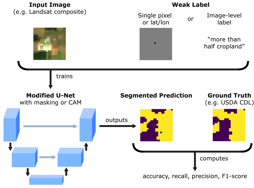
This repo contains the implementation of weakly supervised segmentation for remote sensing imagery from our Remote Sensing paper. We perform cropland segmentation using two types of labels commonly found in remote sensing datasets that can be considered sources of “weak supervision”: (1) labels comprised of single geotagged points and (2) image-level labels.
To train a U-Net on single-pixel labels, run
cd single_pixel_labels
python src/run_masked.py --model_dir ./experiments
To train a U-Net on image-level labels, run
cd image_labels
python src/run_UCAM.py --model_dir ./experiments
Note that the code for the single-pixel labels was written in PyTorch, while the code for the image-level labels was written in TensorFlow 1.x.
The models, datasets, and data loaders are currently written to process Landsat tiles in either .tfrecord (for the image-level labels) or .npy (for the single-pixel labels) formats. The last layer of the .tfrecord or .npy files are assumed to be the segmentation ground truth label.
In each experiments directory is a params.json file that defines the data directory, training/val/test split file names, model architecture, number of channels in the input data, data augmentation procedures to use, and what model outputs to save. The --model_dir flag must point to the directory with a valid params.json file in order for training to proceed.
When using the code from this repo, please cite:
- S. Wang, W. Chen, S. M. Xie, G. Azzari, and D. B. Lobell, “Weakly Supervised Deep Learning for Segmentation of Remote Sensing Imagery,” Remote Sensing, vol. 12, no. 2, p. 207, Jan. 2020, doi: 10.3390/rs12020207.
Please feel free to email sherwang [at] stanford [dot] edu with any questions about the code or suggestions for improvement.
