Accessing the Police API and McDonald's store location data, to use the Haversine formula, to see if level of anti-social "yobbo" crime is higher in the vicinity of a MackyD venue
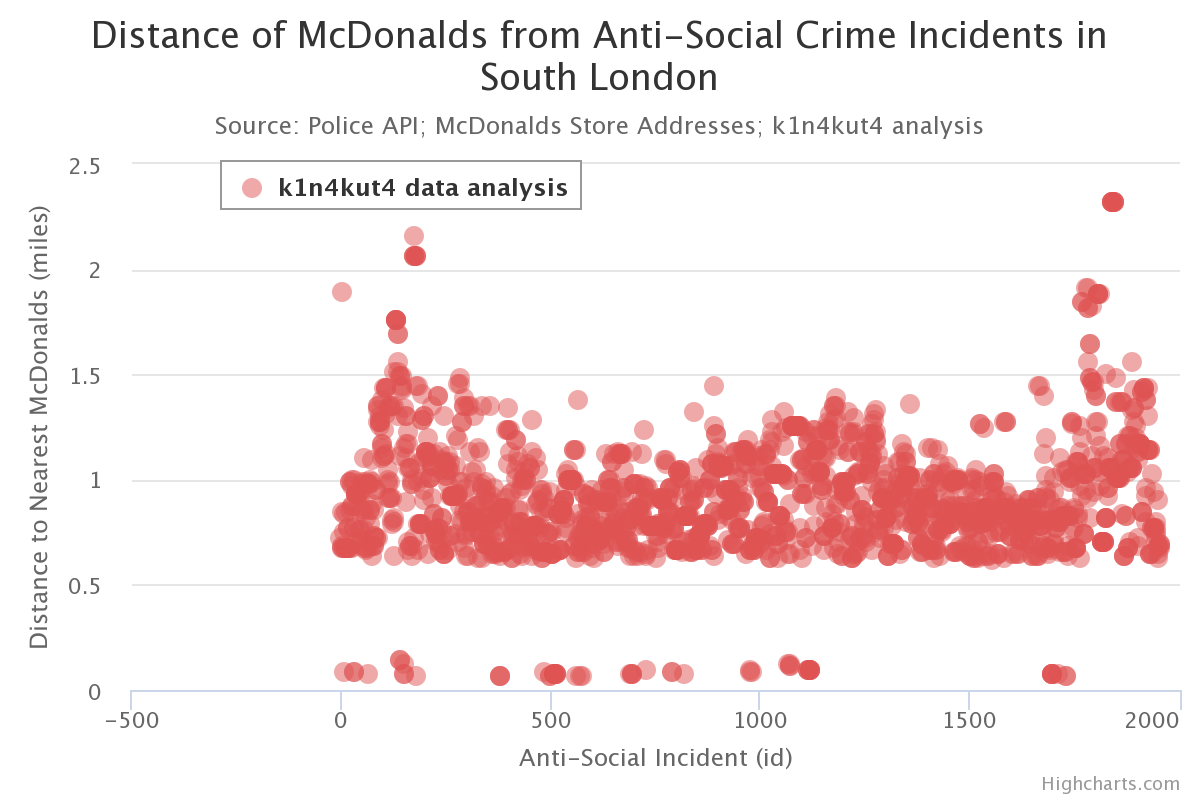
Nearly 2,000 crime incidents reviewed, for distance to the nearest McDonalds store. Plotted to graph. As the data for stores was all within 5 miles of Peckham, I have ignored any crime occuring over 5 miles from a store, because such clearly requires a larger store dataset (and more processing time.)
To calculate distance between crime locations and McDonalds' stores. I calculate the great-circle distance between two points – that is, the shortest distance over the earth’s surface – giving an ‘as-the-crow-flies’ distance between the points (ignoring any hills they fly over).
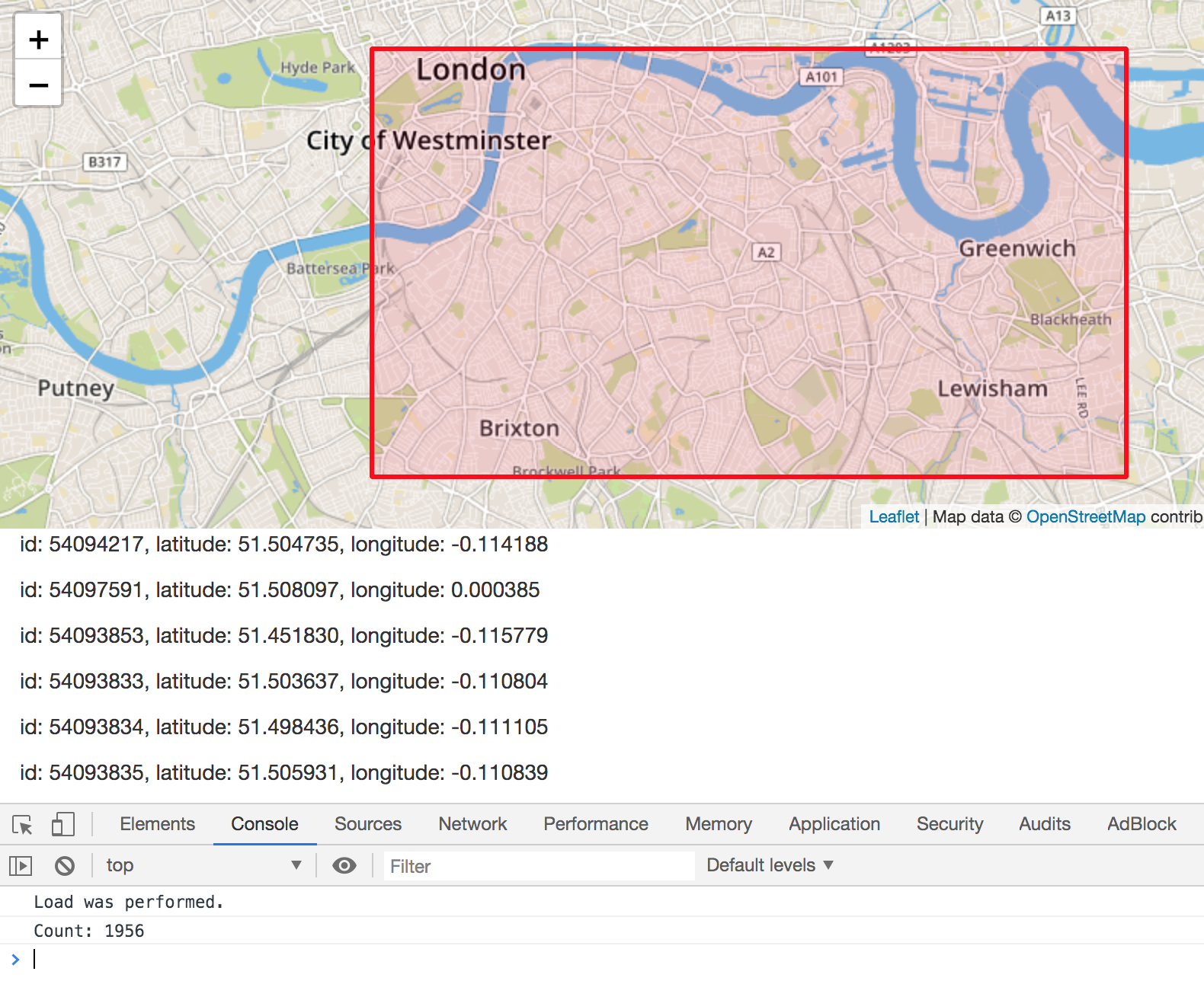
Polygon set for the crime data request to Police API: that is South London, i.e. Lambeth, Peckham, Greenwich.
$.get( "https://data.police.uk/api/crimes-street/anti-social-behaviour?poly=" + bottom_lat + "," + left_long + ":" + bottom_lat + "," + right_long +":" + top_lat + "," + right_long + ":" + top_lat + "," + left_long + "&date=2017-01", .........
From this url https://www.mcdonalds.com/gb/en-gb/restaurant-locator.html, I extracted details of all stores within 5 miles of Peckham, which falls within the centre of the polygon I set for the crime data request.
$('#rl-listView .restaurant-location__address-container').each(function(){

console.log("'"+ $(this).find('.restaurant-location__title').html() + "','" + $(this).find('.restaurant-location__address').html().replace('','').replace('','').replace('
',', ') + "'");

});
Stores extracted:
'Peckham','72/76 RYE LANE, PECKHAM, SE15 5DQ'

'Old Kent Road Dt','518 OLD KENT ROAD RETAIL PARK, PECKHAM, SE1 5BA'

'Camberwell','BUTTERFLY WALK, CAMBERWELL GREEN, SE5 8RW'

'Deptford','BESTWOOD RETAIL PARK, DEPTFORD, SE8 5DQ'

'Walworth Rd','198/200 WALWORTH ROAD, SOUTHWARK, SE17 1JJ'

'Brixton','518/522 BRIXTON ROAD, BRIXTON, SW9 8EN'

'Lewisham','166/172 LEWISHAM HIGH STREET, LEWISHAM, SE13 6JL'

'LONDON BRIDGE','TOOLEY STREET, , SE1 2TF'

'Greenwich-Cutty Sark','2 CRESCENT ARCADE, GREENWICH, SE10 9EJ'

'Highway Shadwell','102/106 THE HIGHWAY WESTBOUND, SHADWELL, E1W 2BX'

'Catford 2','CATFORD ISLAND, CATFORD, SE6 2DD'

'Waterloo Station','UNIT 43 THE COLONNADE, LAMBETH, SE1 8SF'

'Clapham','130/134 CLAPHAM HIGH STREET, CLAPHAM, SW4 7UH'

'Wandsworth Road','368/370 WANDSWORTH ROAD, CLAPHAM, SW8 4ET'

'Streatham Place','2/22 STREATHAM PLACE, STREATHAM, SW2 4PZ'

'Sydenham','BELL GREEN RETAIL PARK, SYDENHAM, SE26 4PU'

'Commercial Road','201/217 COMMERCIAL ROAD, TOWER HAMLETS, E1 2BT'

'St Pauls','1A LUDGATE HILL, CITY OF LONDON, EC4M 7AA'

'Liverpool Street','UNIT 25 THE CONCOURSE, CITY OF LONDON, EC2M 7PY'

'Fleet Street','152/153 FLEET STREET, CITY OF LONDON, EC4A 2DQ'

'Whitehall','45/47 WHITEHALL, WESTMINSTER, SW1A 2BX'

'Strand','34/35 STRAND, WESTMINSTER, WC2N 5HY'

'Victoria','155 VICTORIA STREET, WESTMINSTER, SW1E 5NA'
Postcodes:
SE15 5DQ
SE1 5BA
SE5 8RW
SE8 5DQ
SE17 1JJ
SW9 8EN
SE13 6JL
SE1 2TF
SE10 9EJ
E1W 2BX
SE6 2DD
SE1 8SF
SW4 7UH
SW8 4ET
SW2 4PZ
SE26 4PU
E1 2BT
EC4M 7AA
EC2M 7PY
EC4A 2DQ
SW1A 2BX
WC2N 5HY
SW1E 5NA
Which have the latitudes and longitudes of:
51.47040,-0.06910
51.48439,-0.06843
51.47316,-0.09259
51.48966,-0.04256
51.48987,-0.09716
51.46160,-0.11597
51.46043,-0.01140
51.50474,-0.08391
51.48161,-0.01071
51.50914,-0.06167
51.44454,-0.01795
51.50315,-0.11192
51.46295,-0.13571
51.47421,-0.13299
51.44613,-0.12619
51.42986,-0.03394
51.51482,-0.05888
51.51367,-0.10114
51.51849,-0.08220
51.51435,-0.10784
51.50642,-0.12689
51.50877,-0.12445
51.49645,-0.14107
Crime is clearly higher when within 2 miles of a McDonalds, but there is a MackShack within approx said distance almost anywhere in Londonium. The correlation is weak due to many outliers, and in fact, when in the vicinity of store, that is under a mile, the crime rate is lower.
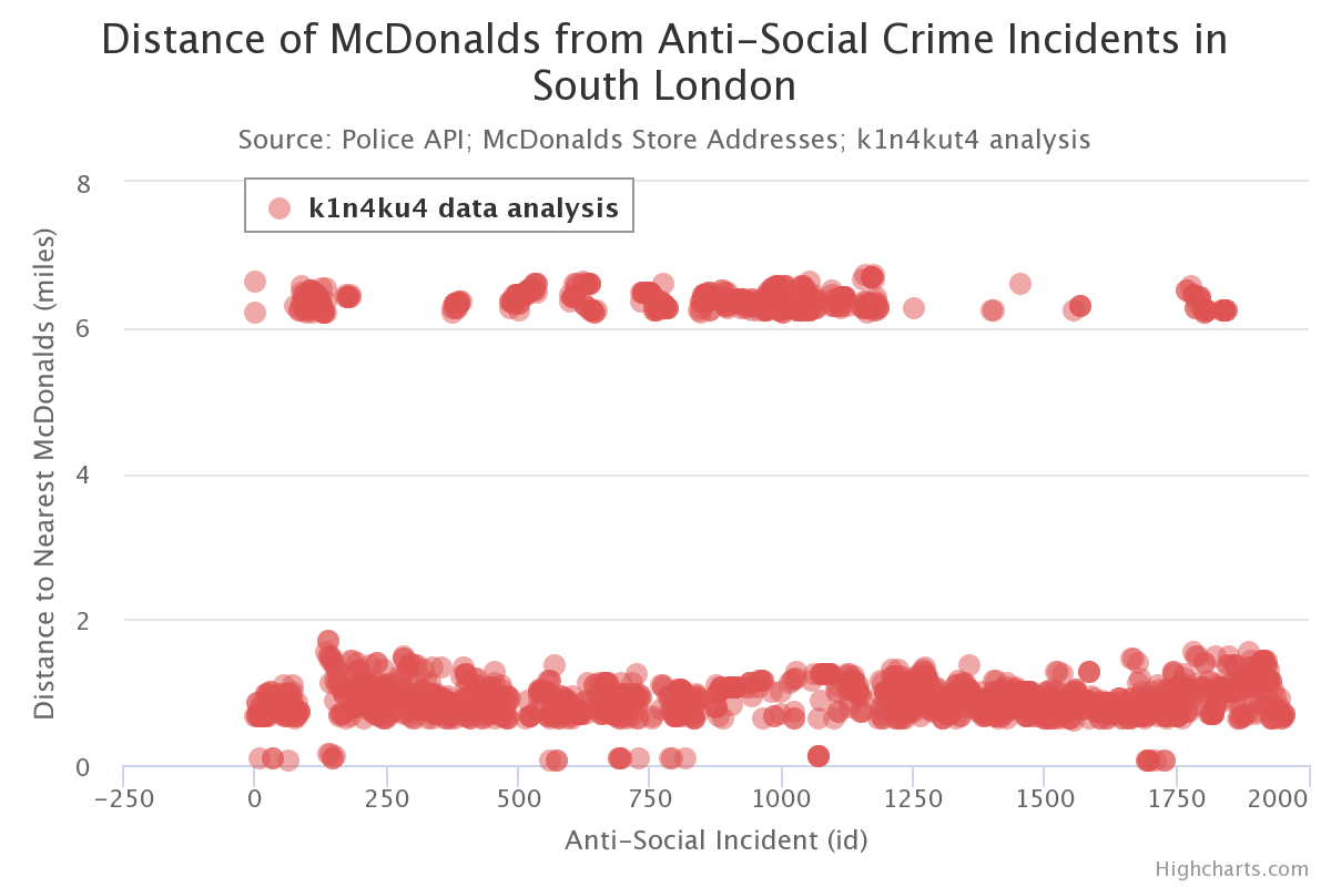
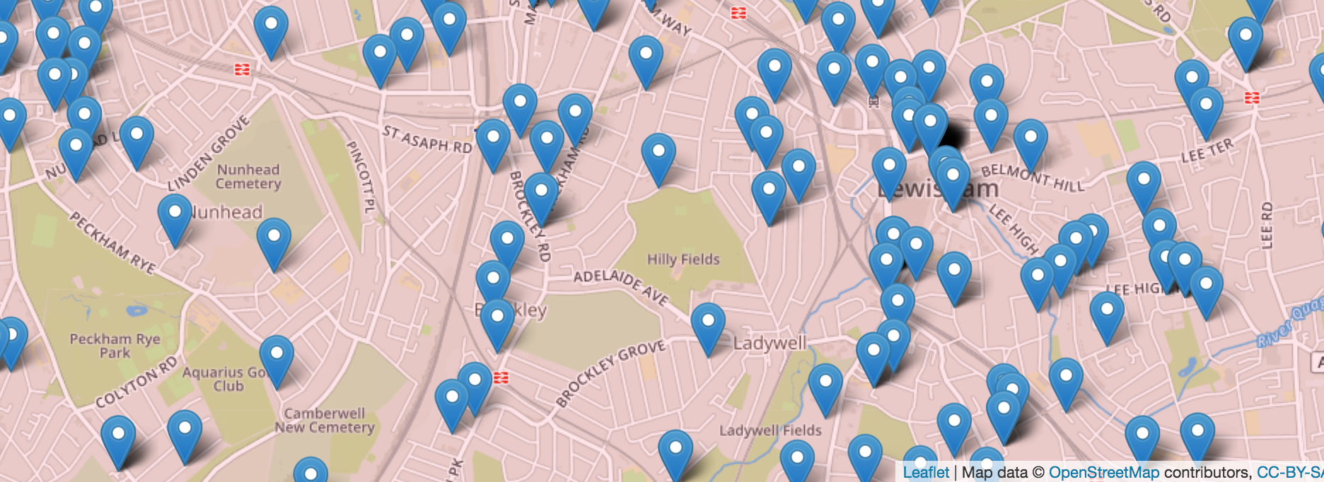
However, as plotting the crime incidents to a map reveals most areas of London have faced some form of anti-social crime, the prescence of two extremes is peculiar, even impossible. Some instances could be away from a store but 8 miles is unrealistic. I suggest that this is rather due to the two datasets (crime incidents, and store locations) having different boundaries.
While the police data is retuned based on a rectangular polygon, the McDonalds' store details are simply an extraction of all stores within 5 miles of Peckham. Thus for incidents with the stores at distance 8 miles of higher, there probably is a local McDonalds.
Would consider extracting data of all stores within 10 miles of Peckham.


