Library for conversion GPS location info to UTM coordinates (WG86). It has been implemented From library UTMconversion.h (TinyTrackGPS V0.7)
For a tutorial on how to install new libraries for use with the Arduino development environment please refer to the following website: http://www.arduino.cc/en/Reference/Libraries
--- or ---
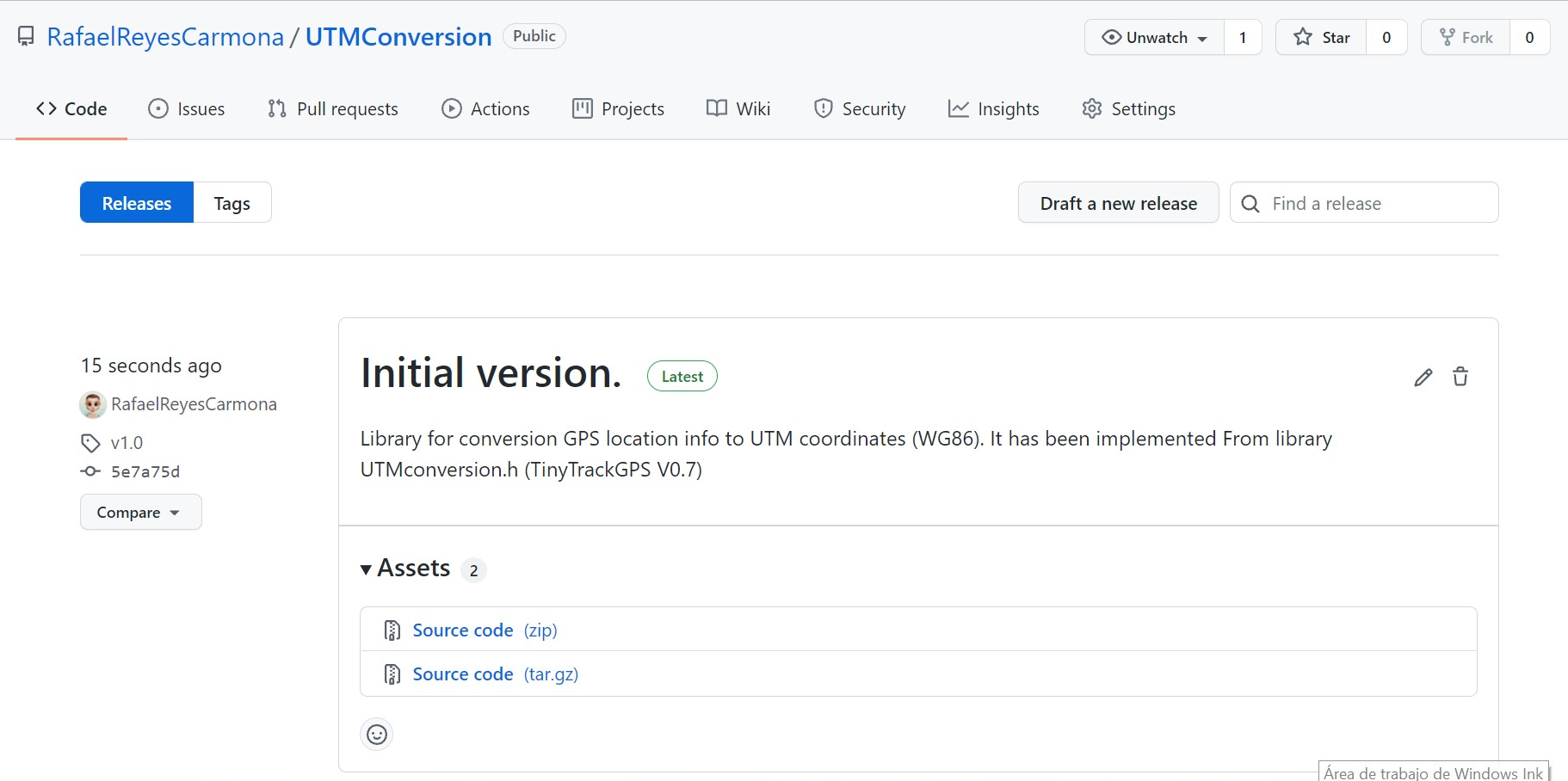
- Download the ZIP file from the page releases to your machine.
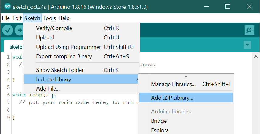
- In the Arduino IDE, choose Sketch/Include Library/Add Zip Library.
- Navigate to the ZIP file, and click Open.
How to use the library in PlatformIO see documentation of Library Manager.
The only one simple step is to define dependencies in “platformio.ini” (Project Configuration File). For example,
[env:pro16MHzatmega328]
platform = atmelavr
board = pro16MHzatmega328
framework = arduino
lib_deps = rafaelreyescarmona/UTMConversion

[env:LGT8F328]
board = LGT8F328P
board_build.f_cpu = 32000000
platform = lgt8f
framework = arduino
lib_deps = rafaelreyescarmona/UTMConversion@^1.0.0
For Manual installation in PlatformIO Core:
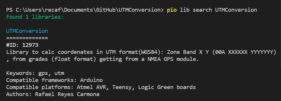
- Run a terminal and type for search the library:
pio lib search UTMConversion
- Type for install:
pio lib install 12973
--- or ---
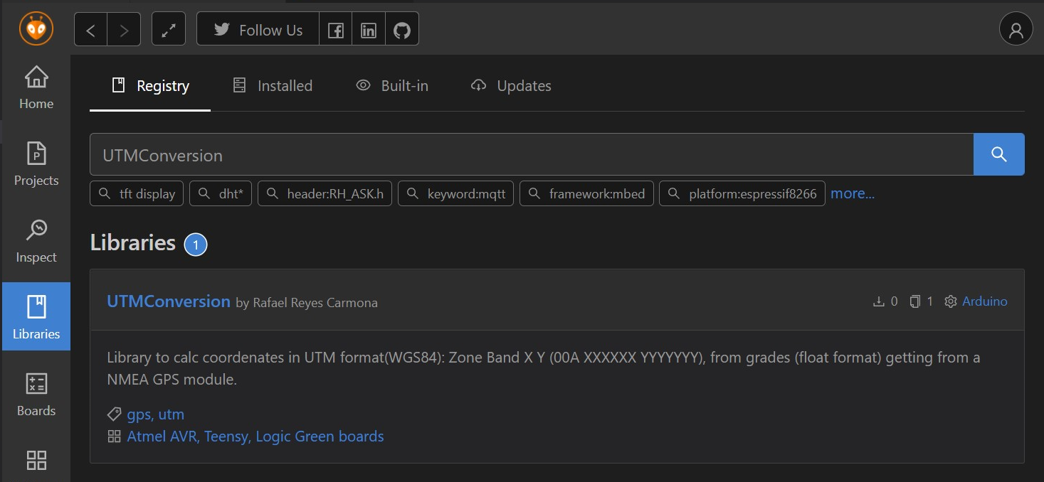
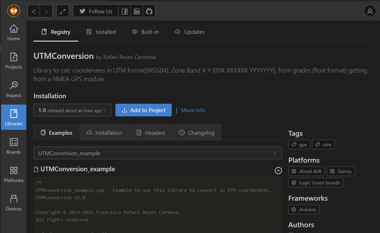
- Search "UTMConversion" in search box of Libraries of panel.
- Click Add to project button. Library will be included in the project and "platformio.ini" updated.
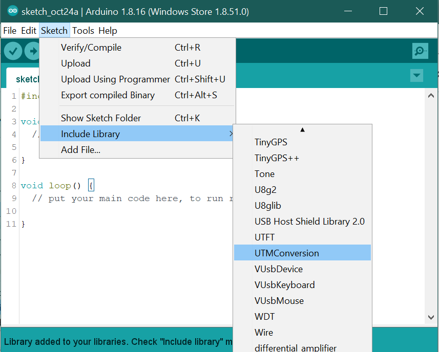
In Arduino IDE, Choose Sketch/Include Library/Scroll and select "UTMConversion".
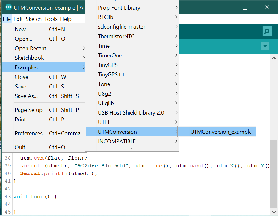
There are a two examples files with the library. In the Arduino IDE, choose File/Examples/UTMConversion, and you can see "UTMConversion_example".
--- or ---
Example of use:
#include "UTMconversion.h"

float flat = 37.8959210;
float flon = -4.7478210;

GPS_UTM utm;

void setup() {
  char utmstr[] = "30S 123456 1234567";

  Serial.begin(9600);

  utm.UTM(flat, flon);
  sprintf(utmstr, "%02d%c %ld %ld", utm.zone(), utm.band(), utm.X(), utm.Y());
  Serial.println(utmstr);
}

void loop() {

}
Those are some examples using the library:
Coordenates 37.895920, -4.747821 -> UTM: 30S 346323 4195707
Coordenates 40.033222, -2.567744 -> UTM: 30T 536879 4431534
Coordenates 40.774998, 15.582325 -> UTM: 33T 549141 4513943
Coordenates 66.077492, -45.853359 -> UTM: 23W 461387 7328810
Coordenates 33.406994, -84.482201 -> UTM: 16S 734146 3699241
Coordenates -11.551785, -45.151016 -> UTM: 23L 483534 8723004
Coordenates 7.333418, -69.030663 -> UTM: 19N 496616 810607
Coordenates -41.266792, -67.625977 -> UTM: 19G 615092 5430716
Coordenates -21.643806, 18.059813 -> UTM: 34K 195661 7603716
Coordenates -37.463226, 146.629180 -> UTM: 55H 467207 5853673
You can test theM with this page: (https://coordinates-converter.com/en)
- Fix an error when latitude is between -1 and 0.
- Added high precision using 'long' instead decimal for latitude and longitude.
- Change algoritm to calculate zone letter.
- Fix a possible overflow with integers when calculate _y.
- Initial version release. Library for conversion GPS location info to UTM coordinates (WGS86). It has been implemented From library UTMconversion.h (TinyTrackGPS V0.7)
This file is part of UTMConversion.
UTMConversion is free software: you can redistribute it and/or modify it under the terms of the GNU General Public License as published by the Free Software Foundation, either version 3 of the License, or (at your option) any later version.
UTMConversion is distributed in the hope that it will be useful, but WITHOUT ANY WARRANTY; without even the implied warranty of MERCHANTABILITY or FITNESS FOR A PARTICULAR PURPOSE. See the GNU General Public License for more details.
You should have received a copy of the GNU General Public License along with UTMConversion. If not, see https://www.gnu.org/licenses/.
Copyright © 2019-2021 Francisco Rafael Reyes Carmona. Contact me: rafael.reyes.carmona@gmail.com
Location icon at the beginning is from Flaticon.es designed by Good Ware and licensed by free license.


