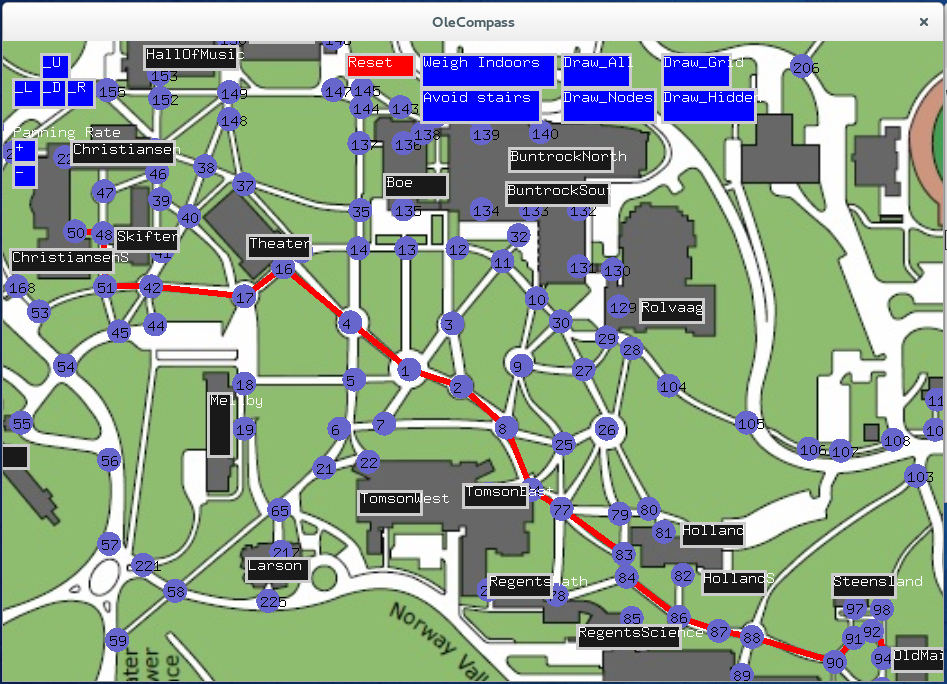
In the frozen tundra known as Northfield, Minnesota, determining the fastest way from Rolvaag Math to Skogland is a difficult and critical task. Especially so when trying to factor in the perceived increase in distance experienced in crossing the icy and windswept campus sidewalks. But what of those who cannot climb stairs? Never fear because for such users, our program offers a way to quantitatively determine the shortest path between two buildings, various different locations on campus, and is also capable of increasing the priority certain factors such as staying indoors when it's -30 degrees or avoiding stairs when you've broken your leg.
Navigating campus is even more difficult for those who are not familiar with St. Olaf Campus. Such may include prosective students, the occasional Carleton student who comes and realizes what they're missing out on, or even visiting alumni who are now unfamiliar with the current layout of campus and find that themselves attempting to work out at the Theatre building by mistake. This program offers a means of navigating campus and figuring out how to get from point A to point B with the detail that google maps lacks. This allows greater equity of access to the wonderful facilities St. Olaf has to offer.
The program has an intuitive graphic interface that makes choosing a path to calculate simple and understanding the programs output intuitive. The algorithm that calculates the shortest path is robust and versatile enough to calculate paths by weighting the paths in several distinct manners based on the user's preference.
Originally from the OleCompass page on the CS Wiki
To compile the code, simply type make mapDraw in the command line. To run it, enter ./mapDraw, without quotations.
The input files are StoMap.pam, EntireMapCalc.txt, buttonList.txt, and SpecialButtons.txt.
