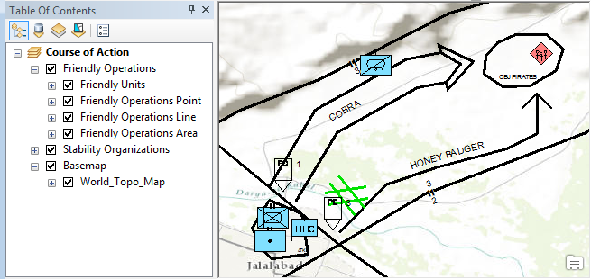
The ArcGIS Defense and Intelligence Military Features Data repository is a set of data and test applications for use in ArcGIS Desktop and ArcGIS Runtime. This data is used to create features for planning, operations and intelligence domains based on military symbology specifications such as MIL-STD-2525C and APP-6(B).
- This is the source data for the ArcGIS Defense and Intelligence military feature templates. This data is used to create features and derived data products using military symbology.
- Provides data files that let you create command and control (C2) operational features based on military symbology specifications MIL-STD-2525C and APP-6(B) in ArcGIS Desktop
- Provides layer packages that include the database schema to create features for units, equipment and installations and operations as well as for stability operations, emergency management and meteorological and oceanographic (METOC) features
- Provides symbology style files for displaying and creating military symbology in ArcGIS Desktop
- Provides additional derived data products for use in ArcGIS Runtime
- ArcGIS Desktop 10.1 (or later)
- If using the Style and Layer Files
- ArcGIS Runtime 10.2 (or later)
- If using the Symbol Dictionary Files
New to Github? Get started here.
- Download the repository
- If using the source data with ArcGIS Desktop...
- Update the local ArcGIS Military Style Files to the latest versions from the repository.
- Navigate to the folders
- Update/copy all of the .style files from each folder into your ArcGIS Desktop Style folder (overwrite if necessary - you may want to create a backup of these files before this step)
- For example, copy the style files from above location into this Desktop Folder:
- {ArcGIS Install Location}\ArcGIS\Desktop10.X\Styles
- Create symbology using the ArcGIS Style Manager or open the provided layer packages to create military features
- If using the source data with ArcGIS Runtime...
- Update the local ArcGIS symbol dictionary files with the versions from the repository.
- Navigate to the folders
- Update/copy the files from each folder into your ArcGIS Runtime folder (overwrite if necessary - you may want to create a backup of these files before this step)
- There are several applications provided to verify/validate the correctness of this data.
- For more information, see the instructions in the test folder.
- Learned more about Esri's Solutions Templates
- Learn more about Esri's ArcGIS for Defense maps and apps.
- Find a bug or want to request a new feature? Please let us know by submitting an issue.
Esri welcomes contributions from anyone and everyone. Please see our guidelines for contributing.
Copyright 2013-2014 Esri
Licensed under the Apache License, Version 2.0 (the "License"); you may not use this file except in compliance with the License. You may obtain a copy of the License at
http://www.apache.org/licenses/LICENSE-2.0
Unless required by applicable law or agreed to in writing, software distributed under the License is distributed on an "AS IS" BASIS, WITHOUT WARRANTIES OR CONDITIONS OF ANY KIND, either express or implied. See the License for the specific language governing permissions and limitations under the License.
A copy of the license is available in the repository's license.txt file.
[](Esri Tags: ArcGIS Defense Intelligence Military Features 2525 APP6 2525C APP6B) [](Esri Language: Java)
