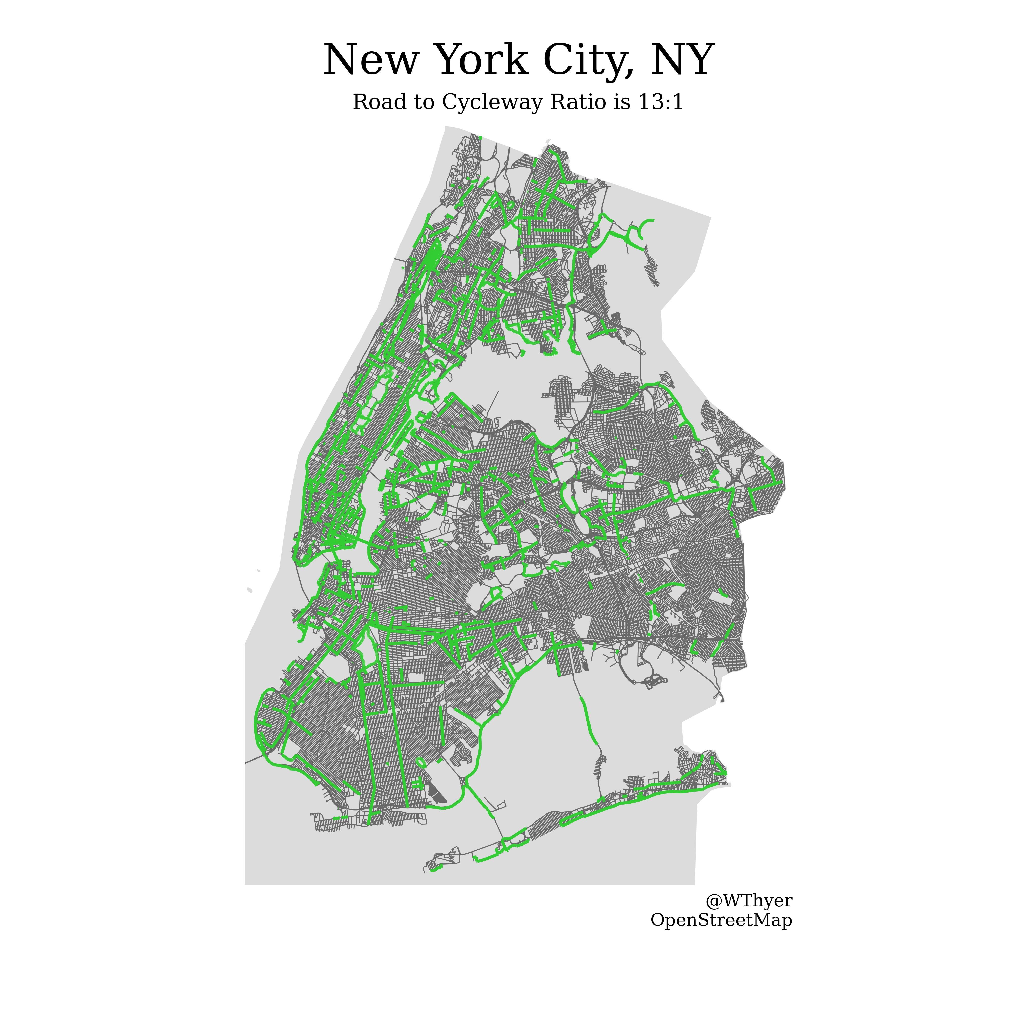
By William Thyer Using OSMnx in Python to visualize and quantify bikeability of cities.
network_functions.py:
Contains useful functions that notebooks call. Mostly wrappers for OSMnx and Matplotlib functions.
bike_networks.ipynb:
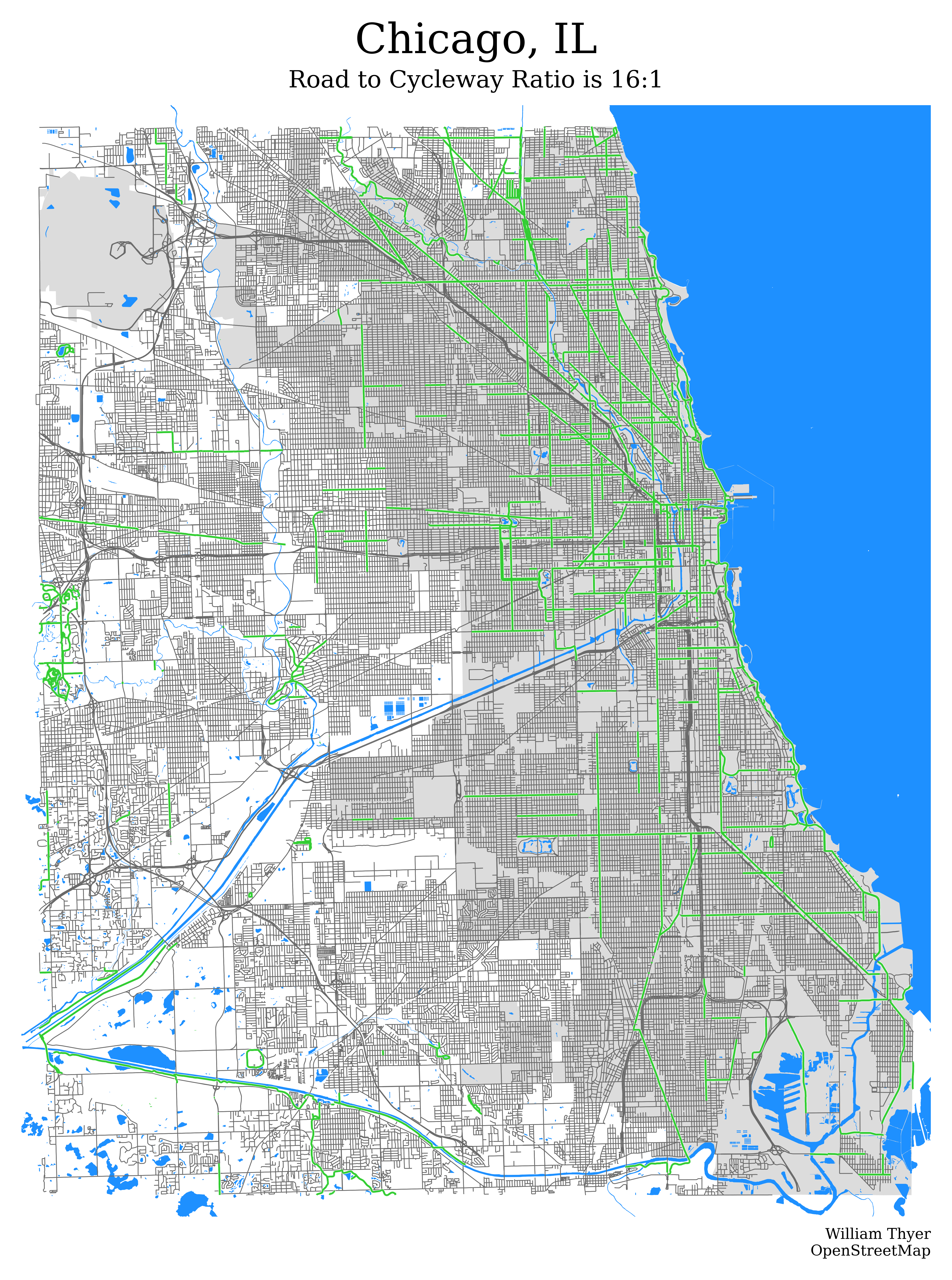
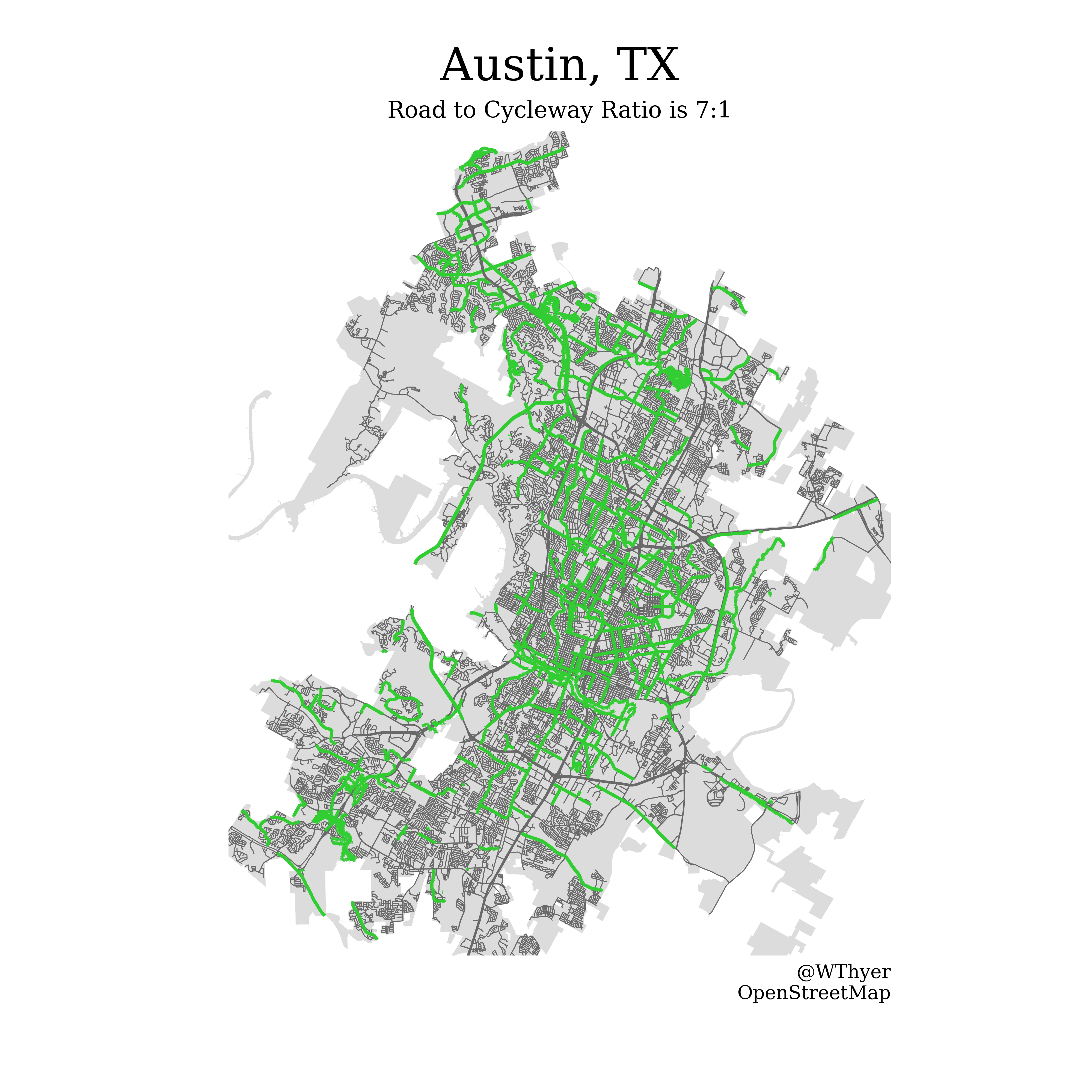
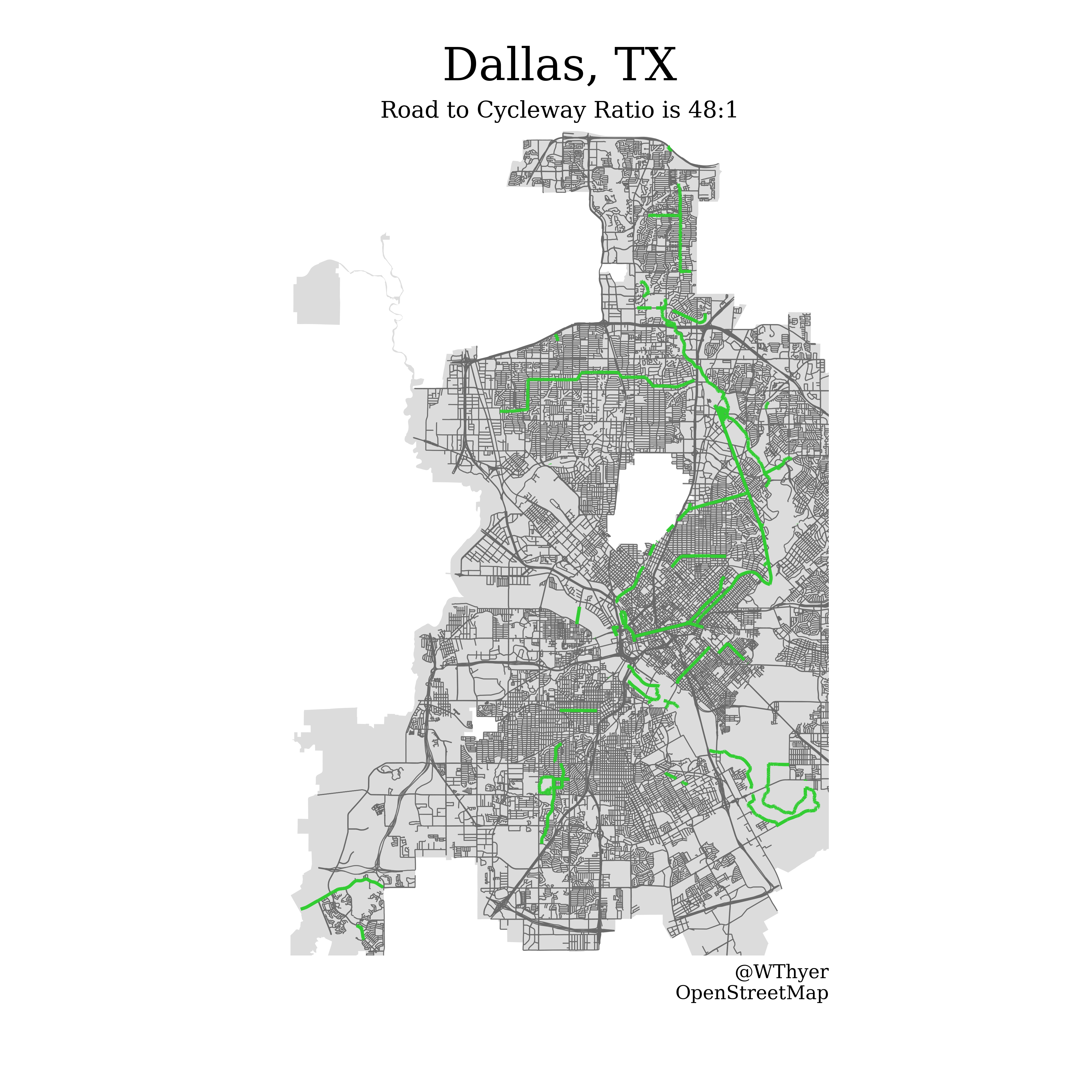
Main notebook for creating a map of cycleways and public roads in any given city. If you want to make a map, this is the file to look at!
best_worst_major_cities.ipynb:
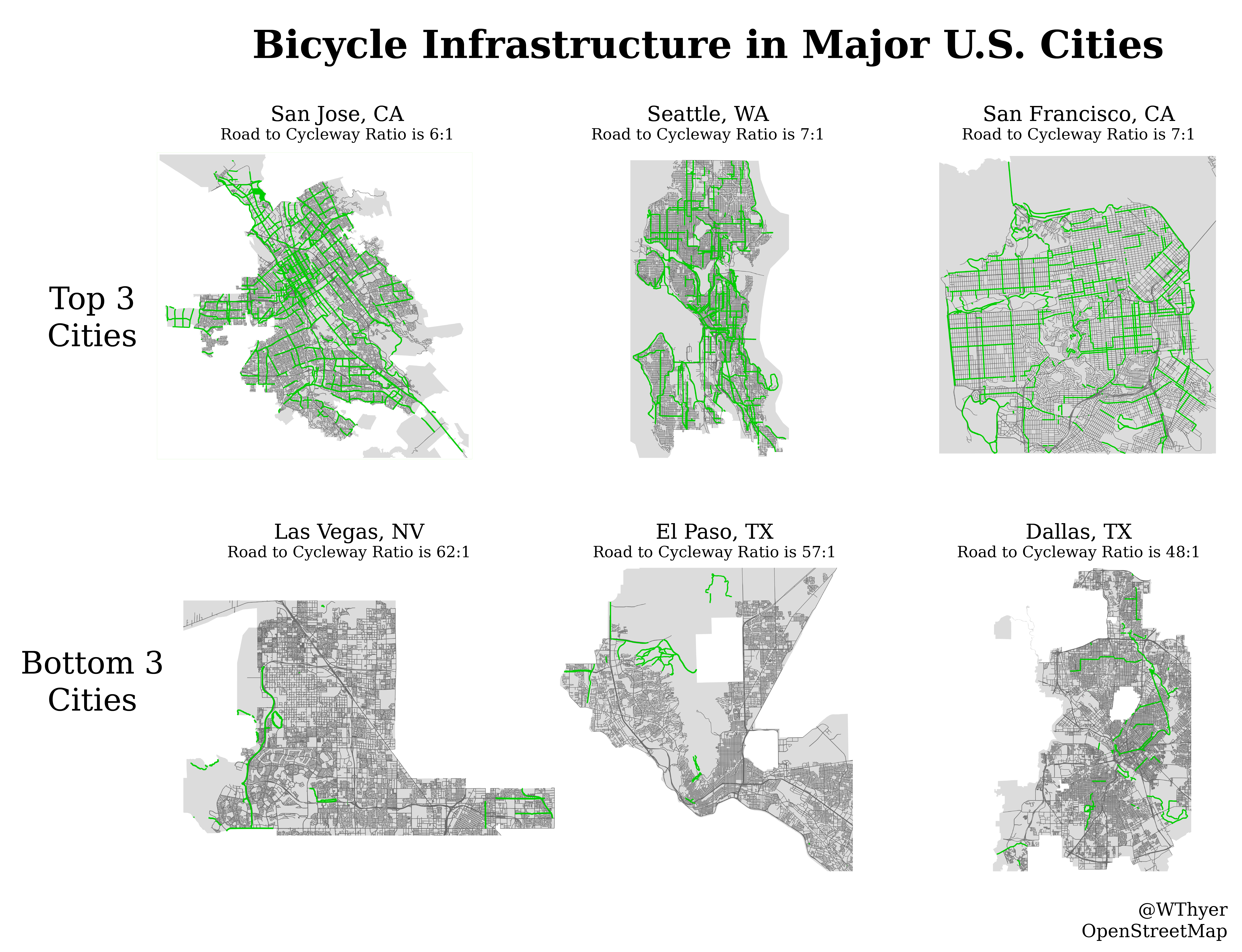
Goes through top 30 cities and creates a cycleway map. Used to find best and worst cities for bike infrastructure.
OSMnx Docs
Really nice tutorial
OSMnx examples Github
Useful thread related to cycleways
Other tutorial
Water thread
Map polygon intersection thread
Urban walkabililty
