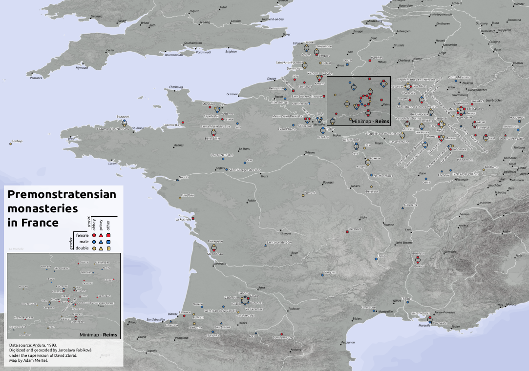
This maps (static and interactive) visualize a dataset of Premonstratensian houses in France from the foundation of the order up to the present. The dataset is a digital adaptation and formalization of the most complete catalogue available, edited by Bernard Ardura (Abbayes, prieurés et monastères de l’ordre de Prémontré en France des origines à nos jours: Dictionnaire historique et bibliographique, 1993)
Data were digitized from Ardura, 1993 by Jaroslava Fabíková under the supervision of David Zbíral. This dataset is published online and open to be used.
Hosted under DISSINET domain, this map allows interactively filtering the dataset by time, the gender of the community, a choice of base maps and query the detail of the record on marker click. The map was constructed with react-leafltet and tailwindcss.
This static map was created in QGIS, and it is the appendix of the Bachelor's thesis of Jaroslava Fabíková.

This is a side-activity of the project of Dissident Networks Project (DISSINET) at the Masaryk University, Brno. The project received funding from the Czech Science Foundation (project No. GX19-26975X “Dissident Religious Cultures in Medieval Europe from the Perspective of Social Network Analysis and Geographic Information Systems”). We gratefully acknowledge this financial support.
