aeChack Read Me
Team entry for the AEC Hackathon 2013-11-08/10 held at Facebook HQ, Menlo Park CA
Concept
aeChack is a free, online and open source platform for running and visualizing environmental analysis using daylighting and energy analysis engines.
All 43,961 buildings in Manhattan, NY in zoomable, pannable 3D
GitHub Presence
Hosted code: aechack.github.io
Source code: github.com/aechack
Ongoing Work
- 2013-11-13 ~ Limited version. Only loads two external files: New York sun data and user-selected building JSON data. To be used as the basis for further development.
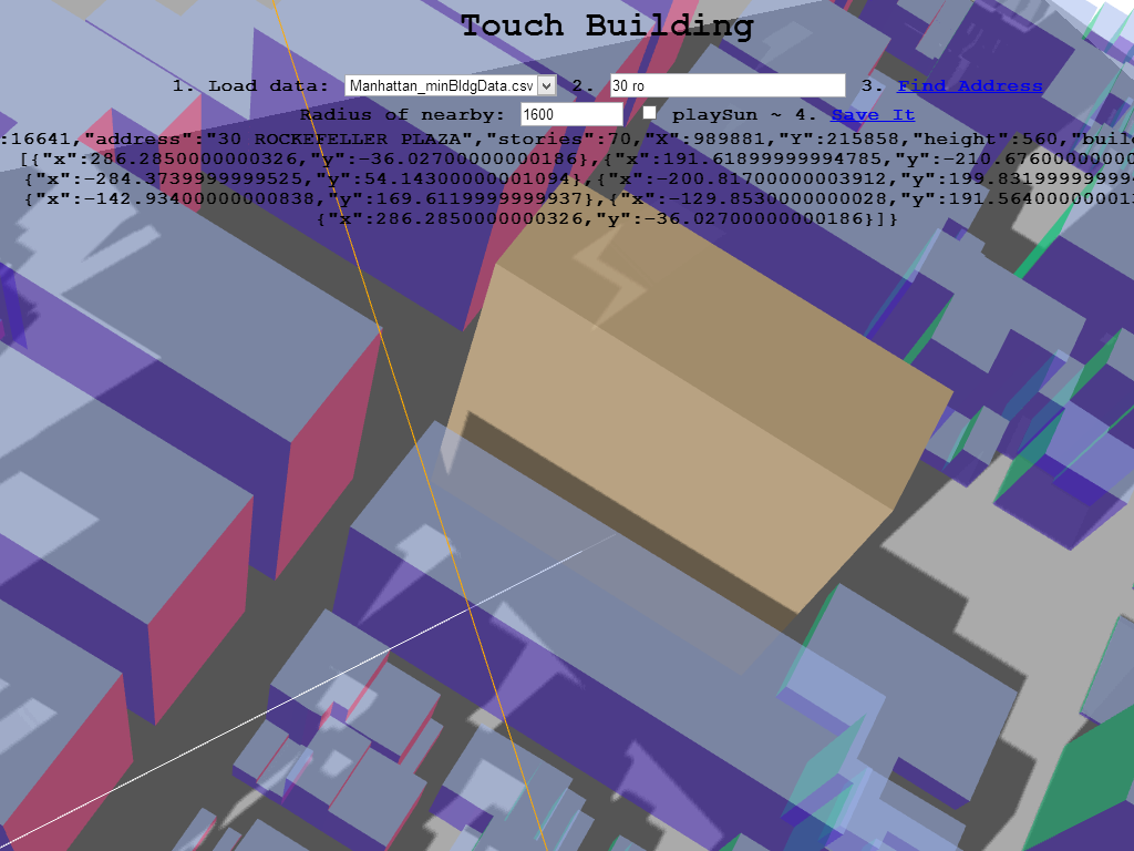
Hot Spot #3 ~ new title: 'touchBuilding'
- 2013-11-17 ~ See 'Change Log' below. Display nearby buildinga as well. Adds manic replay sun position toggle. Note: best to reload page between each each building.
- 2013-11-16 ~ See 'Change Log' below. Display just one building. Adds face planes with vertices plus shading and shadows.
Hot Spot #2 ~ Export polyline data for any selected New York City building
- 2013-11-13/14 ~ Load NYC data from any of the five boroughs, type in address, get building data, display building in 3D, and then save data to building-polylines folder. Note: you don't need to 'Display Borough'. It's there just because we *can* do it, but it takes time and only Manhattan works.
Live demos used in aeChack Team Presentation
- Using radiance gendaymtx, the sky for NYC is generated. aeChack calculates the amount of radiation on each building surface. Currently the analysis does not return visible geometry back to the preview. This shold be be possible very soon.
Hot Spot #1 ~ 43,961 NYC buildings in 3D
- Using data obtained from NYC OpenData, aeChack prepared a 3D visualization that can zoom, pan and rotate in real-time all 43,961 buildings in Manhattan, NY. The visualization runs in any browser that supports WebGL. No plugins are required. The app is entirely FOSS. The team believes this was the first time such a visualization has been accomplished.
Demos built while hacking 2013-11-09
Warm-Up #9 ~ Read typical JSON file and display in Three.js
Warm-Up #8 ~ Read NYC data and create Three.js
- Read NYC data from file and display with Three.js. Very slow. Many errors
Warm-Up #7 ~ Read NYC data and save to JSON
- Read NYC data from file, parse the text and display as text. Save parsed text to file
Warm-Up #6 ~ Export Three.js data to JSON
Warm-Up #5 ~ Save text to file in JavaScript
Warm-Up #4 ~ Find Object to object intersection
Warm-Up #3 ~ Extruded Polyline with vertex shading
- Each vertex has a color
Warm-Up #2 ~ Extruded Polyline with sub-divisions
- In wireframe mode to show sub-divisions
- There appears to be no built-in method for dividing straight lines into multiple segments. This could be an issue.
Warm-Up #1 ~ Cube with sub-divisions
- In wireframe mode to show sub-divisions
- Best app to get-going
- Shadows being cast
- Sliders move object
- Zoom, pan and orbit using your pointing device.
Data Sources
NYC Buildings ~ BIN and address data
Copyright and License
Copyright © 2013 aeChack authors ~ All work herein is under the MIT License
Change Log
2013-11-17 ~ Theo
- Accessing the revised smaller CSV files
- Source code objectified and name-spaced in simple manner
- Possible errors in CSV files stepped around
- Nearby buildings are identified and displayed. All have shading and shadows.
- You can change the search radius for nearby buildings.
- The ground plane is circular and updates with change in search radius.
- Clicking a checkbox allows you to replay the sun's position for the 8760 hours in a year
2013-11-16 ~ Theo
- Added Hot Spot #3, cleaned code. No more 'Display Borough' - memory hog, will move to separte app.
- Renamed app to 'touchBuilding'
- Input box now operates when you hit
Enter - Variable set for wireframe display
- Manhattan & '30 ro' set as defaults for speedy testing
- Three.js planes generated for each face and displayed 'underground, data output to console
- Added light, shading and shadows from an arbitrary point
2013-11-14 ~ Theo
- Added load data from any of the five boroughs using select with options
- Added When you do a 'Find Address', selected building is displayed in 3D centered on screen. You may need to zoom in to see.
- Note: 'Display Borough' only works for Mahattan. All other boroughs quit before display finish because of issues with data. Working on this
2013-11-13 ~ Theo
- photo gallery added
- 2 new app updates
- Added text to home page
2013-11-11 ~ Theo
- Cleaning up contents
2013-11-9/10 ~ All
- Many additions
2013-11-08 ~ Theo
- First commit of files

