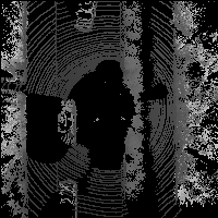
3d lidar point cloud 2d image projection in python.
Requirement:
- numpy
- matplotlib
- python-pcl
- (Opt.) ros, for real-time display
File:
tool.py: methods to load.pcddata or kitti.binpoint cloud datashow.py: methods to perform projection
Running: Not well coded yet, just for test.
#for ros velodyne points real time projection
python ros_realtiem.py#for static point cloud data projection
#test.py should be modified
python test.pyResutls:
Front View & Panorama


Thanks http://ronny.rest/blog
