polygeoasher is a python package to implement polygon to geohash and vice versa with optimisation of geohash levels as per the user requirement, with error rate being controlled by the user.
Use the package manager pip to install polygeohasher.
pip install polygeohasher

#install all dependencies
pip3 install -r requirements.txt
from polygeohasher import polygeohasher
import geopandas as gpd

gdf = gpd.read_file("your geospatial file format") # read your geometry file here

primary_df = polygeohasher.create_geohash_list(gdf, geohash_level,inner=False) # returns a dataframe with list of geohashes for each geometry

secondary_df = polygeohasher.geohash_optimizer(primary_df, largest_gh_size, smallest_gh_size, gh_input_level) # returns optimized list of geohash

polygeohasher.optimization_summary(primary_df, secondary_df) #creates a summary of first and second output

'''
--------------------------------------------------
            OPTIMIZATION SUMMARY
--------------------------------------------------
Total Counts of Initial Geohashes :  2597
Total Counts of Final Geohashes   :  837
Percent of optimization           :  67.77 %
--------------------------------------------------
'''

geo_df = polygeohasher.geohashes_to_geometry(secondary_df,"geohash_column_name") # return geometry for a DataFrame with a column - `opitimized_geohash_list` (output from above)

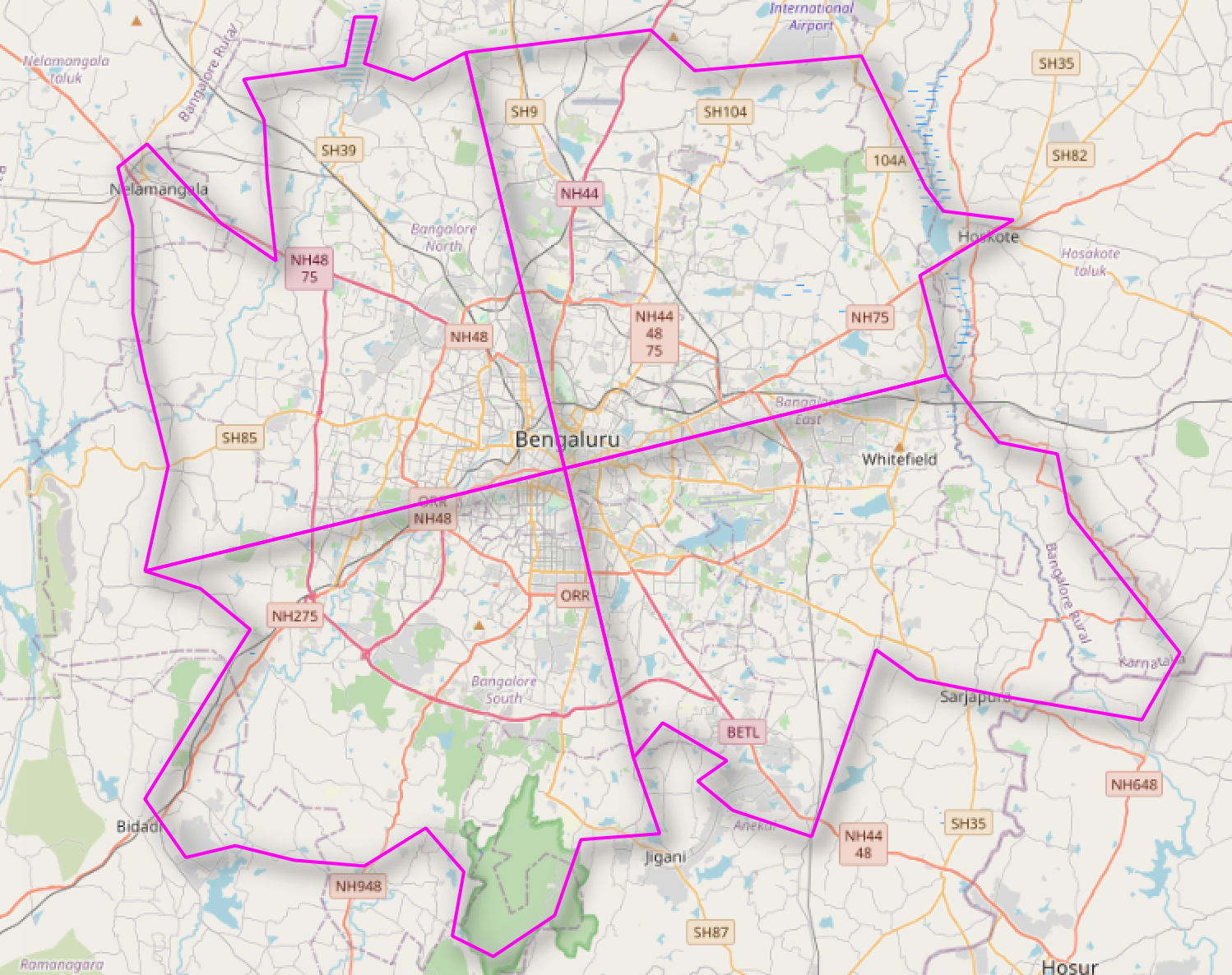
geo_df.to_file("your write path.format",driver = "GeoJSON") #write file in your favorite spatial file formatStudy are consist of division of City of Bengaluru in India.
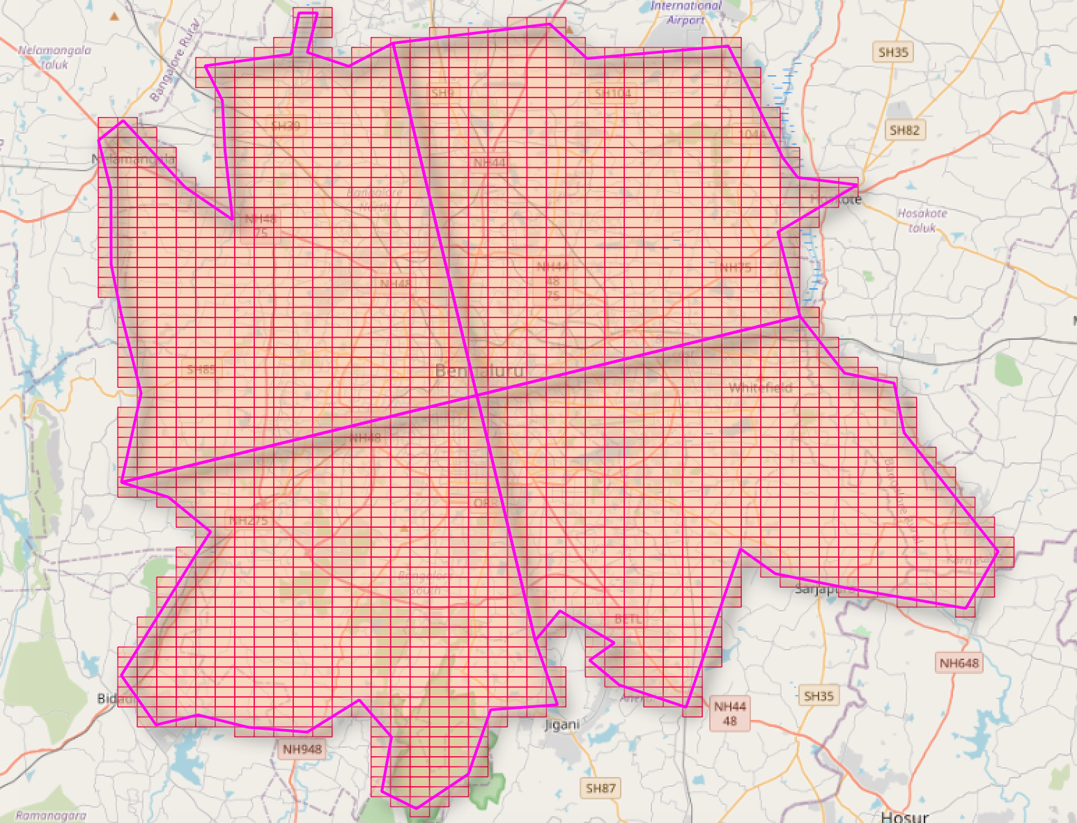
Primary Output of geohashes without any optimisation.
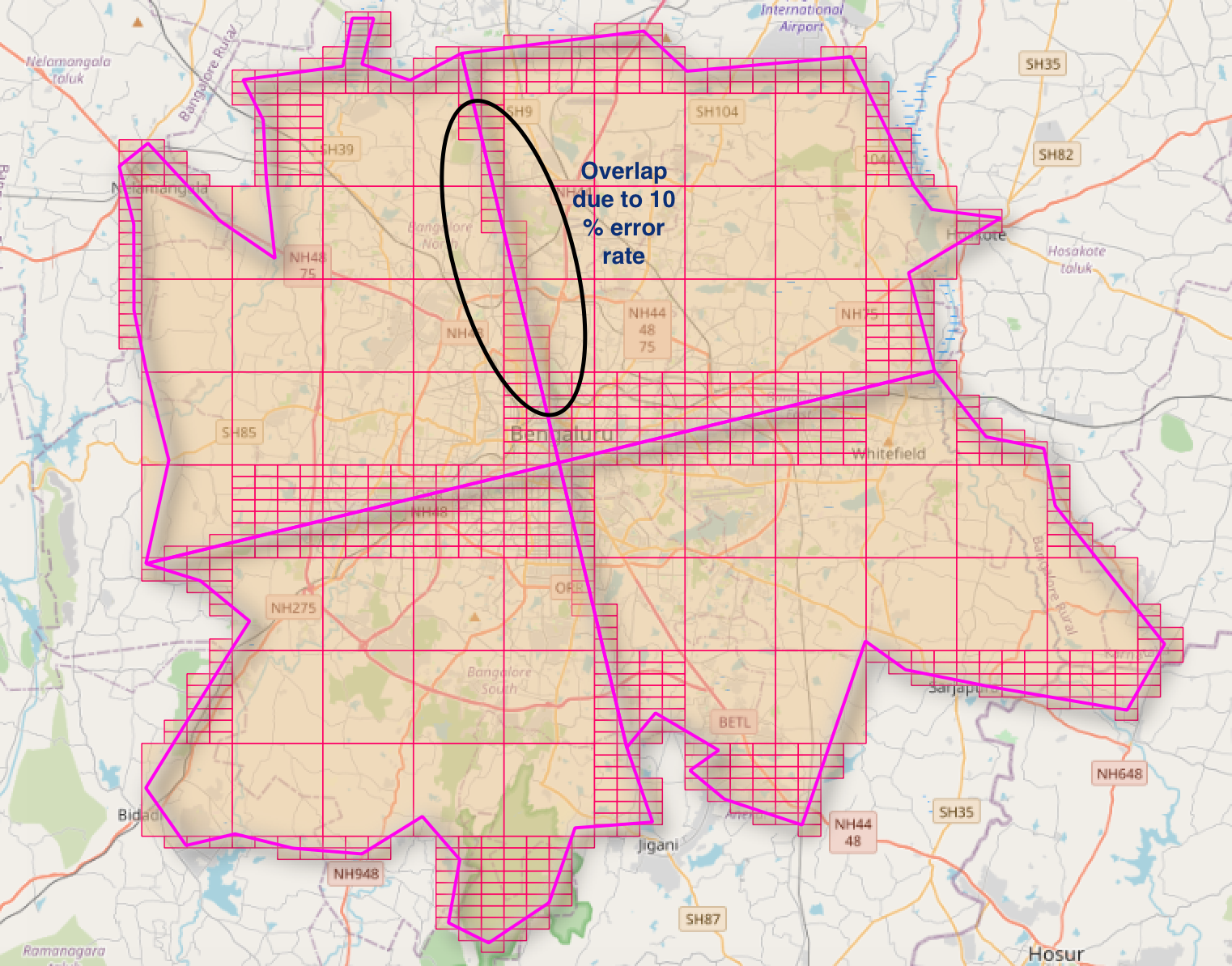
Final Output of geohashes with optimization of number of geohashes at different levels to cover an area.
Pull requests are welcome. For major changes, please open an issue first to discuss what you would like to change.
Please make sure to update tests as appropriate.


