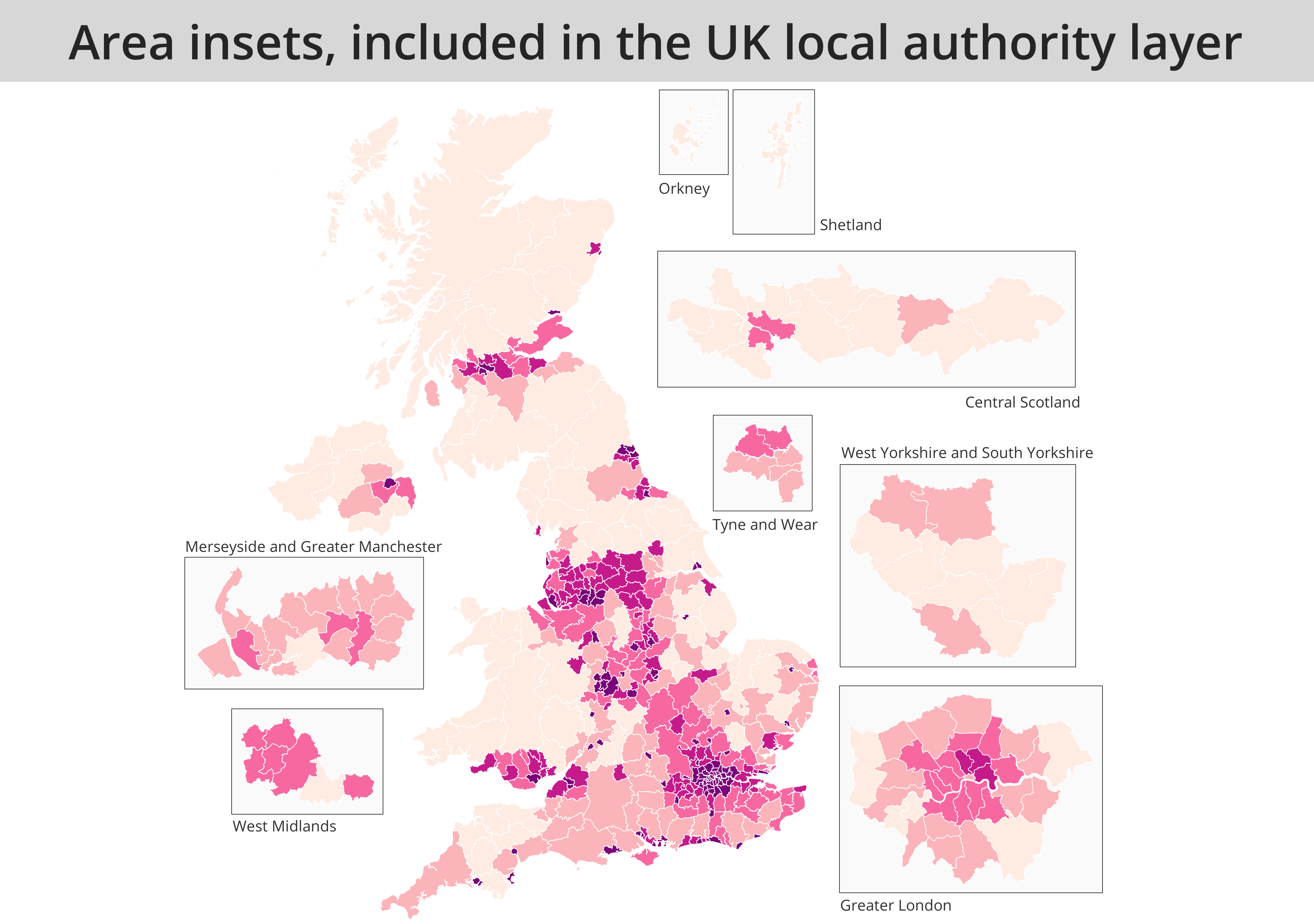
This repository contains a UK local authority layer that includes larger insets for 7 parts of the UK. I haven't included everywhere (sorry), just some of the main urban areas with small areas that are difficult to see on a zoomed out map. I have also (as of January 2022) added in a new file that takes into account the 2021 local government boundary changes in Northamptonshire. These are the current UK local authority boundaries as of June 2022. If you join some spreadsheet data to the Shapefile then the data will also be joined to the areas in the insets as well, with no fuss.
Feel free to use as you see fit. There's also a video showing how to use the files - scroll down to the bottom of the page to see this.
There are FOUR zipped folders. One is just the boxes that the insets fit within. The other three are the UK local authority files - one version has just the basic fields (area names, codes, country, etc) but I also added another one with population data, using the latest ONS mid-year estimates (2019).
The 'scale' field tells you how much bigger I made the inset areas - most are 3x bigger, apart from London (5x) and Orkney and Shetland (same size, just moved south). I have also added QGIS style files for the inset boxes and one for the layer with the population data (this style shows the % aged 80+ in each area). As of January 2022 there is also another local authority file that uses the 2021 boundaries, and includes the 2020 population estimates for each area.
I have also included bounding boxes with a 10km buffer so that you can add these in to make clear which areas are insets and which are not.
The idea behind this is to make maps that are easier to see and understand, but also more quickly, and from one layer.
There are lots of possibilities, but if for example you wanted to just put Orkney and Shetland into a little inset, you could run a filter on the layer, like this one below.
"inset_area" = 'None' and NOT "lad20nm" IN ('Orkney Islands','Shetland Islands') OR "inset_area" = 'Orkney and Shetland'
If you just wanted an inset for London, you could try something like this:
"inset_area" IN ('Greater London','None')
If you wanted to show all insets, but not Shetland and Orkney in their actual location, then you could do this:
NOT "areaname" IN( 'Orkney Islands','Shetland Islands') OR "inset" = 'Yes'
And in all cases you just do a similar filter on the box layer to show a box round these areas.
*Just note that in different versions of the file the columns have different names - e.g. in the 2020 version, the ONS local authority name column is called "lad20nm" but in the 2022 version of the file it's called "ons_name" - so just update any of the filter text below to reflect this, if you need to.
I used data from the ONS geography portal to create this. It's all open, licenced under the Open Government Licence v3.0.
Source: Office for National Statistics licensed under the Open Government Licence v.3.0. Contains OS data © Crown copyright and database right [2020].
Alasdair Rae
26 Nov 2020 Updated 25 Jan 2022 to include new file with 2021 boundary changes taken into account (i.e. Northamptonshire councils)
(work in progress)
