Geoscience Hackathon in Aberdeen (16-18/11/2018)
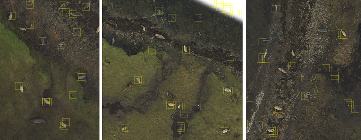
We used a dataset of around 3000 geolocated seals from a Scottish island to train a Linear Support Vector classifier (sklearn.svm.LinearSVC). The quickly trained classifier can then be used to convolve across a given images and highlight the location of seals:
savewally/notebooks/03_learning_keras.ipynb contains a working prototype Convolutional Neural Networks using Keras with Tensorflow.
