The PICity is result of Map and GPS lesson of Udemy iOS Developer course.
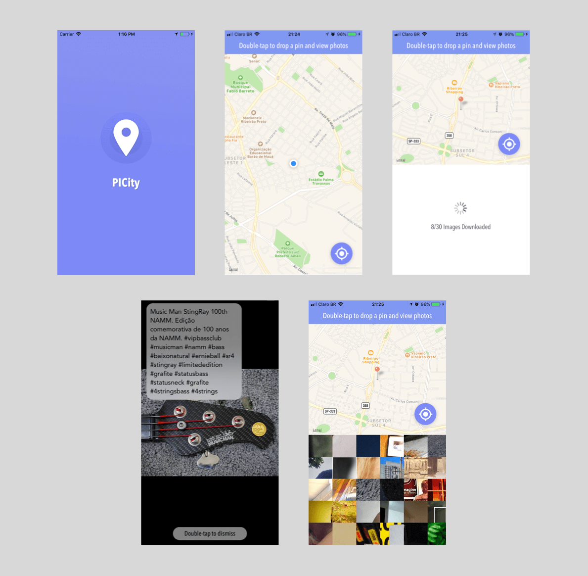
PICity is an app, that enables users to download fotos from a specific map location area.
When the app launchs a map is displayed, and after the user double touch a specific location, the coordinates from that area are send to flickr api to retrieve photos.
- UIKit
- MapKit
- CoreLocation
- UINavigationControllers
- UICollectionViews
- UICollectionViewCell
- Delegation
- MVC (Model View Controller)
- Extensions
- Alamofire
- AlamofireImage
- UITapGestureRecognizer
- UISwipeGestureRecognizer
- IBDesignable and IBInspectable
- Animations
- 3D Touch
All the layout ideas that I created for this project are available on this repository.
- Xcode 9.3
- Swift 4.0
Copyright (c) 2018 André Rosa