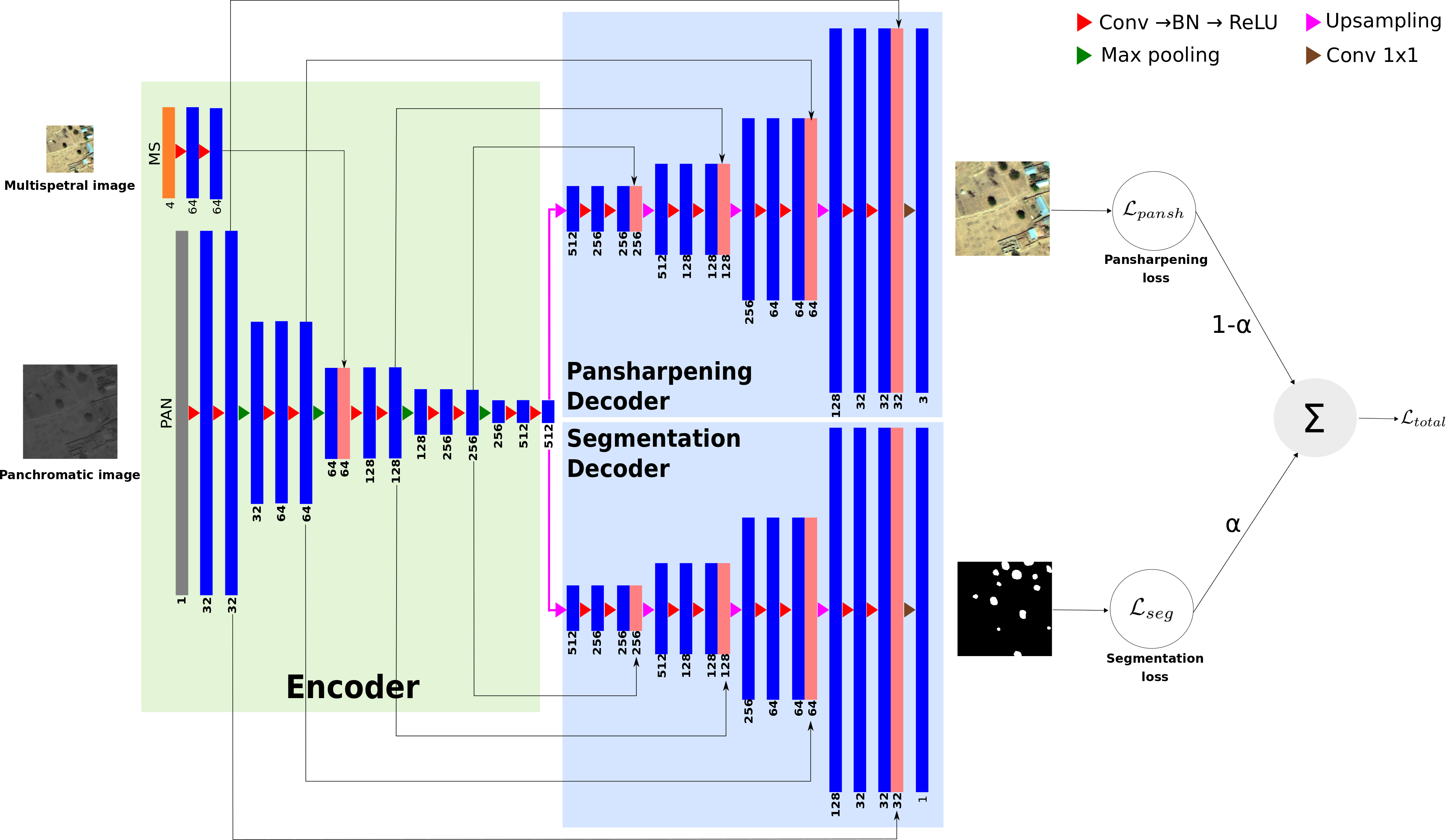
Implementation of the methods described in the paper entitled “Multi-task deep learning for satellite image pansharpening and segmentation”
- Python 3.6.4
- Tensorflow 1.10.0
- Numpy 1.14.2
- GDAL 2.2.4
The codes have been tested on Fedora 25
We recommend to use QGIS, where the outputs can easily be displayed despite of the image size.
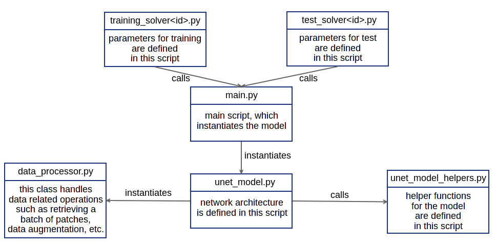
- The solver sub-directories, namely training_solvers and test_solvers contain solvers, which train a model and test the trained model (See the figure under Software Architecture section).
- To train a model, enter the following command (we assume that you are under multi-task directory, otherwise you will get an error):
python3 train_solvers/train_solver<id>.py - To test a trained model, enter this command:
python3 test_solvers/test_solver<id>.py
<id> in the commands above determines which solver to run.
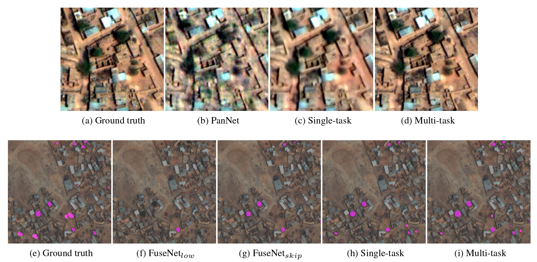
Here, we illustrate several original visual outputs from the World-View3 dataset for different methods including our multi-task framework.
@inproceedings{khalel2019multi,
  title={Multi-task deep learning for satellite image pansharpening and segmentation},
  author={Khalel, Andrew and Tasar, Onur and Charpiat, Guillaume and Tarabalka, Yuliya},
  booktitle={IEEE International Geoscience and Remote Sensing Symposium--IGARSS 2019},
  year={2019}
}