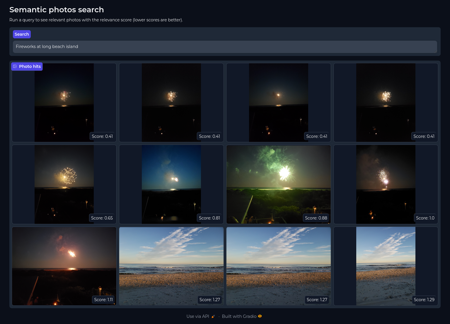
Make you photo albums semantically search-able. Using scene captioning combined with tagged people and locations make your albums work better for you and recall memories faster and naturally.
Photo searching is typically restricted to tag filtering and keyword searching if images have description notes manually added. This app aims to make photo libraries easier and more natural to search through by creating a search index based on
- image-to-text auto-captioning
- reverse geo coding to add place name descriptions
- descriptions of named people in the image
This app leverages your existing photo libraries and creates a light weight database to run searches without the need to copy, move or modify your original images. This currently supports JPEG, PNG, and HEIC image types.
Clone the repository
git clone https://github.com/brainsqueeze/semantic-photos.gitPhoto search databases can be build automatically using the builder. CLI options include
  -h, --help            show this help message and exit
  --geonames_user GEONAMES_USER
                        Username for Geonames API (default: None)
  --type {MACOS_PHOTO_LIBRARY,DIGIKAM_PHOTO_LIBRARY}
  --photo_lib_path PHOTO_LIB_PATH
                        Absolute path to the photo library to process (default: None)
  --chroma_path CHROMA_PATH
                        Override the path to the ChromaDB database (default: None)
  --album ALBUM         Album name to process (default: None)
An example build looks like
python -m semantic_photos.build \
    --type MACOS_PHOTO_LIBRARY \
    --photo_lib_path ~/Pictures/Photos Library.photoslibrary \
    --chroma_path ./database \
    --album album_1 \
    --album album_2 \
    --album album_3 \
    ...
This project uses the Geonames API to do reverse geocoding on lat/lon coordinates. You will need to create an account and use your username to authenticate with the service. Once you have a username you can pass it to the build tool as a CLI parameter like --geonames_user=<user_name>. Usernames can also optionally be set as an environmental variable:
export GEONAMES_USERNAME=<your_username>Optionally set a path to cache the transformer models, image-to-text models, and ChromaDB files
export MODEL_CACHE_DIR=/cache_dir/<some_path>import os
from tqdm import tqdm
from semantic_photos.galleries.database import DigikamReader
from semantic_photos.geographies import GeonamesReverseGeocoder
from semantic_photos.models.caption import ImageCaption
from semantic_photos.models.documents import ImageVectorStore
from semantic_photos.models.schema import ImageData
from semantic_photos.utils import describe_people_in_scene, describe_geo_location
captioner = ImageCaption(device="cpu") # if CUDA is available then set `device="cuda"`
rev_geo_coder = GeonamesReverseGeocoder(geonames_user=os.getenv("GEONAMES_USERNAME"))
docs = ImageVectorStore(os.environ["MODEL_CACHE_DIR"])
album_names = [...]
metadata = []
with DigikamReader(path="/absolute/path/to/photo/library") as db:
albums = db.albums
for album in album_names:
for record in tqdm(
db.stream_media_from_album(album_id=albums[album]["album_id"]),
total=albums[album]["count"],
desc=f"Loading {album}"
):
meta = albums[record.relative_path]
img_data = ImageData(
path=os.path.join(meta["path"], record.image_file_name),
album_name=meta["name"],
file_name=record.image_file_name,
created=record.creation_date,
caption=captioner.caption(os.path.join(meta["path"], record.image_file_name))[0]["generated_text"],
)
if record.people_names:
img_data.people_description = describe_people_in_scene(record.people_names.split(','))
if record.lat and record.lon:
geos = rev_geo_coder.find_nearby_place_name(
latitude=record.lat,
longitude=record.lon
)
img_data.geo_description = describe_geo_location(geos.get("geonames", []))
metadata.append(img_data)
if len(metadata) > 256:
docs.add_images(metadata)
metadata.clear()
if len(metadata) > 0:
docs.add_images(metadata)
metadata.clear()
rev_geo_coder.teardown()This will create a ChromaDB database within the directory set by MODEL_CACHE_DIR. The database can be queried like
docs.query("Three people wearing sunglasses swimming in a pool near Pacific Beach")To start the search app simply run
python -m semantic_photos.appThis will start a Gradio app server at http://localhost:7860. This looks for a ChromaDB database located at MODEL_CACHE_DIR. You can override this location if your Chroma file is located elsewhere by running
python -m semantic_photos.app --chroma_path=<absolute_path>Currently this works with MacOS, and Digikam photo libraries. If you would like to enable support for other libraries please make a pull request.
