ggmapstyles is an R package which extends the ggmap package. This package simplifes the process of creating custom designs for Google Maps, and provides a range of tools for quickly loading themes from Snazzy Maps by simply copying a website URL.
Say goodbye to the standard Google Maps background, and easily choose from one of over 20000 custom themes! If you cannot find a style you like, it is easy to sign up and create your own customised layers.
This package is still in development. If you find any errors, or have any suggestions for improvements, please open an Issue.
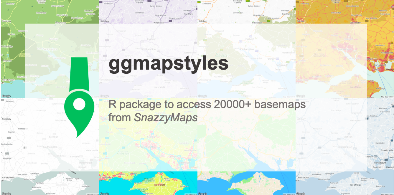
A selection of some of the styles available are shown below:
You can install the development version of the package through Github:
devtools::install_github("dr-harper/ggmapstyles")
Google recently changed their API requirements, so you will need to register with Google first. A useful guide is found in the ggmaps package: https://github.com/dkahle/ggmap
You can browse Snazzy Maps to find a style you like. A number of functions have been developed to simplify the usage of Snazzymaps within existing workflows.
The main function to use within the package is get_snazzymap. This is
a wrapper of the get_googlemap function, with the style of the map
being set by mapRef:
library(ggmapstyles)
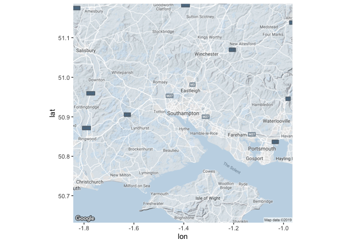
basemap <- get_snazzymap("Southampton, UK", mapRef = "https://snazzymaps.com/style/83/muted-blue")
ggmap(basemap)
The mapRef parameter can accept the Snazzy Map reference in a number
of different ways:
- Full URL:
mapRef = "https://snazzymaps.com/style/83/muted-blue" - ID & Name:
mapRef = "83/muted-blue" - ID:
mapRef = 83
You can also supply additional arguments to the get_snazzymap function
which are provided to get_googlemap. For example, the zoom can be
changed as follows:
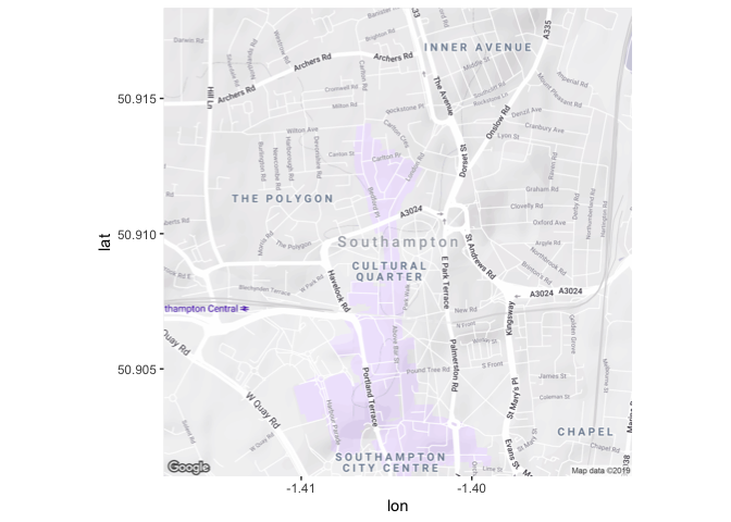
basemap <- get_snazzymap("Southampton, UK", mapRef = "98/purple-rain", zoom = 15)
ggmap(basemap)
It’s useful to note that the maptype argument of get_googlemap still
defaults to returning a terrain map. This may make the Snazzymaps
styling look different from expected, and different from the appearance
on the Snazzymaps site, where the default is a roadmap. This is mostly
useful for styling terrain or roadmaps; some, but not all, styling will
show up with hybrid maps as well.
# default: terrain
terrain <- ggmap(get_snazzymap("Southampton, UK", mapRef = "23/bates-green")) +
  ggtitle("Terrain")
roadmap <- ggmap(get_snazzymap("Southampton, UK", mapRef = "23/bates-green", maptype = "roadmap")) +
  ggtitle("Roadmap")
hybrid <- ggmap(get_snazzymap("Southampton, UK", mapRef = "23/bates-green", maptype = "hybrid")) +
  ggtitle("Hybrid")

gridExtra::grid.arrange(terrain, roadmap, hybrid, ncol = 3)
If you would rather use the style argument within the get_googlemap,
you can create a formatted string using the ggmap_style_sm function:
style_string <- ggmap_style_sm("84/pastel-tones")
style_string
#> [1] "feature:landscape%7Csaturation:-100%7Clightness:60&style=feature:road.local%7Csaturation:-100%7Clightness:40%7Cvisibility:on&style=feature:transit%7Csaturation:-100%7Cvisibility:simplified&style=feature:administrative.province%7Cvisibility:off&style=feature:water%7Cvisibility:on%7Clightness:30&style=feature:road.highway%7Celement:geometry.fill%7Ccolor:0xef8c25%7Clightness:40&style=feature:road.highway%7Celement:geometry.stroke%7Cvisibility:off&style=feature:poi.park%7Celement:geometry.fill%7Ccolor:0xb6c54c%7Clightness:40%7Csaturation:-40&style="
This string can then easily be reused within any other ggmap function which takes a style argument. This approach is recommended if you want to plot multiple maps with the same basemap:
plot1 <- ggmap(get_googlemap("Southampton, UK", style = style_string)) + labs(title = "Southampton")
plot2 <- ggmap(get_googlemap("London, UK", style = style_string)) + labs(title = "London")
plot3 <- ggmap(get_googlemap("Bristol, UK", style = style_string)) + labs(title = "Bristol")

gridExtra::grid.arrange(plot1, plot2, plot3, ncol = 3)16 map styles are supplied within the package. These can be accessed by
using the map_styles() function, and the following styles are
available:
| ID | Name | Description |
|---|---|---|
| 61 | Blue Essence | A light blue style that helps you focus on content on the map. |
| 35 | Avocado World | A creamy green color palette. |
| 98 | Purple Rain | Everything on this map is a pleasant shade of desaturated purple. |
| 84 | Pastel Tones | Simple pastel look and feel. |
| 64 | Old Dry Mud | Orange with pale blue sea. |
| 8097 | WY | Map style for WY default color scheme. |
| 60952 | apple-like | Similar to Apple Maps. |
| 23 | Bates Green | A nice, simple green version of the map. |
| 83 | Muted Blue | An unobtrusive blue design for minimal user-experiences. |
| 127403 | No label Bright Colors | A map without label and brighter colors. |
| 14 | Vintage | A dark two-tone map with a striking red color against a dark grey. |
| 68 | Aqua | A cool two tone map that looks great when zoomed in. |
| 72 | Transport for London | Style based on London transport maps. |
| 6296 | darkdetail | minimal, dark grayscale, retaining POI labels. |
| 21 | Hopper | Based upon Edward Hopper’s paintings. |
| 40 | Vitamin C | Inspired by the Adobe Kuler theme of the same name. |
| 72543 | Assassin’s Creed IV | Themed map matching the colors from Assassin’s Creed IV. |
There are several ways you can use this function to refer to a style:
- By name:
map_style("Blue Essence") - By ID:
map_style(ID = "40") - Pick one style at random:
map_style(random = TRUE): this also prints a message so that you know which style to reuse.
# search by name
map_style("Blue Essence")
#> [1] "feature:landscape.natural%7Celement:geometry.fill%7Cvisibility:on%7Ccolor:0xe0efef&style=feature:poi%7Celement:geometry.fill%7Cvisibility:on%7Chue:0x1900ff%7Ccolor:0xc0e8e8&style=feature:road%7Celement:geometry%7Clightness:100%7Cvisibility:simplified&style=feature:road%7Celement:labels%7Cvisibility:off&style=feature:transit.line%7Celement:geometry%7Cvisibility:on%7Clightness:700&style=feature:water%7Celement:all%7Ccolor:0x7dcdcd"

# search by ID
map_style(ID = "40")
#> [1] "feature:water%7Celement:geometry%7Ccolor:0x004358&style=feature:landscape%7Celement:geometry%7Ccolor:0x1f8a70&style=feature:poi%7Celement:geometry%7Ccolor:0x1f8a70&style=feature:road.highway%7Celement:geometry%7Ccolor:0xfd7400&style=feature:road.arterial%7Celement:geometry%7Ccolor:0x1f8a70%7Clightness:-20&style=feature:road.local%7Celement:geometry%7Ccolor:0x1f8a70%7Clightness:-17&style=element:labels.text.stroke%7Ccolor:0xffffff%7Cvisibility:on%7Cweight:0.9&style=element:labels.text.fill%7Cvisibility:on%7Ccolor:0xffffff&style=feature:poi%7Celement:labels%7Cvisibility:simplified&style=element:labels.icon%7Cvisibility:off&style=feature:transit%7Celement:geometry%7Ccolor:0x1f8a70%7Clightness:-10&style=&style=feature:administrative%7Celement:geometry%7Ccolor:0x1f8a70%7Cweight:0.7"

# Use directly within ggmap function
ggmap::get_googlemap("Southampton", style = map_style("apple-like"))
#> Source : https://maps.googleapis.com/maps/api/staticmap?center=Southampton&zoom=10&size=640x640&scale=2&maptype=terrain&style=feature:administrative.country%7Celement:labels.text%7Clightness:29&style=feature:administrative.province%7Celement:labels.text.fill%7Clightness:-12%7Ccolor:0x796340&style=feature:administrative.locality%7Celement:labels.text.fill%7Clightness:15%7Csaturation:15&style=feature:landscape.man_made%7Celement:geometry%7Cvisibility:on%7Ccolor:0xfbf5ed&style=feature:landscape.natural%7Celement:geometry%7Cvisibility:on%7Ccolor:0xfbf5ed&style=feature:poi%7Celement:labels%7Cvisibility:off&style=feature:poi.attraction%7Celement:all%7Cvisibility:on%7Clightness:30%7Csaturation:-41%7Cgamma:0.84&style=feature:poi.attraction%7Celement:labels%7Cvisibility:on&style=feature:poi.business%7Celement:all%7Cvisibility:off&style=feature:poi.business%7Celement:labels%7Cvisibility:off&style=feature:poi.medical%7Celement:geometry%7Ccolor:0xfbd3da&style=feature:poi.medical%7Celement:labels%7Cvisibility:on&style=feature:poi.park%7Celement:geometry%7Ccolor:0xb0e9ac%7Cvisibility:on&style=feature:poi.park%7Celement:labels%7Cvisibility:on&style=feature:poi.park%7Celement:labels.text.fill%7Chue:0x68ff00%7Clightness:-24%7Cgamma:1.59&style=feature:poi.sports_complex%7Celement:all%7Cvisibility:on&style=feature:poi.sports_complex%7Celement:geometry%7Csaturation:10%7Ccolor:0xc3eb9a&style=feature:road%7Celement:geometry.stroke%7Cvisibility:on%7Clightness:30%7Ccolor:0xe7ded6&style=feature:road%7Celement:labels%7Cvisibility:on%7Csaturation:-39%7Clightness:28%7Cgamma:0.86&style=feature:road.highway%7Celement:geometry.fill%7Ccolor:0xffe523%7Cvisibility:on&style=feature:road.highway%7Celement:geometry.stroke%7Cvisibility:on%7Csaturation:0%7Cgamma:1.44%7Ccolor:0xfbc28b&style=feature:road.highway%7Celement:labels%7Cvisibility:on%7Csaturation:-40&style=feature:road.arterial%7Celement:geometry%7Ccolor:0xfed7a5&style=feature:road.arterial%7Celement:geometry.fill%7Cvisibility:on%7Cgamma:1.54%7Ccolor:0xfbe38b&style=feature:road.local%7Celement:geometry.fill%7Ccolor:0xffffff%7Cvisibility:on%7Cgamma:2.62%7Clightness:10&style=feature:road.local%7Celement:geometry.stroke%7Cvisibility:on%7Cweight:0.50%7Cgamma:1.04&style=feature:transit.station.airport%7Celement:geometry.fill%7Ccolor:0xdee3fb&style=feature:water%7Celement:geometry%7Csaturation:46%7Ccolor:0xa4e1ff&key=xxx
#> Source : https://maps.googleapis.com/maps/api/geocode/json?address=Southampton&key=xxx
#> 1280x1280 terrain map image from Google Maps.
#> See ?ggmap to plot it.This cheatsheet into ggmap is useful for picking up some of the basics of ggmap.


