This repo contains QGIS stylesheets (QML) for use with EuroGlobalMap data in ESRI Shapefile format
EuroGlobalMap is a 1:1 million scale topographic dataset covering 45 countries and territories in the European region. It is now available as opendata.
==============================
EuroGeographics recently made EuroGlobalMap available as open data. There aren't many stylesheets available for use with this data so I decided to make my own.
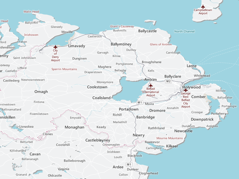
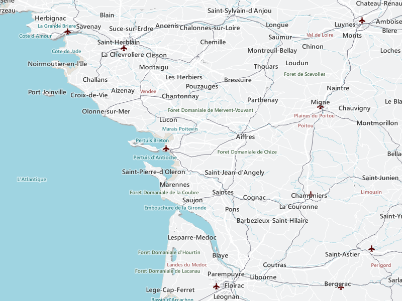
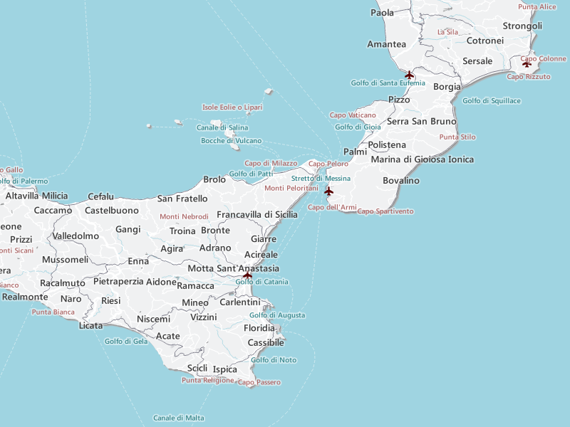
These stylesheets have been designed to work at various scales. I would recommend using them between 1:200,000 and 1:5,000,000
They have been made to work with ESRI Shapefiles available here.
To fill in the sea tint you will need to set your background colour to R 159 G 212 B 225.
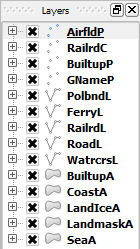
I have only styled 14 of the layers to create a basemap and I recommend this layer order:
Thanks to the guys at EuroGeographics for providing the ESRI Shapefiles and making them available as open data.
You are free to use these stylesheets however you want :)