from PySDMs import PySDMs
| Bioclimatic Variable | Coast redwood % Change | Giant sequoia % Change | Joshua tree % Change |
|---|---|---|---|
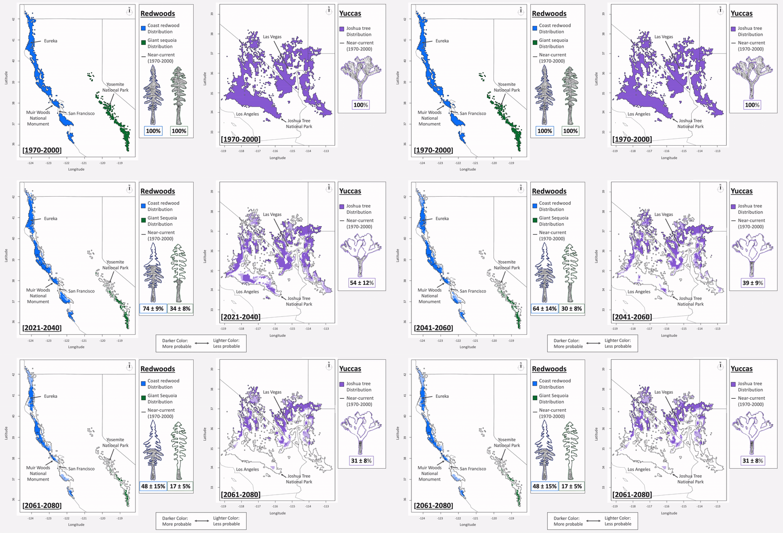
| Temperature Annual Mean | +22% | +47% | +24% |
| Temperature Annual Range | +5% | +4% | +2% |
| Precipitation Driest Month | -1% | -2% | -7% |
- SSP 370 CMIP6 models for the IPCC6 report.
- Bioclimatic Features from WorldClim2
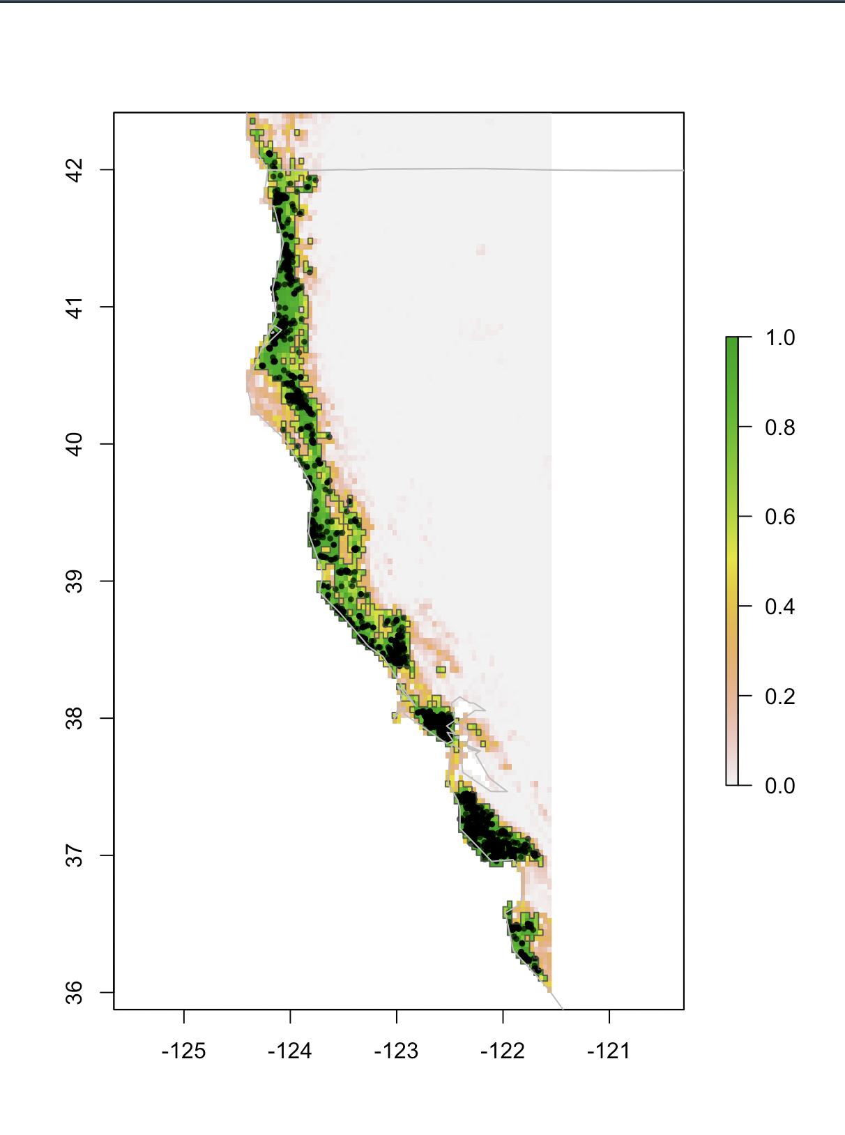
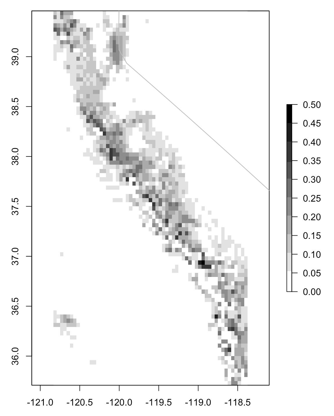
- Species presences from GBIF and carefully cleaned
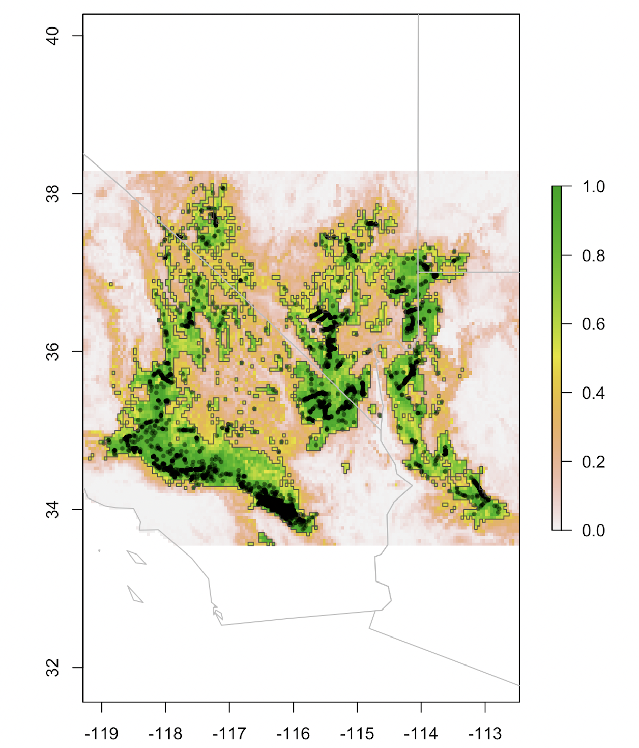
- Blending methods boosted model performances to ~ two-zero false negatives per species.
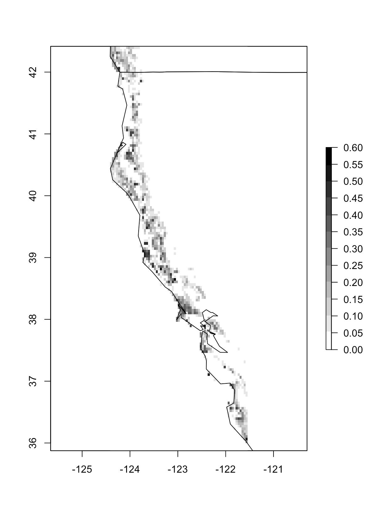
| Coast redwood SDM geo-classification (Sequoia sempervirens) | Standard deviations from multiple seeds/samples. |
|---|---|
 |
 |
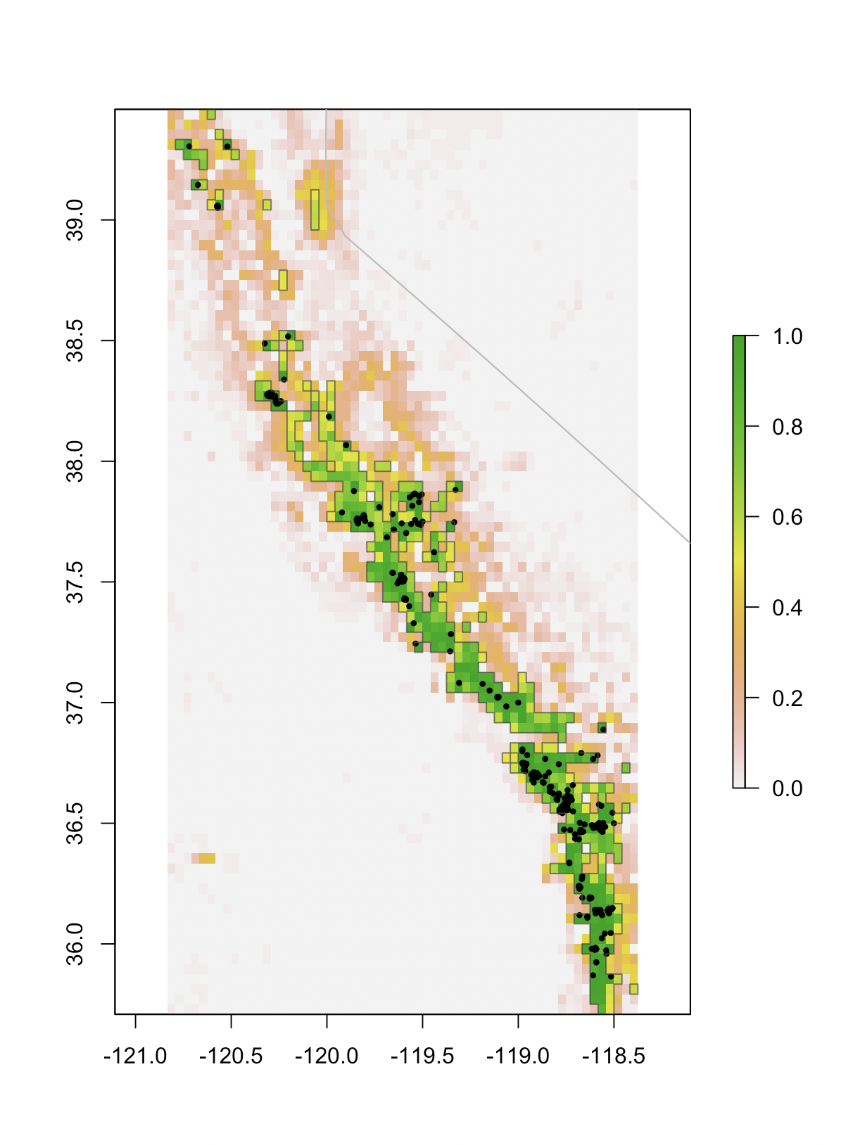
| Giant sequioa SDM geo-classification (Sequoiadendron giganteum) | Standard deviations from multiple seeds/samples. |
|---|---|
 |
 |
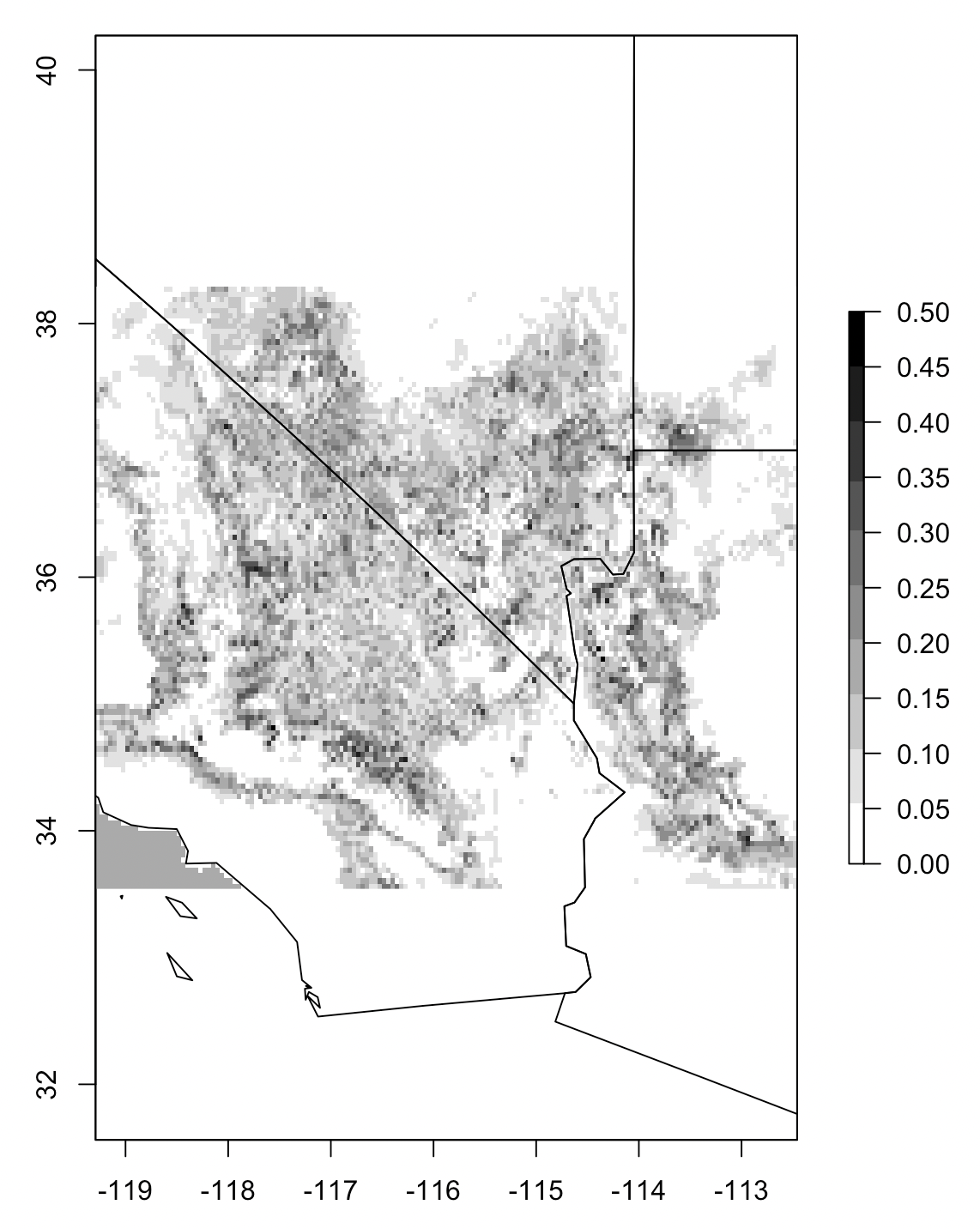
| Joshua tree SDM geo-classification (Yucca brevifolia) | Standard deviations from multiple seeds/samples. |
|---|---|
 |
 |
An object-oriented Python class for semi-auto ML geo-classification (running on PyCaret). Compares gradient boosted tree algorithms by default, with options to include soft voters and NNs. Designed for Species Distribution Modeling applications.
- PySDMs/ - the library code itself
- LICENSE - the MIT license, which applies to this package
- README.md - the README file, which you are now reading
- requirements.txt - prerequisites to install this package, used by pip
- setup.py - installer script
- tests/ - unit tests
self.fit(): Model training with PyCaret, considering tree-based methods, neural nets, and best-subset-selection soft voting blends. Requires a data-frame with a classification target and numerical explanatory features. Returns the voter with the best validation metric performance (default metric=F1).
self.interpolate(): Geo-classification function for model interpolation to raster feature surfaces. Saves to file both probabilistic and binary distribution predictions.
self.validation_performance(): Metric scores and AUC visuals on the test set.
