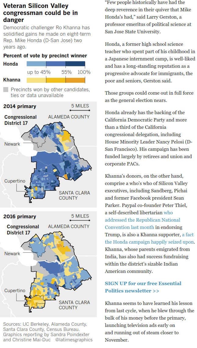
Maps of the consolidated precincts used in California's Alameda and Santa Clara counties for the 2016 primary election.
ESRI shapefiles provided by county officials in response to a public records request by the Los Angeles Times. Converted into GeoJSON via ogr2ogr. They made us pay for them. We're giving them away here for free.