Generate equidistant points along urban area road network
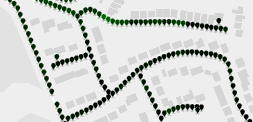
This repo. contains code + a set of scripts for extracting equidistant points for cities/urban areas in a national road network. Specifically, for each road within a city, a set of points are generated at equal distances along with the associated heading/bearing for each point. The points/bearings are then output to a CSV.
This is part of a larger project which uses these sample points and associated bearings to query Google street view API for all images on the left and right hand side of a road network. The sample points may be useful as inputs into other projects or may be used in isolation to derive city specific geospatial features. For example, we have found that the distribution of sample point bearings for most UK cities is biased toward North, East, South, West and not uniform:
This could be related to historical relationships with neighboring towns and is representative of the overall spatial layout of a town's road network. We plan to explore this idea/finding at a later date. For example, it may be interesting to compare this data with road safety: towns with a predominant East, West road orientation may exhibit higher occurrence of incidents with respect to traveling in the direction of a rising/setting sun.
- osmium
- nodejs, npm
- osmtogeojson
- geojsplit
- json_pp
mkdir osmium ;cd osmium
git clone https://github.com/mapbox/protozero
git clone https://github.com/osmcode/libosmium
git clone https://github.com/osmcode/osmium-tool
cd osmium-tool
mkdir build ;cd build
cmake ..
make
sudo make install
sudo npm -g install geojsplit
sudo npm -g install osmtogeojson
make
The whole process can be executed by invoking the run.sh script.
./run.sh
This will perform the following steps:
-
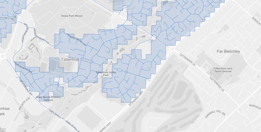
Get ONS major towns and cities polygon data. data/area_geojson will download the 112 major towns and cities geojson data from ONS Geography portal, then extract each city into individual geojson files in
data/area_geojson/split/. -
Extract the road network for each city. extract_roads.sh will download the latest open street map data for Great Britain, extract the road network using osmium, and then for each city, extract the road network bounded by the city polygon obtained in step (1) and convert to geojson:
- Generate sample points for each city.
For each individual city road network in
data/city_roads_geojson/extracted in step (2), sample_points.sh will generate a set of 10 metre equidistant points along each road, storing the result indata/csv_output. For convenience, the resulting sample points are also aggregated into a single filedata/csv_output/final/england_and_wales.csv.
The result is a csv file for each city stored in
data/csv_output/CITY_NAME.csv. For example:
| osm_way_id | road_name | road_type | sidewalk | abutters | lanes | lighting | surface | speed_limit | sequence | area | latitude | longitude | bearing |
|---|---|---|---|---|---|---|---|---|---|---|---|---|---|
| way/4355028 | Barlow Moor Road | secondary | retail | 2 | yes | asphalt | 30 | 40 | Manchester | 53.43965 | -2.275101 | 170.17 | |
| way/4355028 | Barlow Moor Road | secondary | retail | 2 | yes | asphalt | 30 | 41 | Manchester | 53.43957 | -2.275076 | 170.17 | |
| way/4355028 | Barlow Moor Road | secondary | retail | 2 | yes | asphalt | 30 | 42 | Manchester | 53.43948 | -2.275051 | 170.17 | |
| way/4355028 | Barlow Moor Road | secondary | retail | 2 | yes | asphalt | 30 | 43 | Manchester | 53.43939 | -2.275026 | 170.17 | |
| way/4355028 | Barlow Moor Road | secondary | retail | 2 | yes | asphalt | 30 | 44 | Manchester | 53.43931 | -2.275001 | 170.17 | |
| way/4355028 | Barlow Moor Road | secondary | retail | 2 | yes | asphalt | 30 | 45 | Manchester | 53.43922 | -2.274976 | 170.17 | |
| way/4355028 | Barlow Moor Road | secondary | retail | 2 | yes | asphalt | 30 | 46 | Manchester | 53.43913 | -2.274951 | 170.17 | |
| way/4355028 | Barlow Moor Road | secondary | retail | 2 | yes | asphalt | 30 | 47 | Manchester | 53.43905 | -2.274925 | 170.17 | |
| way/4355028 | Barlow Moor Road | secondary | retail | 2 | yes | asphalt | 30 | 48 | Manchester | 53.43896 | -2.274897 | 158.42 | |
| way/4355028 | Barlow Moor Road | secondary | retail | 2 | yes | asphalt | 30 | 49 | Manchester | 53.43889 | -2.274844 | 151.79 |
Where:
| Column | Description |
|---|---|
| osm_way_id | Road network "Edge" id |
| road_name | Road name |
| road_type | Road network classification (see below) |
| sidewalk | Path on left,right? |
| abutters | Road features |
| lanes | Number of lanes |
| lighting | Road has lighting? |
| surface | Surface type |
| speed_limit | Speed limit |
| sequence | Sample point order |
| area | City |
| latitude | Latitude |
| longitude | Longitude |
| bearing | Heading (angle of line from previous to next point.) |
| OSM label | UK Meaning |
|---|---|
| motorway | M- road |
| trunk | A- road |
| primary | A- non-primary |
| secondary | B- road |
| tertiary | Significant minor road (with road markings etc) |
| unclassified | Less significant road |
| residential | Residential road |
Open Government license v3 OGL v3.


