Description: this code is intended to collect a dataset of images from Google Streets View. More details will be discussed below.
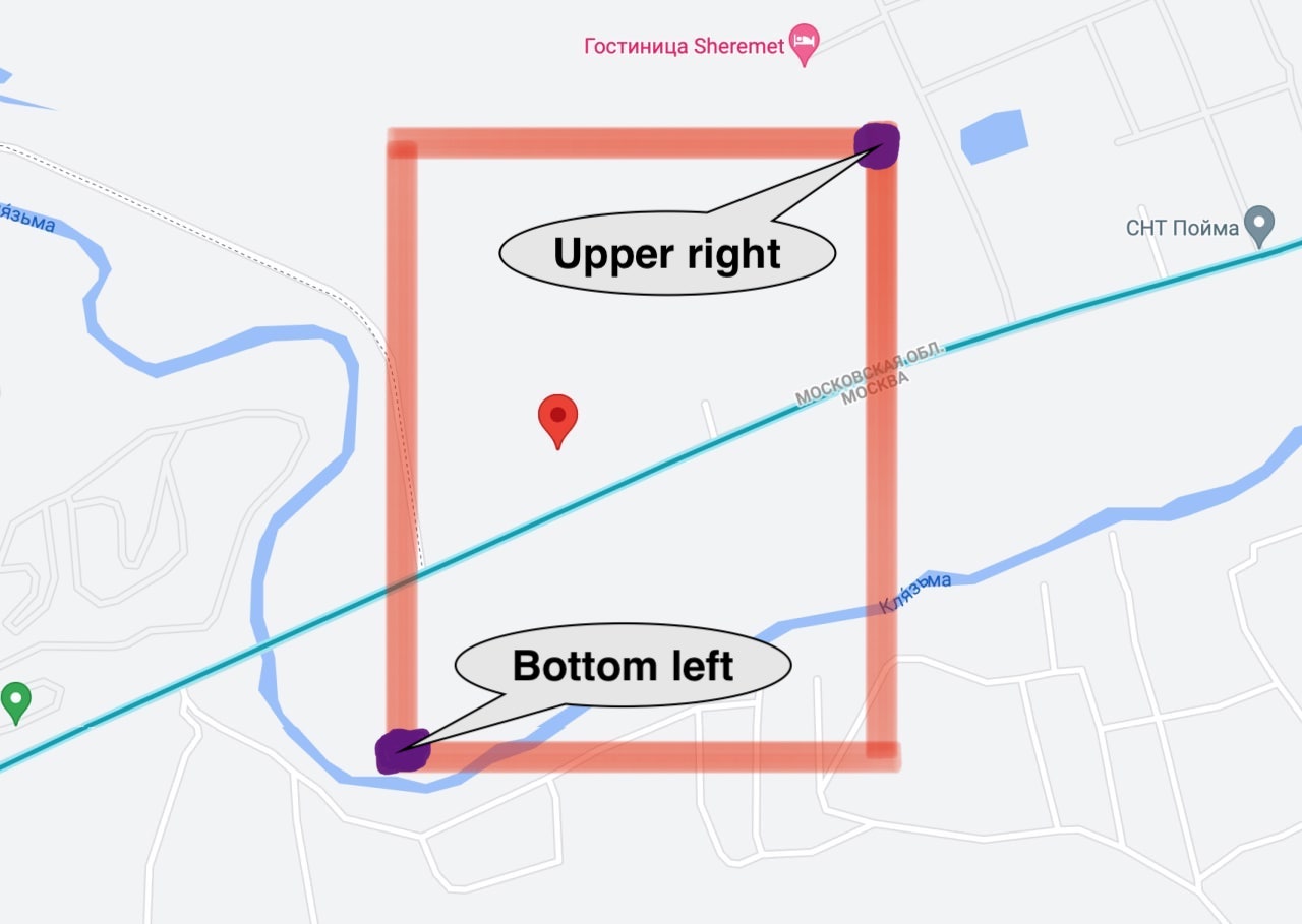
- Firstly, we use uniform distribution to select point from rectangular between bottom left and upper right point:
- Then we need to snap selected point to road
- We are ready to request street view image, but also we need to specify angle of head look (0...360), so next steps will focus on calculating direction of road (compass bearing)
- Lets shift snapped point N.2 to random direction with random value and get point N.3
- Snap shifted point N.3 to closest road and get point N.4, we "hope" that this point will be snapped to the same road as point N.2


- We use points N.4 and N.2 to get difference between their latitude and longitude and calculate compass bearing using elementary triangle geometry (see
geo_utils.py)
Note: you can't use Google Streets View Static Api without google developer key (you can find a way to get it by searching the internet)
To use custom key, overwrite function
def get_developer_key():
    pass
in file google_developer_key.py
Open processing.py and edit last fragment of code:
Processing.process_json(
    path_to_json='zones/coords_zones.json',
    root_path='collected_images/',
    proc_type='randomdirectional'
)-
path_to_json- path to json the file where zones are listed (see json file structure section below) -
root_path- If you are collecting dataset, path to collected images will be like:'./root_path/label/...' -
proc_type- we have two processing types:'randomdirectional'- collecting 9 images from one position with rotating shift 40 degrees (e.g. heading will be 0, 40, 80, 120, 160, 200, 240, 280, 320)'multidirectional'- when directions specified:- Forward heading
- Backward heading
- Left heading
- Right heading
Note: you can edit and tune both of them in
processing.py
{
    "zones": [
        {
            "bottom_left": [lat, lng],
            "upper_right": [lat, lng],
            "num": ...,
            "is_processed": false,
            "label": ...,
            "description": "..."
        },
        ...
    ]
}lat,lng- latitude, longitudebottom_left- point of rectangular for point selectionupper_right- same meaning asbottom_leftnum- numer of randomly selected points you want to processlabel- class label for street view from point (e.g. village, city, ...)description- optional, for understanding meaning of current rectangular