Sistem Informasi Geografis Persawahan
A rich geographical information system for mapping the agricultural lands by using satellite imagery. Built with LeafletJS library and Codeigniter framework.
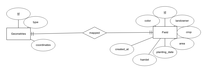
Entity Relationship Diagram
Installation
- Save the project folder name as
sig-sawah - Create a new database called
sig_sawah
Database
Default db file is postgresql located in db.psql
If you prefer MySQL or MariaDB then use db.sql for the migration. Then, change the code inside /application/config/database.php into :
$db['default'] = array(
	'dsn'	=> '',
	'hostname' => 'localhost',
	'username' => 'root',
	'password' => '',
	'database' => 'sig_sawah',
	'dbdriver' => 'mysqli',
	...
);
