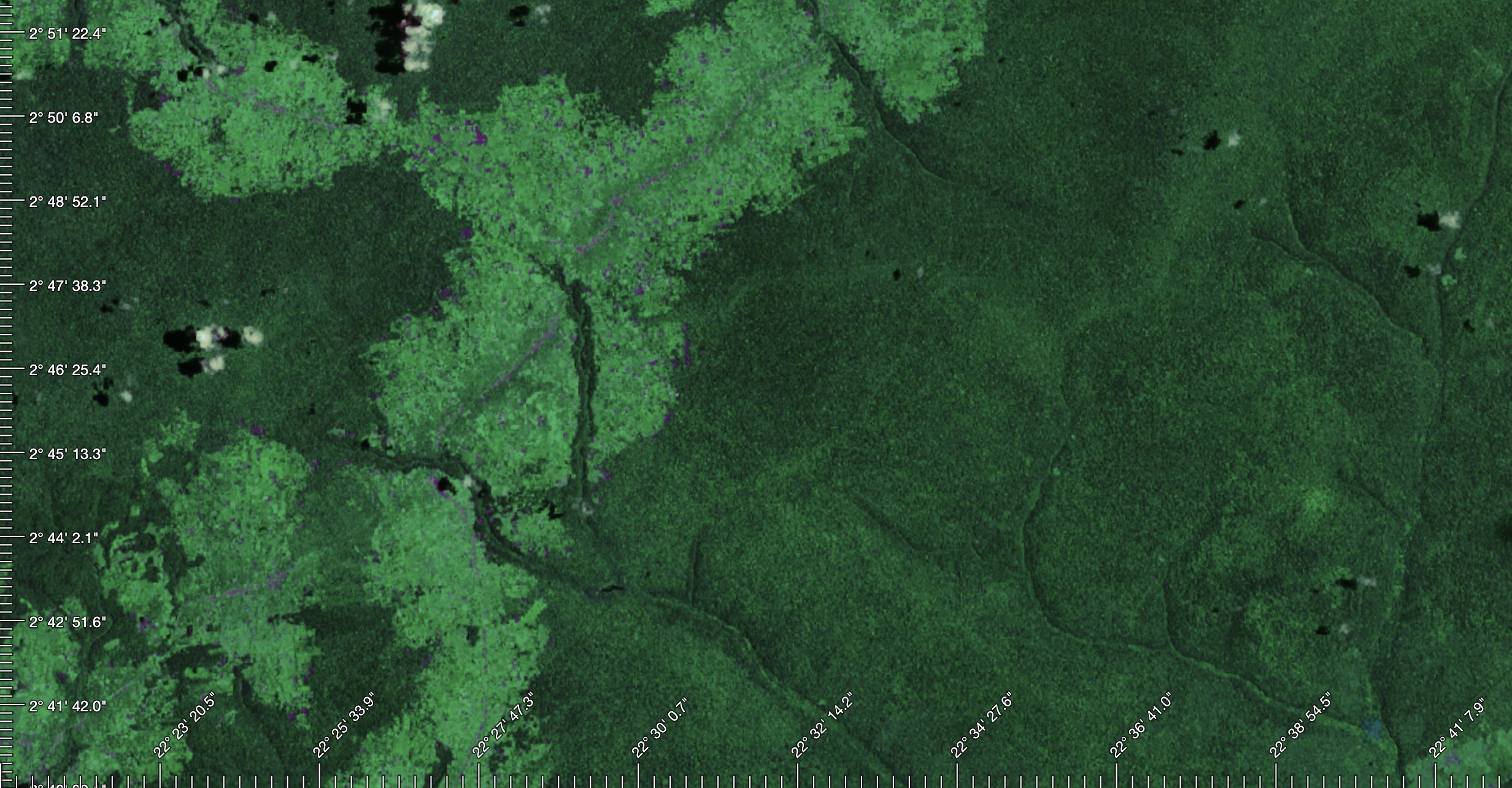
Lat/Long ticks generator for mapbox-gl / maplibre maps.
There are two main methods to include GeoTickGen in your project:
import { GeoTickGen } from "https://cdn.jsdelivr.net/npm/@fxi/geotickgen/+esm";First, install the package:
npm install @fxi/geotickgenThen, import in your project:
import { GeoTickGen } from "@fxi/geotickgen";After importing, you can easily use GeoTickGen to generate Lat/Long ticks on your mapbox-gl or maplibre maps:
const map = new mapboxgl.Map({
  // ... your map initialization here
});

const tickGen = new GeoTickGen(map, {
  // ... your optional configurations here
});.gtg-container {
position: absolute;
top: 0;
left: 0;
width: 100%;
height: 100%;
pointer-events: none;
}
.gtg-outline {
stroke: #fff;
fill: #000;
font-family: monospace;
font-size: 12px; /*should match configuration*/
paint-order: stroke;
stroke-width: 3px;
stroke-linecap: round;
stroke-linejoin: round;
}Default options:
{
  ticks: {
    sizeMinor: 10, // tick width
    sizeMajor: 20, // major tick width
    nStepMinor: 50, // number of step
    nStepMajor: 10, // major step each n
    enableLat: true, // show latitudes
    enableLng: true, // show longitudes
    fontSize: 12, // for compute label position. Should match CSS
    offsetLabel: 4, // distance tick-label
    offsets: { // offsets of ticks bars
      lat: {
        top: 0,
        right: 0,
        bottom: 0,
        left: 0,
      },
      lng: {
        top: 0,
        right: 0,
        bottom: 0,
        left: 0,
      },
    },
  },
};
You can override these options by passing in your own configuration object when creating an instance of GeoTickGen.
If you encounter any issues or would like to contribute, please open an issue or a pull request on the GitHub repository.
MIT
