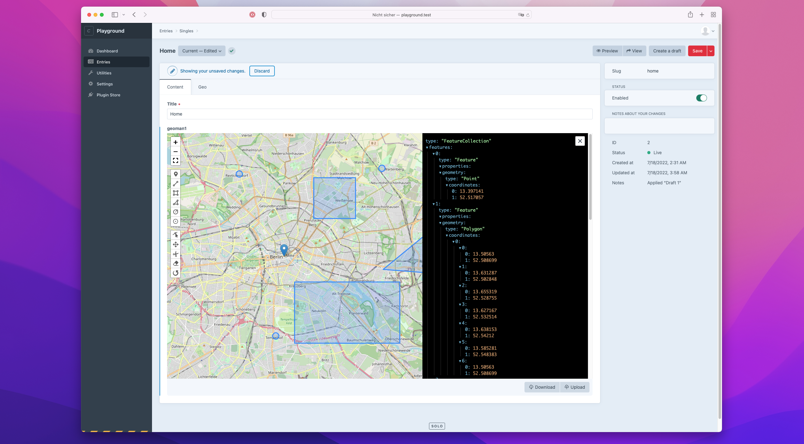
This plugin adds a “Geoman” field type to Craft CMS, which provides geometry editing powered by leaflet-geoman by geoman.io.
This plugin requires Craft CMS 4.0 or later.
You can install this plugin from the Plugin Store or with Composer.
Go to the Plugin Store in your project’s Control Panel and search for “Craft Geoman”. Then click on the “Install” button in its modal window.
Open your terminal and run the following commands:
# go to the project directory
cd /path/to/my-project

# tell Composer to load the plugin
composer require handplant/craft-geoman

# tell Craft to install the plugin
./craft plugin/install craft-geoman<link href="https://unpkg.com/leaflet@1.7.1/dist/leaflet.css" rel="stylesheet" />
<script src="https://unpkg.com/leaflet@1.7.1/dist/leaflet.js"></script>
<div id="map" style="height: 500px; border: 1px solid black;"></div>
<div id="geojson" style="display: none;">
{{ entry.geoman }}
</div>
<!-- prettier-ignore -->
<script>
var map = L.map(document.getElementById('map')).setView([47.9034, 8.10577], 10);
L.tileLayer('https://{s}.tile.openstreetmap.org/{z}/{x}/{y}.png', {
attribution: 'Data ©<a href="http://osm.org/copyright">OpenStreetMap</a>',
maxZoom: 18
}).addTo(map);
var layer = L.featureGroup().addTo(map);
var geojson = document.getElementById('geojson');
if (geojson.innerHTML) {
var geojsonLayer = L.geoJson(JSON.parse(geojson.innerHTML), {
pointToLayer: (feature, latlng) => {
if (feature.properties.radius) {
return new L.Circle(latlng, feature.properties.radius)
} else if (feature.properties.shape == "CircleMarker") {
return new L.CircleMarker(latlng)
} else {
return new L.Marker(latlng)
}
return
},
})
geojsonLayer.eachLayer(function (l) {
layer.addLayer(l)
})
map.fitBounds(layer.getBounds())
}
</script>

