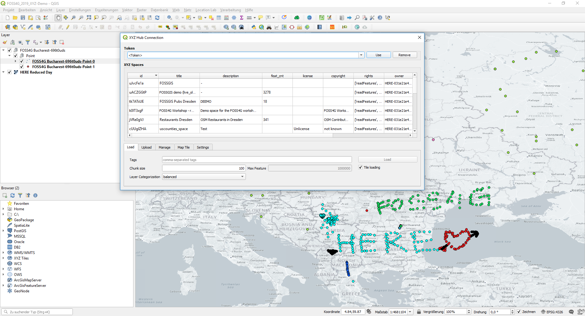
HERE Maps for QGIS is a QGIS plugin which can be used to visualize, edit and analyze data from Interactive Map Layers (IML) on HERE Platform and from xyz-hub spaces directly on a map.
- QGIS version 3.0 or later
- In QGIS, navigate to menu Plugins > Manage and Install Plugins... > All
- Search for
HERE Maps for QGIS> Install plugin - Switch to tab Installed, make sure the plugin
HERE Maps for QGISis enabled.
- Download the latest release zip file
- In QGIS, navigate to menu Plugins > Manage and Install Plugins... > Install from ZIP, then select the downloaded zip file.
- Switch to tab Installed, make sure the plugin
HERE Maps for QGISis enabled.
Once user have installed and enabled the plugin HERE Maps for QGIS, it can be accessed via the toolbar, or the menu Web. To use the plugin, user first need to create an account in HERE Platform. Once done, user can try to login in the plugin either with the same HERE Platform user credential or with the app credential (in case the first option does not work).
- Ensure that
HERE Platformis selected in the Server drop down. - If the User credential
HERE Platform User Loginexist in the Credential drop down, proceed directly to step 7 - Click on
Addto add your credential. - Tick the box
User login - Enter "HERE Platform User Login" in the
Name, user email in theUser emailand the realm from the Account confirmation email. - Click on OK to save the credential
- Select the User credential and click
Connectto login for the first time. The Platform login webpage will pop up. - Follow the steps in the Platform login webpage. Once login succesfully, the popup windows will be closed automatically and the list of available IML layers in your Platform account shall show up.
- Ensure that
HERE Platformis selected in the Server drop down. - Click on
Addto add your credential. - Enter "My App credential" as the name.
- Select a
credentials.propertiescontaining your HERE Platform app credential (typically location in{$HOME}/.here/credentials.properties) - If user don't already have an app or a
credentials.propertiesfile then user can create one, following the instructions here. - Grant access on the data to the HERE platform app so that it can access your project, following the instructions here.
- Click on OK to save the credential, and close the connection window.
- Click
Connectto show the list of available IML layers.
- Select either the User credential or the App credential and click
Connect - The list of available IML layers in your Platform account shall show up in the tabular form
- User use the search bar to find the catalogs and layers of interest
The main dialog contains 5 tabs:
-
Load: load data from a HERE Platform IML into QGIS, given a valid credential.-
Mode: there are 3 modes of loadingLive loading: interactively refresh features in tiles within the current canvas. Useful for visualization of dynamic dataset with full editing capabilitiesIncremental loading: interactively refresh and cached features in tiles within the current canvas (no features delete). Useful for visualization and exploration of large datasetStatic loading: load and cache all features in space in background. Useful for importing and analysis of static dataset
-
Chunk sizeindicates the number of features per tile or iteration. Default: 100. For large layer of point, lines features, value of 10000 is recommended. For large layer of polygon features, value of 1000 is recommended. -
Layeringcontrols the organization of data in one layer into different QGIS layers based on fields similarity, with 3 levels:single: merge data into 1 layer per geometry typemaximal: do not merge data, as many layers per geometry typebalanced: merge only similar data into 1 layer, balanced number of layers per geometry type
-
-
Upload: upload local QGIS Vector Layer to the server. For this to work, make sure that your token also has write-level permissions. -
Manage: create new space, edit or delete existing space. -
Map Tile: create HERE Map Tile layer given validapp_idandapp_code. Alternatively,api_keycan also be used. -
Settings:Clear cache: empty the temporary cache folder. Active layers will be invalid after clearing cache.Clear cookies: clear the login cookies. This could be helpful when login or loading show Authorization error
When the user make some edits to the loaded layer, the changes can be pushed to the server via the button Push changes in the toolbar.
Note: User can also add background map tiles via the "Map Tile" tab. User will need to use your API key following the instructions here.
Test with unittest
./runTest.sh -m unittest test
Test with pytest-xdist
./runTest.sh -m pytest -n 2 test
- Clone this repository.
- Build the plugin by running
sh makeBuild.sh <VERSION NUMBER>, e.g.sh makeBuild.sh 1.5.5.
Copyright (C) 2019-2024 HERE Europe B.V.
This project is licensed under the MIT license - see the LICENSE file in the root of this project for license details.
