UAV (Unmanned Aerial Vehicle) path planning using the Genetic Algorithm parallelized with CUDA. Search for the shortest path for a UAV to fly pass all selected cities in a real region of US. Implementation is based on this paper.
- Make sure Numba is installed. We use version 0.42.0.
- Download the United States Cities Database and put it in folder "data/".
- Run main.py to get the results shown below.
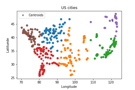
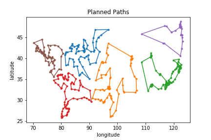
Problem Setting: 6 UAVs should fly pass all US cities with population more than 100k.
The K-means clustering result:
The planned paths for all UAVs:

