This document is a draft that may become a blog post at https://jakecoppinger.com in future.
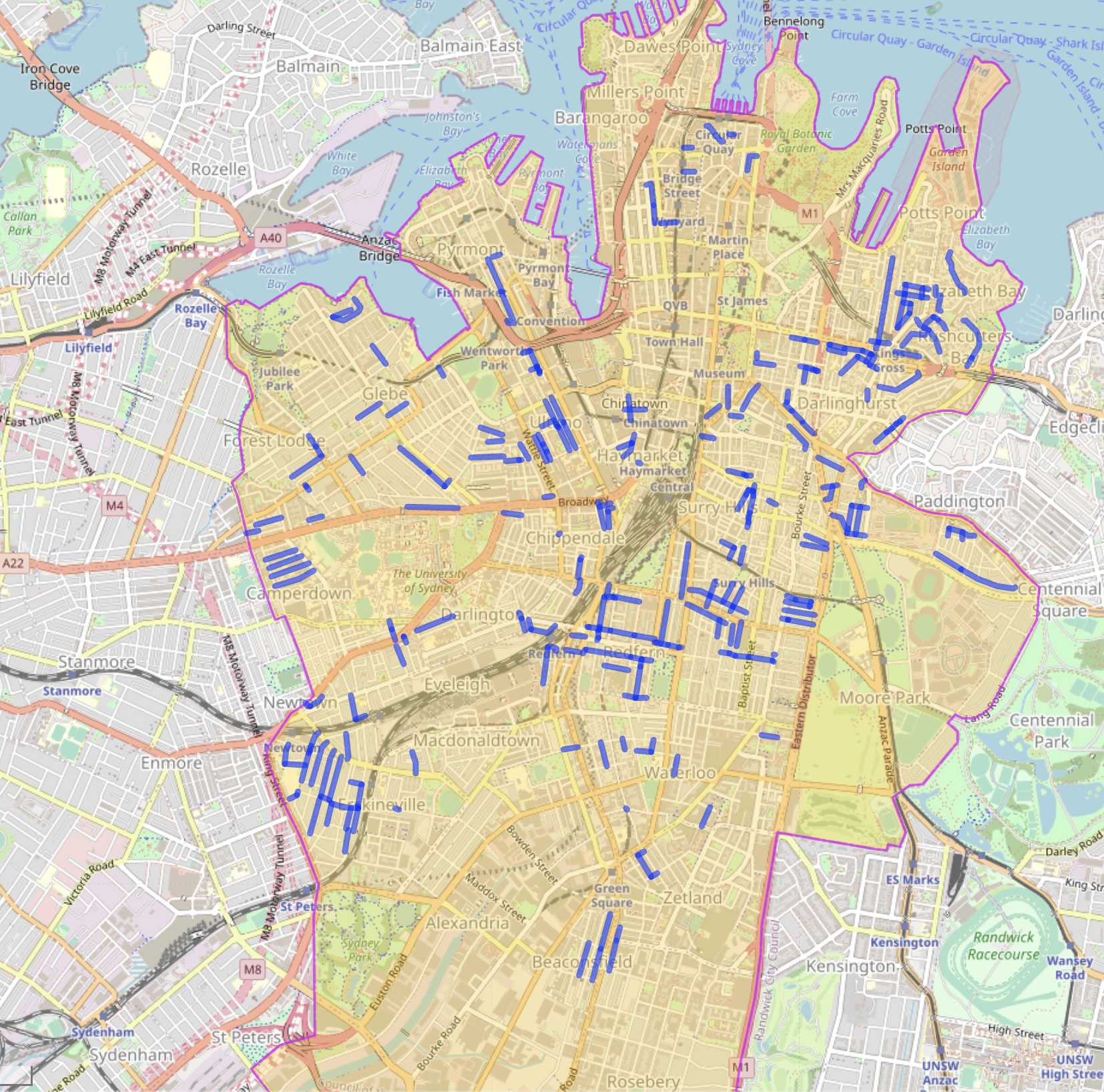
(work in progress, incomplete list) This is a map of the streets in the City of Sydney council area. The image is likely already out of date - click the link below to see the latest.
View live map with zoom: https://overpass-turbo.eu/s/1wjm
[out:json][timeout:25];
(
  // Relation 1251066 is COS boundary:
  // https://www.openstreetmap.org/relation/1251066
  rel(1251066);map_to_area->.region;
  way["highway"]
  ["oneway:bicycle"="no"]
  (area.region);
);
out body;
>;
out skel qt;
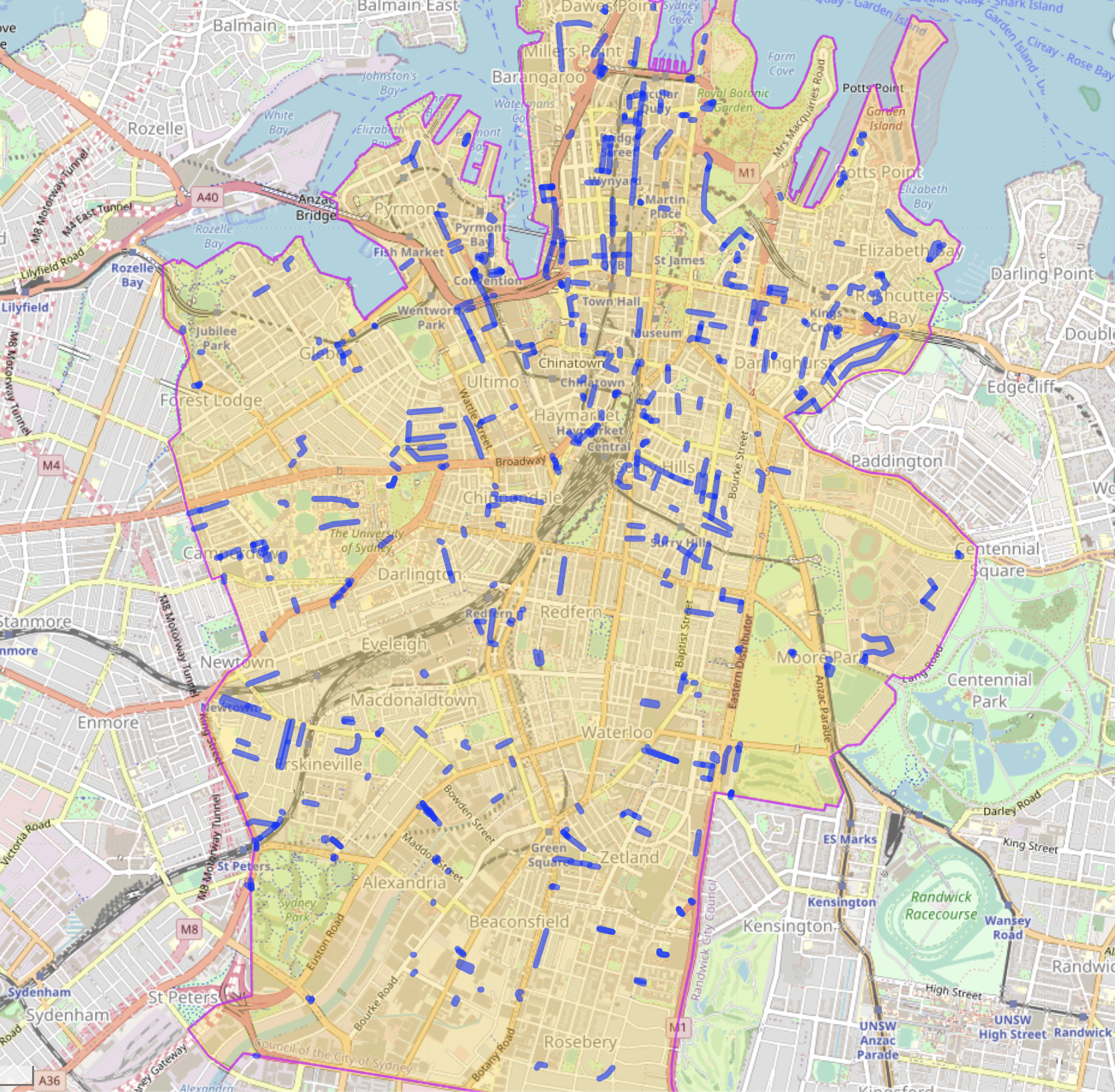
Work in progress. The following query finds roads in the City of Sydney that are:
- One way
- Do not currently allow bicycles to travel in the opposite direction
- Do not currently have a parallel separated cyelway
And excludes:
- Roads with more than 1 lane
- Dual carriageway one way roads
- Private roads
- Parking aisles, private or customer only roads
- Slip roads or highway links
View live map with zoom: https://overpass-turbo.eu/s/1wlc
[out:json][timeout:25];
(
  // Relation 1251066 is COS boundary:
  // https://www.openstreetmap.org/relation/1251066
  rel(1251066);map_to_area->.region;

  // Select roads
  way["highway"]

  // Excluded under construction ways
  ["highway"!="construction"]
  // Excluded proposed ways
  ["highway"!="proposed"]

  // Only roads which are marked one way,
  // and don't allow bicycle contraflow
  ["oneway"="yes"]
  ["oneway:bicycle"!="no"]

  // Don't include roads that are bidirectional,
  // but are separated (and appear to be one way)
  ["dual_carriageway"!="yes"]

  // Don't include if a cycleway already present
  ["highway"!="cycleway"]

  // If a road is customers only it's likely
  // in a parking lot
  ["access"!="customers"]

  // Don't include roads where public access not allowed
  ["access"!="no"]

  // Don't include link roads (on ramps/slip roads)
  ["highway"!="motorway_link"]
  ["highway"!="primary_link"]
  ["highway"!="secondary_link"]
  ["highway"!="tertiary_link"]

  // Don't include major roads
  ["highway"!="primary"]
  ["highway"!="secondary"]


  ["lanes"!=2]
  ["lanes"!=3]
  ["lanes"!=4]
  ["lanes"!=5]
  ["lanes"!=6]
  ["access"!="private"]

  // Don't consider parking isles
  ["service"!="parking_aisle"]


  (area.region);
);
out body;
>;
out skel qt;
- Laneway behind Metro Woolworths near central
- Would provide access from south Surry Hills to the Belmore Park cycleway (and further north into the city)
- Already marked as cycleroute on the official City of Sydney cycling map
- Long laneway with excellent visibility
- Gradient towards eastern end
- No parking, a number of infrequently used driveways
- Great link from Fitzroy St via Riley St to lower Surry Hills
- Car parking both sides
- Connects to Crown St
- Excellent visibility (completely straight)
- Already has contraflow marking, for pedestrians?
- Already close to Boronia Street though (allowing contraflow in last batch)
- Excellent visibility (completely straight)
- Connects to Bourke St cycleway
- Excellent visibility (completely straight)
- Car parking one side
- Has continuous footpath east side, west side is Crown St (future continuous footpath?)
- Similar to Davis Street
- Excellent visibility (completely straight)
- Car parking one side
- Connects to Bourke St cycleway
- Has continuous footpath east side, west side is Crown St (future continuous footpath?)
- Excellent visibility (completely straight)
- Alredy contraflow permitted Emanuel St north
- No car parking
- Similar design to Castlereagh Lane
- Already allows contraflow to north and south-east end
- The laneway just next to Wynyard Station
- Would provide a north -> south route for bikes avoiding York St, Carrington St buses and George St pedestrians
(work in progress, incomplete list)
- Bend in road affecting visibility
- Changes widths a number of times
- Existing traffic table + choker and traffic calming measures too narrow for bike + car (unsure if this is an issue)
- Parking both sides - 45 degree and parallel
- Very narrow due to parking on one side
(work in progress, incomplete list)
- Next lane north (Railway Lane) already one way (opposite) and suitable for bikes
- Car parking both sides so narrow in between
- Otherwise good charactistics:
- Has modal filter at west end
- Bicycle contraflow permitted & has paint at junction of Angel St
- Nearby Wilson St contraflow lane
- Near Ivy Street with contraflow
(work in progress, incomplete list)
- All mapped streets with contraflow allowed (including outside City of Sydney): https://overpass-turbo.eu/s/1wjl
Query:
[out:json][timeout:25];
(
  way["highway"]

  ["oneway:bicycle"="no"]

  ({{bbox}});
);
out body;
>;
out skel qt;

