Open Elevator is a free elevation API with up to 3m global accuracy. API currently down due to moving to another provider The API is publicly hosted for free at https://opendata.predly.com/v1/elevation.
API
$ curl https://opendata.predly.com/v1/elevation/json?lat=50.078217&lon=8.239761

{
  "elevation": 118.73242074762783,
  "location": {
    "lat": 50.078217,
    "lon": 8.239761
  }
}- OpenElevator Class
- Retrieving and preprocessing of dataset
- Builtin cache for elevation query within python
- Builtin interpolation of elevation between grid points
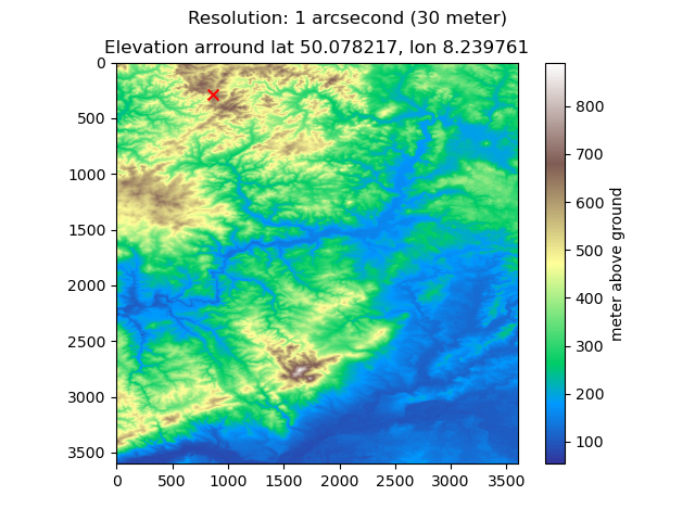
- Visualization of elevation for given locatio
- OpenElevator Web API
- Single location lookup (GET request)
- multiple location lookup
- Builtin API cache
- Builtin Rate Limiting
(Tested on a machine with Ryzen Epyc 32 Cores and 0.5 TB RAM on empty cache)
Request average: 22.21 ms @ 84k requests in 30seconds
running (0m31.8s), 0000/5000 VUs, 84046 complete and 0 interrupted iterations
default ✓ [======================================] 5000 VUs  30s

    data_received..................: 3.3 MB 103 kB/s
    data_sent......................: 2.1 MB 65 kB/s
    http_req_blocked...............: avg=1.24ms   min=0s       med=0s      max=536.8ms  p(90)=4.95µs   p(95)=6.14µs
    http_req_connecting............: avg=1.11ms   min=0s       med=0s      max=276.99ms p(90)=0s       p(95)=0s
    http_req_duration..............: avg=22.21ms  min=0s       med=0s      max=2s       p(90)=86.27ms  p(95)=141.39ms
    { expected_response:true }...: avg=113.01ms min=600.59µs med=87.86ms max=2s       p(90)=216.27ms p(95)=294.67ms
    http_req_failed................: 80.34% ✓ 67523       ✗ 16523
    http_req_receiving.............: avg=414.08µs min=0s       med=0s      max=1.98s    p(90)=41.56µs  p(95)=68.35µs
    http_req_sending...............: avg=1.2ms    min=0s       med=0s      max=1.31s    p(90)=20.65µs  p(95)=37.66µs
    http_req_tls_handshaking.......: avg=0s       min=0s       med=0s      max=0s       p(90)=0s       p(95)=0s
    http_req_waiting...............: avg=20.6ms   min=0s       med=0s      max=957.46ms p(90)=82.3ms   p(95)=134.58ms
    http_reqs......................: 84046  2639.131214/s
    iteration_duration.............: avg=1.83s    min=1s       med=1.72s   max=4.91s    p(90)=2.5s     p(95)=2.7s
    iterations.....................: 84046  2639.131214/s
    vus............................: 2915   min=2915      max=5000
    vus_max........................: 5000   min=5000      max=5000
from PIL import Image
from openelevator import OpenElevator

elevator = OpenElevator()

# visualize a specific location
img = elevator.plot_elevation(lat=50.078217, lon=8.239761)
with Image.open(img) as im:
    im.show()
4. Set up your own with this Tutorial
- Add support for interpolation add tile edges
- Add routes for - max/min slope in area - height profile of given geojson
- add Dockerfile
- add Makefile
- update installation information
- check for free space
Downloading could be speeded up if using a shared client, but boto3 currently does not offer pickling of its ressources (boto/boto3#2741)
- fastapi-limiter currently has a bug that is not merged yet so the current project will throw an exception!!!

