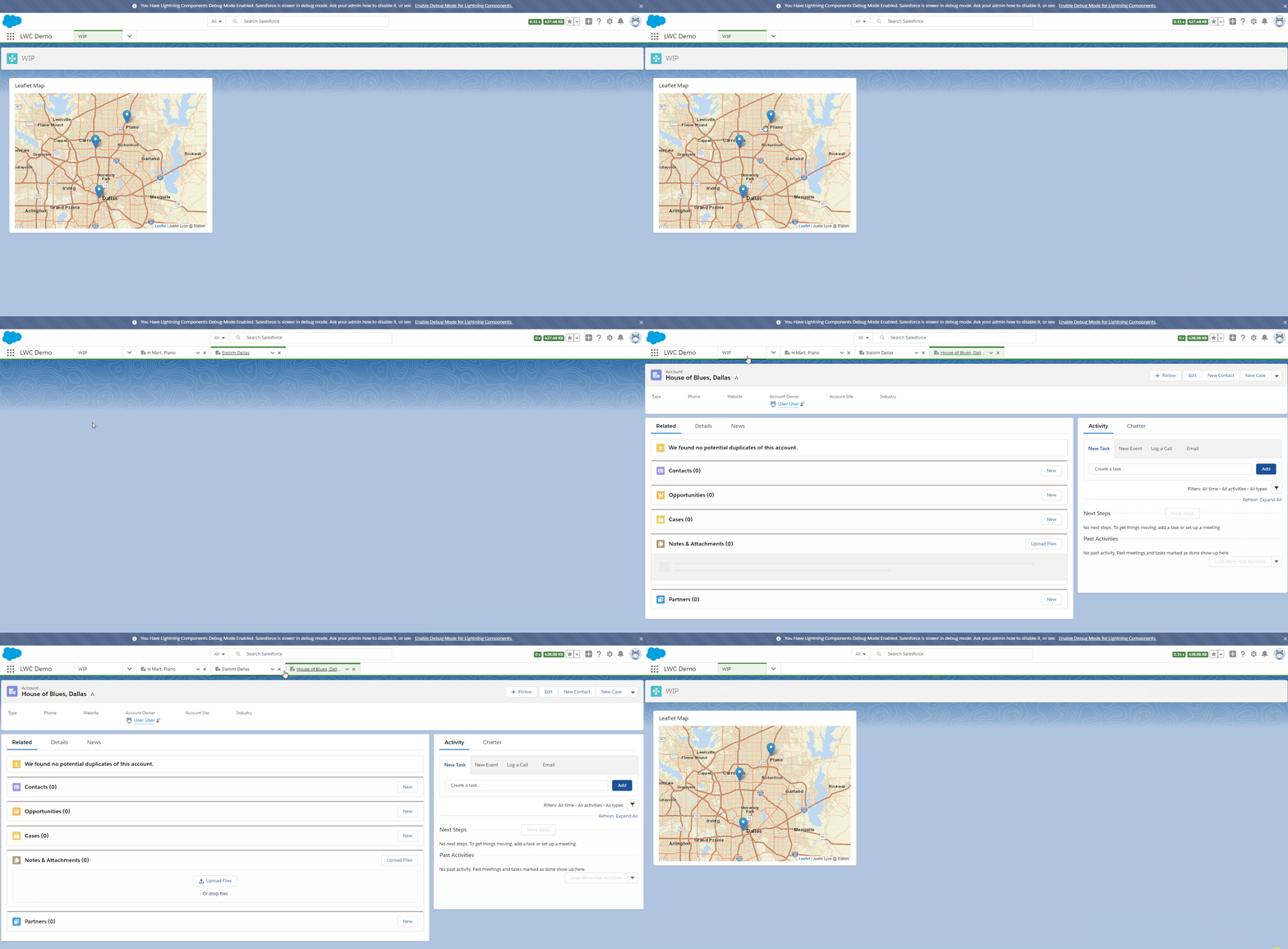
An interactive map using LWCs and Leaflet.
Pass record data with lat/lng geolocation to the leaflet-map, and the leaflet map draws clickable pins on a map.
- Set all pins
- Add a Pin
- Remove a Pin
- Resize the map, bounded on the pins
- onMapInit, event fired when the map is mounted in the component
- onMarkerClicked, event fired when a pin is clicked, carries the record Id on event.detail.
<!-- recentContactsMap.html -->
<!-- Pass in a static height -->
<!-- Handle oninit and onmarkerclick -->
<template>
  <c-leaflet-map class="leaflet-map"
    height={height}
    onready={onMapInit}
    onpinclick={onMarkerClick}></c-leaflet-map>
</template>
import { LightningElement, api, track } from 'lwc'
import getRecentContacts from '@salesforce/apex/RecentContactsMapAuraService.getRecentContacts'
export default class RecentContactsMap extends LightningElement {
@track contactMarkers
@track map
@track error
@api height
// When the map is initialized, give it some pins.
onMapInit () {
// Store the reference to the map
this.map = this.template.querySelector('.leaflet-map')
// Go get contact data from Salesforce Apex
this.getContacts()
}
// Do something when a pin is clicked.
onMarkerClick (event) {
const markerClick = new CustomEvent('markerclick', {
detail: event.detail
})
this.dispatchEvent(markerClick)
}
getContacts () {
getRecentContacts()
.then(data => {
this.contactMarkers = data
this.setMapMarkers()
})
.catch(error => {
this.error = error
this.contactMarkers = null
console.error('Error getting contacts', error)
})
}
createPins (contacts) {
return contacts.map(contact => {
return {
record: contact,
lat: contact.MailingLatitude,
lng: contact.MailingLongitude
}
})
}
setMapMarkers () {
this.map.setMarkers(this.contactMarkers)
}
}