Examine relationships between radar backscatter, soil moisture, leaf water potential, and other hydrobiophysical parameters
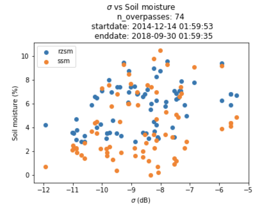
This study seeks to examine empirical relations between remote sensing data and biophysical paramters using in Situ SCAN sites as ground truth.
Are used to transform measured soil moisture to leaf water potential
Unified North American Soil Map
https://daac.ornl.gov/NACP/guides/NACP_MsTMIP_Unified_NA_Soil_Map.html
Only Ascending S1 orbits with VV polarization are used
Eliminated sites in Alaska, Puerto Rico, Hawaii from SCAN db
Filter out soil moisture values with preceding precipitation determined by PRISM
Soil Climate Analysis Network data, root zone, surface soil moisture calculated by averaging over depth intervals.
List of SCAN sites: https://wcc.sc.egov.usda.gov/nwcc/yearcount?network=scan&counttype=statelist&state=
Query builder: https://wcc.sc.egov.usda.gov/reportGenerator/ and build a query with desired columns.
Data availability: 2014-10-03 – Present
Ascending Orbits Only
Polarizations: VV, HV
Naming convention: (https://sentinel.esa.int/web/sentinel/user-guides/sentinel-1-sar/naming-conventions)
2-day sums are calculated at each SCAN site to filter out SM observations during saturated conditions
Unified North American Soil Map
https://daac.ornl.gov/NACP/guides/NACP_MsTMIP_Unified_NA_Soil_Map.html
Not using: Harmonized World Soil Database
http://www.fao.org/soils-portal/soil-survey/soil-maps-and-databases/harmonized-world-soil-database-v12/en/
