SeaRoute is a Java library to compute shortest maritime routes between two points.
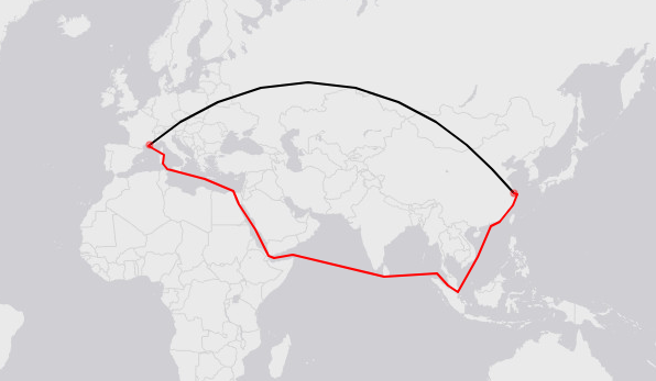
See below an example from Marseille (5.3E,43.3N) to Shanghai (121.8E,31.2N). The red line is the computed maritime route. The black line is the great-circle route.
//create the routing object
SeaRouting sr = new SeaRouting();

//get the route between Marseille (5.3E,43.3N) and Shanghai (121.8E,31.2N)
MultiLineString r = sr.getRoute(5.3, 43.3, 121.8, 31.2);

//compute the distance in km
double d = Utils.getLengthGeo(r);

//export the route in geoJSON format
String rgj = Utils.toGeoJSON(r);SeaRoute is currently not deployed on a maven repository. You need first to install OpenCarto with:
git clone https://github.com/eurostat/opencarto.git
cd opencarto
mvn clean install
And then:
git clone https://github.com/eurostat/searoute.git
cd searoute
mvn clean install
(TODO)
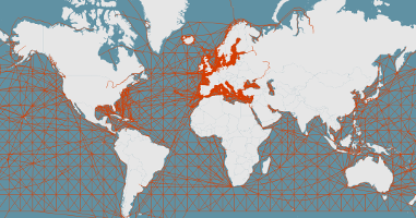
The shortest maritime routes are computed from a network of lines covering the seas and following some of the most frequent martitime routes. The global mesh is based on the Oak Ridge National Labs CTA Transportation Network Group, Global Shipping Lane Network, World, 2000 (retrieved from geocommons.com or github), enriched with some additional lines around the European coasts based on AIS data. Simplified versions of this network have been produced for different resolutions (5km, 10km, 20km, 50km, 100km) based on a shrinking of too short edges and a removal of similar edges.

