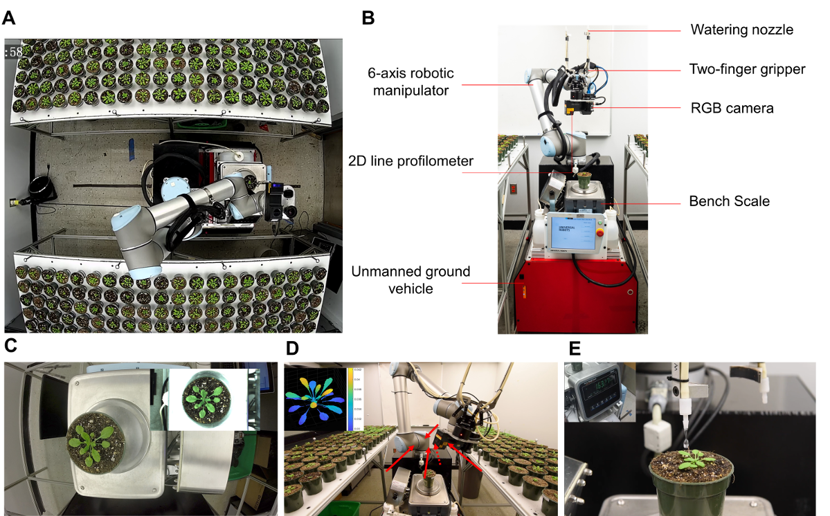
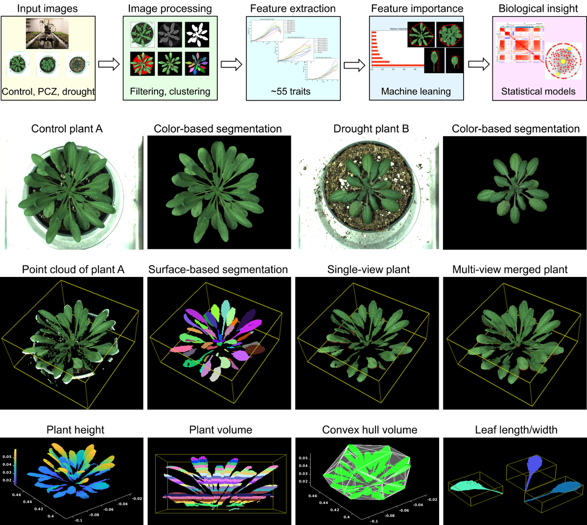
This is a program developed for processing images collected the RoAD system.
RoAD is a highly integrated and customized system for drought research. It integrates mobility, sensor placement flexibility, multi-functionality (navigation, imaging, plant transportation, precision irrigation, weighing), holographic imaging, and point-cloud data processing into a mobile platform that can be shared by multiple chamber rooms and multiple experiments. It technically automated and streamlined the entire experiment from sample placement, image acquisition, plant irrigation per moisture prescription all the way to data processing.
We developed automated image processing pipelines that include image segmentation and phenotypic traits extraction in both 2D and 3D.
see more details in our paper: Robotic Assay for Drought (RoAD): An Automated Phenotyping System for Brassinosteroid and Drought Response
see README files in subfolders.
This project is licensed under the MIT License - see the LICENSE.md file for details
If you find this work or code useful for your research, please cite:
@article {Xiang2020.06.01.128199,
	author = {Xiang, Lirong and Nolan, Trevor M. and Bao, Yin and Elmore, Mitch and Tuel, Taylor and Gai, Jingyao and Shah, Dylan and Huser, Nicole M. and Hurd, Ashley M. and McLaughlin, Sean A. and Howell, Stephen H. and Walley, Justin W. and Yin, Yanhai and Tang, Lie},
	title = {Robotic Assay for Drought (RoAD): An Automated Phenotyping System for Brassinosteroid and Drought Response},
	year = {2020},
	doi = {10.1101/2020.06.01.128199},
	journal = {bioRxiv}
}

