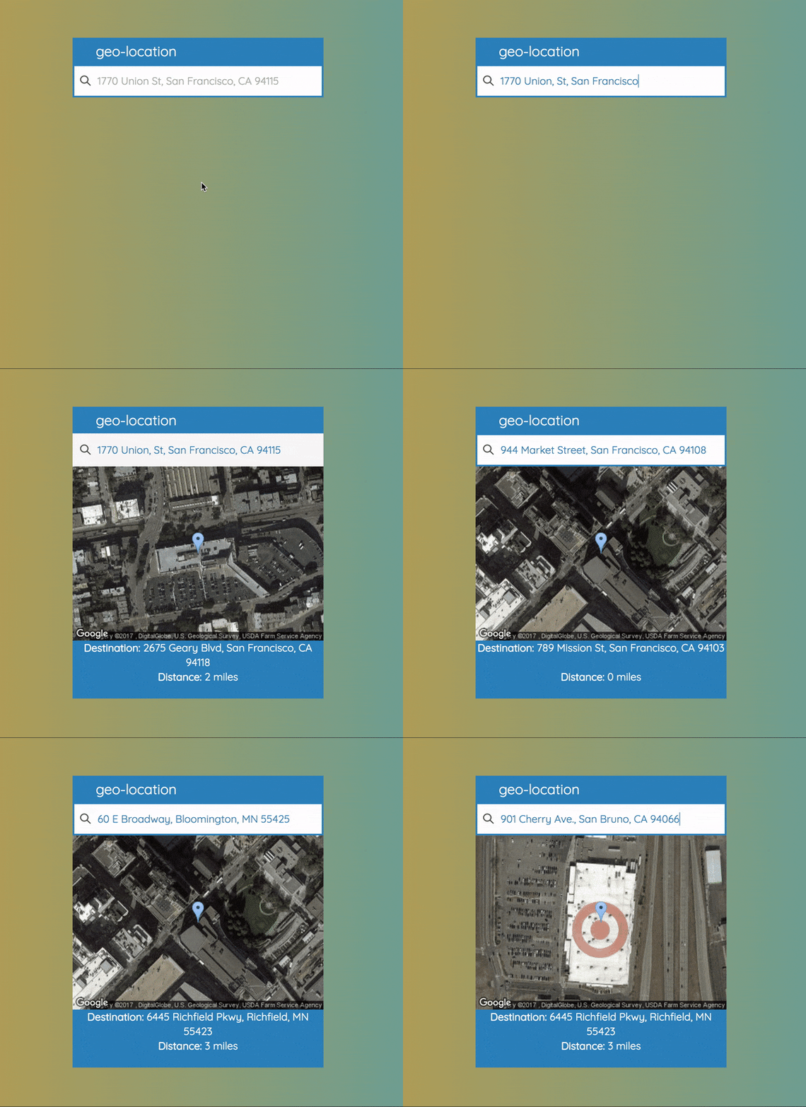
Returns the address of the geographically closest store from the dataset based upon input location
Upon typing in an address in the proper format, a user fires off an onKeyDown event by pressing the enter button. At this point getNearestLocation is invoked with this.state.value as an argument. The value is updated onChange by an event bound to the input field. After getNearestLocation is invoked data from the event is parsed and stored in a data object. A /POST request is then sent to an API endpoint with the data object. This /POST request is promisified with axios.
The server receives a /POST request to its /distance endpoint and middlewear getLatLong is invoked. This method assigns minDistance to Number.MAX_VALUE and minLocation to undefined. Both of these variables are defined in the outer scope for use in calculateDistance. Location information is parsed from the request object and a /GET request is made to the Geocoding API endpoit. When the response comes back latitude and longitude are parsed and stored in variables.
A promise is then instantiated and loadCsv is invoked with lat and long variables. This promise is set to resolve in 1 second. After loadCsv is invoked a fs readStream is created to read store-locations.csv. Relevant headers are set to be read from the stream and for each line, calculateDistance is invoked with lat, long, and data from the CSV line. calculateDistance performs operations which determine distance based on longitude and latitude. After these operations are complete, the conditional checks to see if the current distance is less than the current minDistance. If this is true minDistance and minLocation are updated to the current variables. When there are no more lines in the CSV file an end event is fired off, which closes the stream.
At this point, our promise resolves and a response is sent back to the client's request with a json encoded object containing minDistance and minLocation. The client receives this response and stores the data in variables, which are then used to setState. After the state is set there is a ternary condition that returns the MapImage component when this.state.lat.length && this.state.long.length are true. MapImage contains attributes, which are used to pass in the state as props.
After MapImage receives new props the component renders. This component contains an img tag, which has a src attribute set to the Static Maps API endpoint. The response of this endpoint is a 432X300 map of the location from our dataset nearest to the input address.
- Node/Express
- React
- Webpack
- Babel
- Bootstrap
- Mocha/Chai
Set environment variables:
# open the following file
nano ~/.bash_profile
# add the following lines of code to set environment variables
# activate the API and get an API key (get API key from docs referenced in APIs used)
export MAPS_KEY=<insertKey>
export PORT='8080'
# force session to read file
source ~/.bash_profile
Clone repo from github:
# run git clone
git clone https://github.com/juliusbuckley/geo-location.gitInstall project dependencies:
# run install script
npm installInstall nodemon for dev environment:
# install nodemon globally
npm install -g nodemon
Start server and transpile with babel-cli:
# run dev start script
npm run dev:startTranspile server folder and start app:
# run prod start script
npm startTo search for the nearest store just start typing your current location and the input box will update.
After typing in the location press the enter button.
The closest store will appear on a google map along with its address and distance.
Confirm api is working properly and returing Status Code 200
Start server for testing (Make sure server is not running prior to test):
# run test script
npm testDocumentation for: Google -- Geocoding API
Documentation for: Google -- Static Maps API
