The shp2geoJSON python module is a set of tools to convert geographical data from shapefiles to geoJSON format (and add graphical information such as color and opacity to the shapes).
geoJSON is a popular format for encoding of geographic data structures, which can be directly used to visualize data on the web with tools such as Leaflet.
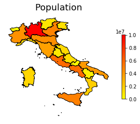
With this module it is possible to load a shapefile, add graphic informations based on data, plot the result in python and export it as geoJSON.
A plot created with this module:
Clone this repo, open a terminal, move to the repository root and run
pip install .
Have a look at the example python-notebook in the project's docs/ folder for a complete use-case.
import shp2geoJSON as geoJ
import json

# load shapefile
features = geoJ.shapefile2geoJSON_features(shp_path)

# [do something with the data here, if you need]

# save as geoJSON
with open("geo_data.json", "w") as f:
  f.write(json.dumps(features))